

Forecast for the Uintas Area Mountains

Issued by Craig Gordon on
Monday morning, December 19, 2022
Monday morning, December 19, 2022
Avoiding the avalanche dragon is easy-
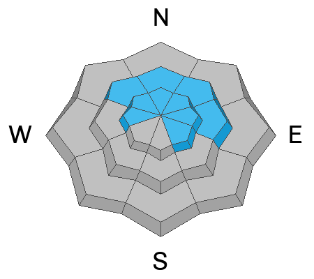
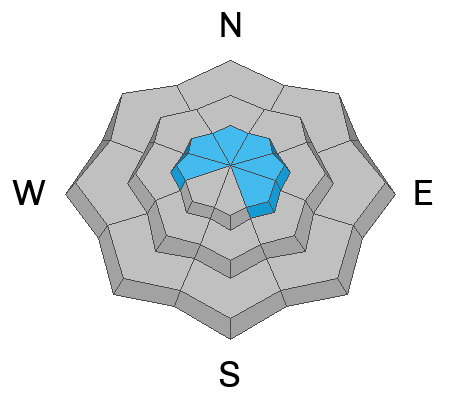
Today, you'll find CONSIDERABLE avalanche danger on all steep, shady slopes. The danger is most pronounced in terrain facing the north half of the compass in the wind zone at and above treeline. Human triggered avalanches breaking to weak, sugary, midpack snow are LIKELY. Low elevation, shady slopes with similar layering offer MODERATE avalanche danger and human triggered avalanches are POSSIBLE.
Looking for the Clif-notes version to LOW avalanche danger? Well then, simply steer yourself toward mid and low elevation south facing slopes, or head to wind sheltered terrain with no overhead hazard (meaning, no steep slopes above or adjacent to where I'm traveling) and that's the hot ticket. I've been finding excellent riding conditions and fun meadow skipping on mellow, wind sheltered slopes with no overhead hazard.
Low
Moderate
Considerable
High
Extreme
Learn how to read the forecast here
 Special Announcements
When-
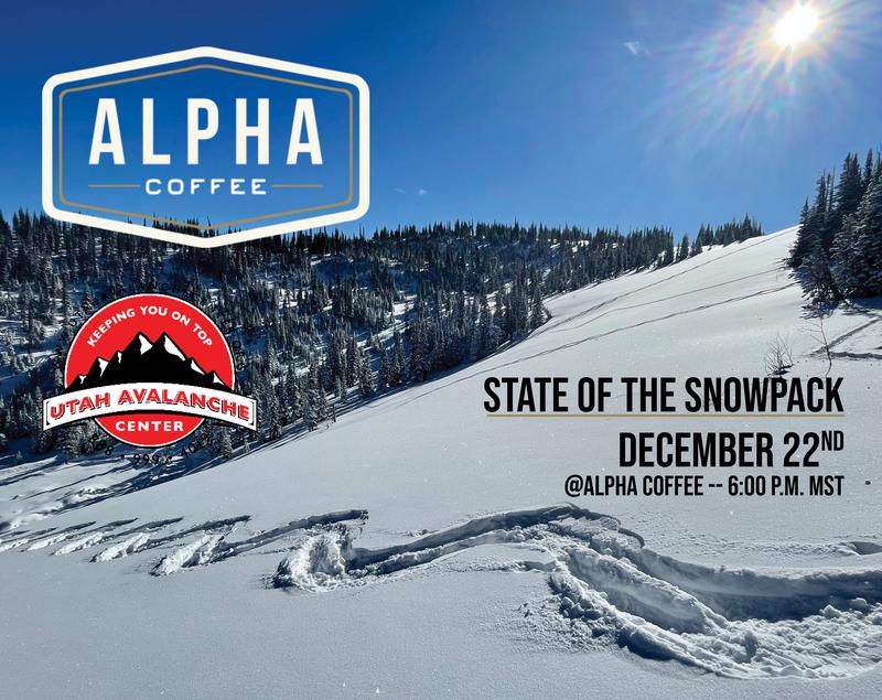
Thursday December 22, 2022
Show starts at 6:00
Thursday December 22, 2022
Show starts at 6:00
What-
Please join Utah Avalanche Center forecaster Craig Gordon (that's me :) as I take a deep dive and reflect on recent close calls along with what’s going on with our current snowpack structure and what's in the store for the future.
Please join Utah Avalanche Center forecaster Craig Gordon (that's me :) as I take a deep dive and reflect on recent close calls along with what’s going on with our current snowpack structure and what's in the store for the future.
Where-
Alpha Coffee
7260 Racquet Club Dr, Cottonwood Heights, UT 84121
 Weather and Snow
Nowcast- Skies are clear and temperatures register in the single digits and mid teens. As the valley gunk starts settling in the best place to be is in the mountains where clear, clean air awaits your arrival. Westerly winds blow in the 20's along the ridges with an occasional gust in the mid to upper 30's near the high peaks. Last weeks big storm is settling, and a solid, go anywhere base stretches from trailhead to ridgetop. Yeah, we've got room to roam, delivering excellent riding conditions, particularly in mid elevation, wind sheltered terrain.
Forecast- A dry northwest flow keeps mostly sunny skies around this morning, along with light winds, and temperatures climbing into the upper 20's. Clouds and wind increase late in the day as a weak storm slides to our north.
Futurecast- Tuesday is cloudy with a snow shower or two. A colder storm system is in the queue for Wednesday through Wednesday night, bringing accumulating snow along with very strong winds.
Lots of excellent trip reports and recent obs are found HERE.
 Recent Avalanches
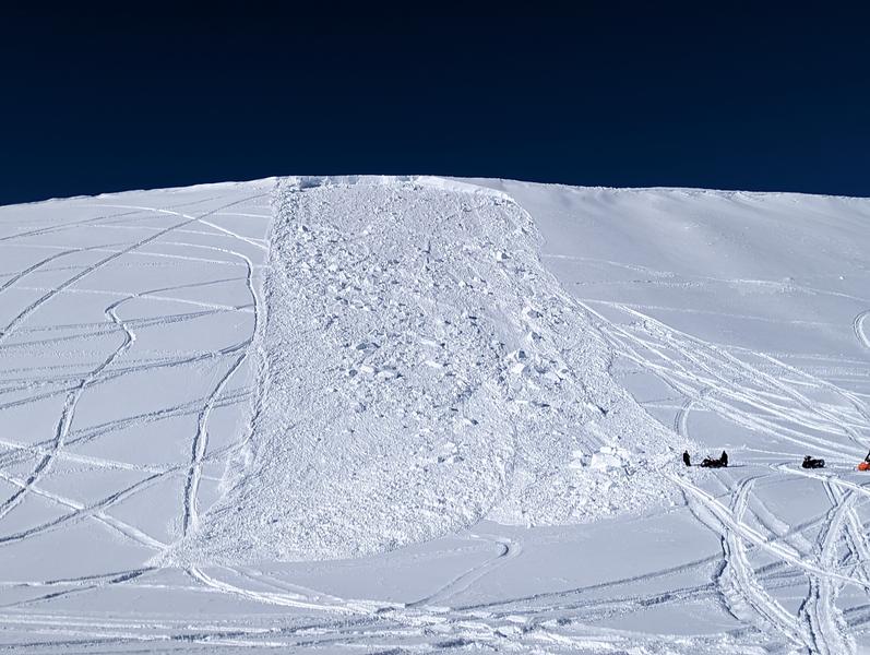
From north to south and points in between, recent human triggered avalanches display similar characteristics, revealing a failure in the midpack weakness which leads to avalanches gouging to the ground-
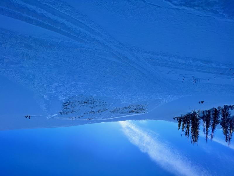
Tyler St. Jeor found this slide yesterday in Roundy Basin, just above the groomed trail on his way to Currant Creek.
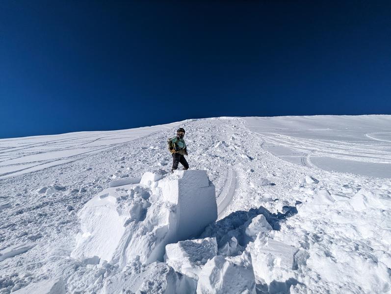
Saturday, Joey Manship rolled up the this freshly triggered avalanche on the south half of the range near Tower Mountain. Yeah, getting pinned under the debris could easily ruin your day. More info HERE
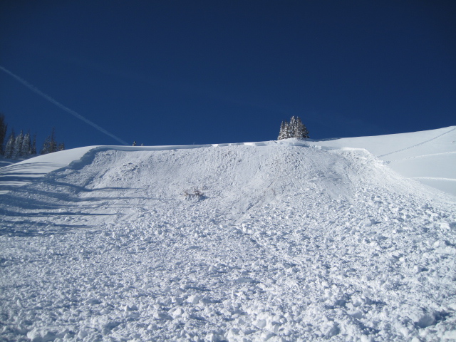
Meanwhile, Ted took a look at a sled triggered slide from Friday on the North Slope near Humpy Peak and has an outstanding writeup found HERE.
Recent avy activity and a slew of Uinta obs are HERE.

Avalanche Problem #1
Persistent Weak Layer
Type
Location
Likelihood
Size
Description
While the snowpack slowly gains strength, we're hardly good to go. In fact, our snowpit stabilities tests continue to confirm our suspicions. But the rubber hits the road with seeing the biggest clue to avalanches.... avalanches!
Yes, snowpack is adjusting to last weeks big storm... and that's good news. The coverage is outstanding and the riding is all-time... and that's great news. Now for the buzz-kill news, but I'm gonna keep it keep it simple and you don't need a Ouija board to figure it out... the formula is rather straight-forward-
It's dangerous if you choose to ride steep slopes, especially those facing the north half of the compass-
The most likely place to trigger an avalanche is where a dense, strong, solid layer (slab) rests on weaker snow (Persistent Weak Layer or PWL) formed during the mid November dry-spell. That combo is found on slopes facing the north half of the compass, especially those in the wind zone at and above treeline. So, by avoiding that setup, you essentially avoid avalanches!
But you're thinking, "That's avalanche geek-speak", I wanna know where I can ride, have an epic day, and NOT trigger an avalanche. And actually that's an easy one. The powder is light, travel is easy on a very supportable base, and low angle terrain rides like a dream! With no shortage of great riding in big open meadows and on low angle slopes there's plenty of opportunity to avoid pulling on the avalanches dragons tail all together.
I'm no sooth-sayer (more the Shaman type :) but I know in time our current instabilities will relax and the snow will slowly gain strength. I also know it's time to pump the brakes, continue practicing some patience, and allow the snow the adjust to the recent big storm.
Avalanche Problem #2
Wind Drifted Snow
Type
Location
Likelihood
Size
Description
While not widespread, today you'll find a few lingering shallow, yet sensitive drifts along the leeward side of ridges and around terrain features like chutes and gullies.
But wait, there's more... once initiated, a seemingly harmless shallow drift can get quickly out of hand if it breaks to older, weaker, midpack snow. Found mostly on the leeward side of upper elevation ridges, I'd also be on the look out for drifting around terrain features like chutes and gullies. In either case, you'll wanna look for and avoid any fat looking rounded pillow of snow, especially if it sounds hollow like a drum.
Hot ticket and where to ride-
Easily managed and avoided with terrain choices... lose the wind, you lose the problem, and score great riding conditions to boot. Done, done, and done :)
Additional Information
And... we were super busy this summer upgrading the western Uinta weather station network and this real-time winter info is found HERE (click weather stations, and then on the Western Uinta tab)
Your observations are important, so please let me know what you're seeing... click HERE and contribute to this amazing community-based program
General Announcements
Issued at 03:56 on Monday December 19th, this forecast expires 24 hours after the date and time posted, but will be updated by 07:00 Tuesday December 20th.
Before it gets too crazy, now is the time to book an avalanche awareness presentation for your group, club, or posse. You can reach Craig directly at 801-231-2170 or [email protected].
This forecast is from the U.S.D.A. Forest Service, which is solely responsible for its content. This forecast describes general avalanche conditions and local variations always occur.