


Forecast for the Uintas Area Mountains

Issued by Craig Gordon on
Sunday morning, December 25, 2022
Sunday morning, December 25, 2022
No significant new snow or wind in the past 24 hours. But steep, upper elevation northerly facing slopes are just waiting for a trigger like us to roll along and knock the legs out from underneath-
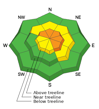
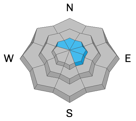
Today you'll find CONSIDERABLE avalanche danger on all steep, upper elevation, shady slopes. The danger is most pronounced in the wind zone at and above treeline, in terrain facing the north half of the compass, particularly on slopes with an easterly component to their aspect. Human triggered avalanches breaking to weak, sugary, midpack snow are LIKELY. Don't get surprised... mid week winds penetrated mid elevation terrain as well where you'll find MODERATE avalanche danger and human triggered avalanches are POSSIBLE on recently wind drifted slopes.
If you're looking for LOW avalanche danger, step this way, you came to the right place. Simply steer towards mid and low elevation wind sheltered terrain and slopes facing the south half of the compass with no overhead hazard (meaning, no steep slopes above or adjacent to where I'm traveling) where you can have a blast and score some quality riding to boot!
Low
Moderate
Considerable
High
Extreme
Learn how to read the forecast here
 Special Announcements
Didn’t get what you want for Christmas? Do your loved ones simply give you money for the holidays and say “Go buy something for yourself?” Support the UAC and get a great gift for yourself or your loved one at our Holiday Auction. The auction closes at 8:00 PM MT on January 2, 2023
 Weather and Snow
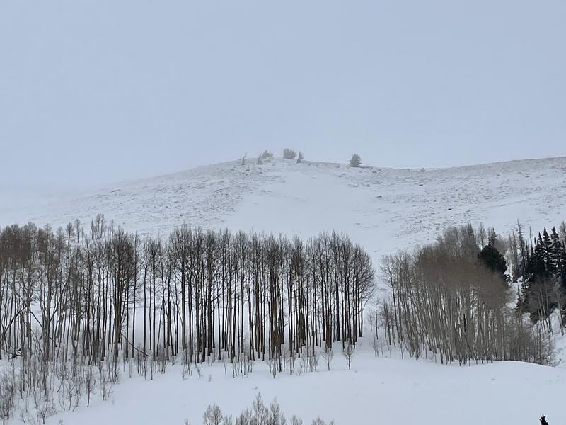
Nowcast- A thin, primer layer of white paint coats our mountains this morning as warm humid air delivers temperatures in the upper 20's. Along the high ridges, west and northwest winds bumped into the 30's overnight. Mid week, hurricane force winds torched our big, open terrain, and yesterday's humid cloud deck added a thin rime crust. So, riding and turning conditions are a bit hit or miss.
Forecast- We might squeeze and inch or two of snow out of today's little storm, but in general it's a non-event. High temperatures climb into the mid 30's with overnight lows dipping into the 20's. Northwest winds remain reasonably well-behaved, blowing 10-20 mph along the ridges with a gust or two in the 30's near the high peaks.
Futurecast- The warm before the storm settles in for Monday before a rather significant multi-day storm homesteads Tuesday through the remainder of the upcoming week. Expect strong southwest winds kicking off the storm, decreasing throughout the week. Heavy, wet snow mid-week transitions to the kind of stuff we like... colder, low-density snow toward the end of the week.
Lots of excellent trip reports and recent obs are found HERE.
 Recent Avalanches
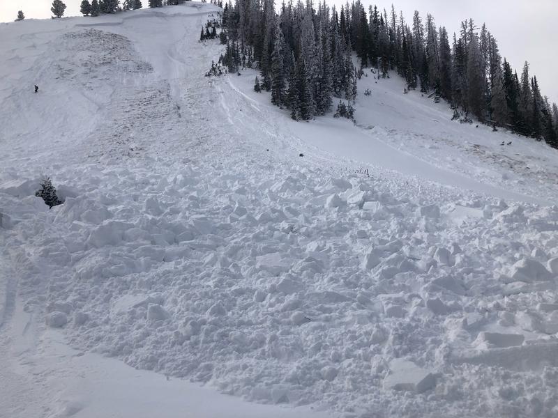
A robust thump to the snowpack yesterday, triggered this well connected slide in Upper Weber Canyon. Failing on the mid November weak layer and breaking 4' deep x 300' wide, whilst running 400' vertical, this piece of snow was packing tree busting heat!
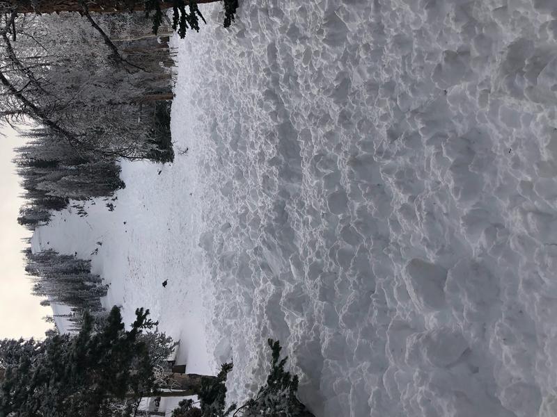
Our main man, avy-savvy snowpro Ted Scroggin had a look at the Double Hill avy from earlier in the week and has a great writeup HERE.
Both human triggered and natural avalanches display similar characteristics, revealing a failure in the midpack weakness which leads to avalanches gouging to the ground.
Recent avy activity and a slew of Uinta obs are HERE.

Avalanche Problem #1
Persistent Weak Layer
Type
Location
Likelihood
Size
Description
This slide triggered yesterday, tells me once we pull the rug out from underneath, we'll be staring down the barrel of a dangerous avalanche.
Here's the structure-
Strong snow on top of weaker snow... that snowpack setup isn't entirely unusual for us. What is unusual is that avalanches aren't breaking to weak sugary snow near the ground, that layer is solid and happy in its own skin. Rather... slides are failing on the persistent weak layer formed during the mid November dry-spell and that layer rests a couple feet off the ground. What's important to note is that avalanches now have a smooth surface with little resistance and that means they'll break wider and deeper and run faster and further than you might expect.
Here's the windup-
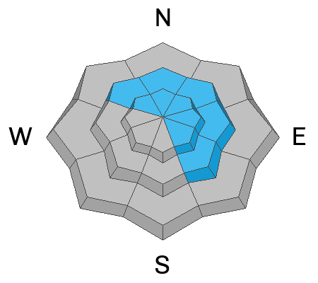
The most likely place to trigger an avalanche is where the snowpack is slightly shallower like lower down on the slope. The tricky party here is that once you knock the legs out from underneath, the entire wood pile crashes down on you! This avalanche dragon is found on slopes facing the north half of the compass, especially those in the wind zone at and above treeline, and particularly on slopes with an easterly component to their aspect. So, by avoiding this setup, you essentially avoid the problem.
Here's the pitch-
My strategy is finding terrain I can ride, have a fun day, and NOT trigger an avalanche. And actually that's an easy one. Travel is straight-forward on a very supportable base and low angle terrain rides like a dream! With no shortage of great riding in big open meadows and on lower angle slopes, there's plenty of opportunity to avoid pulling on the avalanches dragons tail all together.
Avalanche Problem #2
Wind Drifted Snow
Type
Location
Likelihood
Size
Description
Midweek winds nuked vast swaths of terrain facing the south half of the compass that was phat and white earlier this week.
If you went out wind drift hunting today, I bet you'd still find a rogue piece of snow that could react to your additional. In general though, these fat, rounded pillows of snow are welded in place. But don't let your guard down, today you'll wanna continue keying in on and avoid any fat looking piece of snow and avoid 'em, especially if they're sounding hollow like a drum.
Additional Information
Weather stations-
And... we were super busy this summer upgrading the western Uinta weather station network and this real-time winter info is found HERE (click weather stations, and then on the Western Uinta tab)
Observations-
Your observations are important, so please let me know what you're seeing... click HERE and contribute to this amazing community-based program
General Announcements
Issued at 03:54 on Sunday December 25th, this forecast expires 24 hours after the date and time posted, but will be updated by 07:00 Monday December 26th.
Before it gets too crazy, now is the time to book an avalanche awareness presentation for your group, club, or posse. You can reach Craig directly at 801-231-2170 or [email protected].
This forecast is from the U.S.D.A. Forest Service, which is solely responsible for its content. This forecast describes general avalanche conditions and local variations always occur.