Forecast for the Uintas Area Mountains

Issued by Craig Gordon on
Saturday morning, December 24, 2022
Saturday morning, December 24, 2022
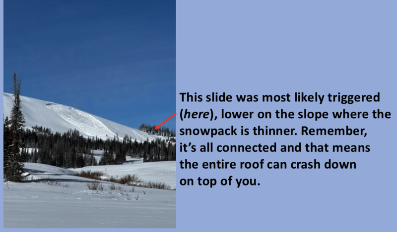
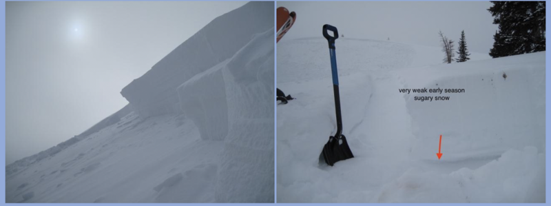
Little has changed in the past 24 hours. Steep, wind drifted slopes hang in a tenuous balance, just waiting for a trigger like us to roll along and knock the legs out from underneath-
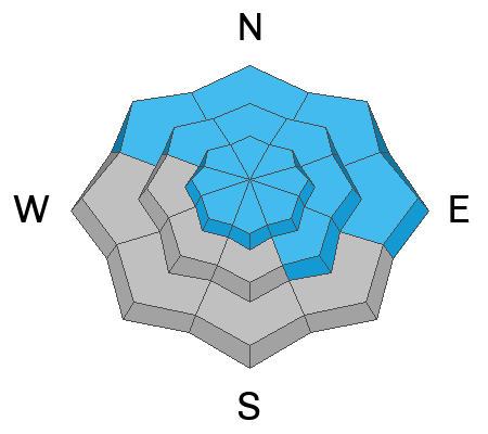
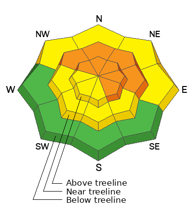
Around the compass you'll find CONSIDERABLE avalanche danger on all steep, mid and upper elevation, wind drifted slopes. The danger is most pronounced in the wind zone at and above treeline, in terrain facing the north half of the compass, particularly on slopes with an easterly component to their aspect. Human triggered avalanches initiating in the storm snow and then breaking to weak, sugary, midpack snow are LIKELY. Don't get surprised... winds penetrated into lower elevation terrain as well where you'll find MODERATE avalanche danger and human triggered avalanches are POSSIBLE on recently wind drifted slopes.
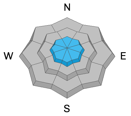
If you're looking for LOW avalanche danger, step this way, you came to the right place. Simply steer towards mid and low elevation wind sheltered terrain and slopes facing the south half of the compass with no overhead hazard (meaning, no steep slopes above or adjacent to where I'm traveling) where you can have a blast and score some quality riding to boot!
Low
Moderate
Considerable
High
Extreme
Learn how to read the forecast here