Join us at our 2nd Annual Blizzard Ball

Forecast for the Uintas Area Mountains

Craig Gordon
Issued by Craig Gordon on
Monday morning, December 26, 2022
Heads up... a firehose of moisture has its sights set on Utah and avy danger ramps up the next couple days as the storm evolves-
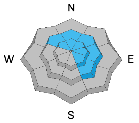
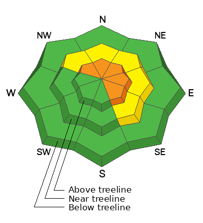
While not widespread, for today, you'll find pockets of CONSIDERABLE avalanche danger on steep, upper elevation, shady slopes. The danger is most pronounced in the wind zone at and above treeline, in terrain facing the north half of the compass, particularly on slopes with an easterly component to their aspect. Human triggered avalanches breaking to weak, sugary, midpack snow are LIKELY. Don't get surprised... last weeks winds penetrated mid elevation terrain as well where you'll find MODERATE avalanche danger and human triggered avalanches are POSSIBLE on steep, wind drifted slopes.
LOW avalanche danger is found on mid and low elevation wind sheltered terrain and slopes facing the south half of the compass with no overhead hazard (meaning, no steep slopes above or adjacent to where I'm traveling) where you can have a blast and score some quality riding to boot!
Low
Moderate
Considerable
High
Extreme
Learn how to read the forecast here
Special Announcements
Didn’t get what you want for Christmas? Do your loved ones simply give you money for the holidays and say “Go buy something for yourself?” Support the UAC and get a great gift for yourself or your loved one at our Holiday Auction. The auction closes at 8:00 PM MT on January 2, 2023

Weather and Snow
Nowcast- Warm, humid air hovers over the region, delivering yet another thin coat of white paint overnight. Temperatures hover in the mid 20's and low 30's while northwest winds blow 10-20 mph along the high ridges. The snow surface took a big hit from last weeks hurricane force winds and riding and conditions are a bit hit or miss. But, on a go-anywhere base, sheltered terrain still offers soft, semi-creamy snow.
Forecast- A warm, cloudy day is on tap as high pressure slides through the region. It'll feel downright balmy with temperatures climbing into the upper 30's. Northwesterly winds remain well-behaved, before switching to the west and southwest and increasing into the 30's late in the day.
Futurecast- An active weather pattern sets up beginning late Tuesday as Mother Nature takes a big pull from the pineapple express firehose. Heavy, wet snow begins stacking up overnight as west-southwest winds crank into the 50's. The good news is, winds back off as the storm progresses and snow densities decrease. It's a solid storm for the Uinta zone with a couple feet of snow piling up by Thursday. Another system is hot on the heels to round out the work week.

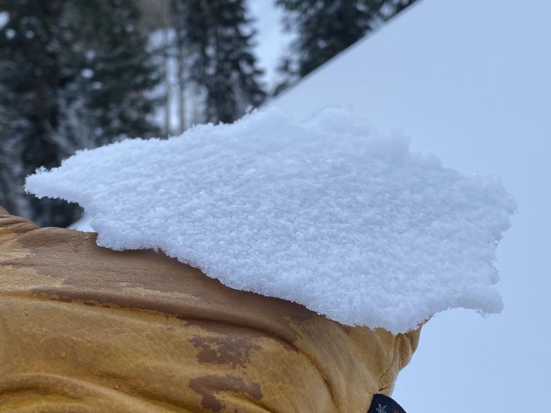
A thin rime crust caps the snow surface throughout the range. While not a big player in the avalanche game, it adds a funky twist to the snow surface.
Lots of excellent trip reports and recent obs are found HERE.
Recent Avalanches
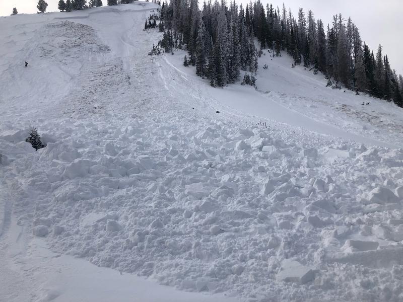
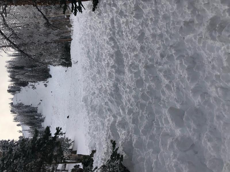
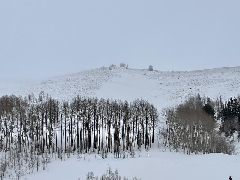
A robust thump to the snowpack Saturday, triggered this well connected slide in Upper Weber Canyon. Failing on the mid November weak layer and breaking 4' deep x 300' wide, whilst running 400' vertical, this piece of snow was packing tree busting heat!
Our main man, avy-savvy snowpro Ted Scroggin had a look at the Double Hill avy from earlier last week and has a great writeup HERE.
Both human triggered and natural avalanches display similar characteristics, revealing a failure in the midpack weakness which leads to avalanches gouging to the ground.
Recent avy activity and a slew of Uinta obs are HERE.
Ad
Avalanche Problem #1
Persistent Weak Layer
Type
Location
Likelihood
Size
Description
This slide triggered Saturday, tells me once we pull the rug out from underneath, we'll be staring down the barrel of a dangerous avalanche.
It's tricky... and here's why-
The snow feels strong and bomber under our skis, board, or sled and in fact, most slopes are generally good to go and happy in their own skin. Now here's the wild card... the most likely place to trigger an avalanche is where the snowpack is slightly shallower, like lower down on the slope. The tricky party here is that once you knock the legs out from underneath and the avalanche breaks to the weak midpack persistent weak layer, the entire roof is gonna crash down on top of us!
But wait... there's more-
Our deep, dangerous avalanche dragon is found lurking on slopes facing the north half of the compass, especially those in the wind zone at and above treeline, and particularly on slopes with an easterly component to their aspect. So... by avoiding terrain with these characteristics, you essentially avoid the problem.

Avalanche Problem #2
Wind Drifted Snow
Type
Location
Likelihood
Size
Description
Last weeks winds nuked vast swaths of terrain facing the south half of the compass that was once phat and white.
If you went out wind drift hunting today, I bet you'd still find a rogue piece of snow that could react to your additional weight. In general though, these fat, rounded pillows of snow are welded in place. But don't let your guard down, today you'll wanna continue keying in on and avoid any fat looking piece of snow and avoid 'em, especially if they're sounding hollow like a drum.
Additional Information
Weather stations-
And... we were super busy this summer upgrading the western Uinta weather station network and this real-time winter info is found HERE (click weather stations, and then on the Western Uinta tab)
Observations-
Your observations are important, so please let me know what you're seeing... click HERE and contribute to this amazing community-based program
General Announcements
Issued at 03:47 on Monday December 26th, this forecast expires 24 hours after the date and time posted, but will be updated by 07:00 Tuesday December 27th.
Before it gets too crazy, now is the time to book an avalanche awareness presentation for your group, club, or posse. You can reach Craig directly at 801-231-2170 or [email protected].

This forecast is from the U.S.D.A. Forest Service, which is solely responsible for its content. This forecast describes general avalanche conditions and local variations always occur.