
Forecast for the Uintas Area Mountains

Issued by Craig Gordon on
Thursday morning, April 3, 2025
Thursday morning, April 3, 2025
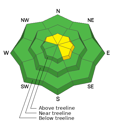
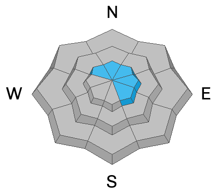
In the windzone, especially in high alpine terrain above treeline, the avalanche danger is MODERATE today. Human triggered avalanches are POSSIBLE, particularly on steep, leeward slopes facing the north half of the compass. As we begin to set our sights on big objectives don't forget... even a small avalanche can knock us off our feet and boss us around, especially in steep, technical, committing terrain.
Mid and lower elevations and most solar aspects offer LOW avalanche danger and human triggered avalanches are UNLIKELY.
In case you're wondering... our problem child, the PWL that's plagued us all season, has grown up, become comfortable in it's own skin, and is off to tennis camp for the spring. I don't expect it'll reappear on our avy forecast for the rest of the season.
Low
Moderate
Considerable
High
Extreme
Learn how to read the forecast here
 Special Announcements
The final report for the Hoyt Peak avalanche accident on March 7th has been published and is available, here.
Motorized Users—Please consider taking this 5-minute survey to help researchers better understand avalanche education participation and safety preparedness. Responses are anonymous and confidential.
 Weather and Snow
Nowcast: Weak storminess overhead delivers mostly cloudy skies, light snow showers and a thin coat of white paint, while winter-like temperatures register in the mid teens across the board. As a more substantial weather system dives to our south, easterly winds blow 10-15 mph near the high peaks.
Forecast: Look for mostly cloudy skies with scattered snow showers delivering a couple inches of snow by days end. East and northeast winds blow in the teens along the high ridges. Temperatures climb into the low 30's and dip into the teens overnight.
Futurecast: Unsettled weather continues across the region to wrap up the work week. A warming and drying trend settles in for the weekend into early next week.
Travel and Riding Conditions:
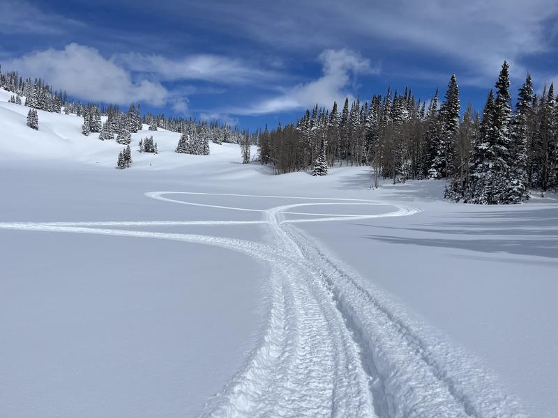
Our main man Ted Scroggin found a clean slate in the Whitney zone yesterday and reports... "12-14 inches of nice, medium density snow that filled in the old rough surface."
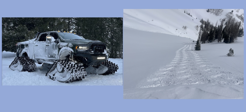
Meanwhile, I redeemed a mailer Groupon for a free Monster Truck test drive and took it for a rip in Upper Weber Canyon. I gotta tell ya... these things handle snow pretty well :)
 Recent Avalanches
No significant avalanche activity to report from yesterday.
Check out all trip reports, avy obs, and general intel from around the state here.

Avalanche Problem #1
Wind Drifted Snow
Type
Location
Likelihood
Size
Description
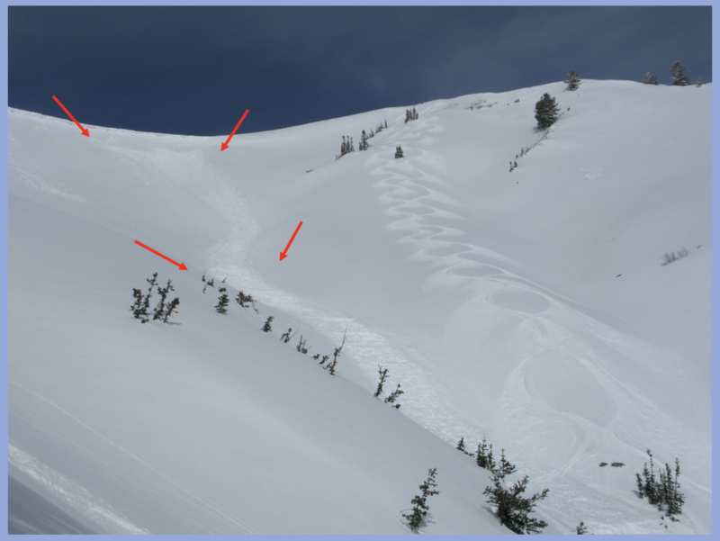
Recent wind slab/storm slab avalanche that ran naturally during the April Fools storm is highlighted with arrows. Even though the avy hazard decreased and isn't nearly as touchy, yesterday I watched Jason and Dave doing it right and with class, stepping into this big terrain, while navigating turns safely by avoiding gullies and instead using natural islands of safety like the raised rib they so eloquently slayed :)
Most of our April Fools storm snow issues have settled out nicely, gained strength, and won't be nearly as reactive as they were just 48 hours ago. But, here's the wrinkle in the fabric... recent wind slabs are camouflaged with an inch or two of fresh snow, making them hard to detect. This is an easy avalanche dragon to avoid... lose the wind and you lose the problem. Yeah... simply avoid steep leeward slopes that appear fat, rounded, and pillowy in nature. I’m taking that intel and heading to mid and upper elevation, wind sheltered terrain where I know I can avoid the problem and still score an outstanding day of riding to boot!
Additional Information
General Announcements
We are always looking for snow and avalanche observations or just general riding conditions. In the meantime reach out to us with questions, concerns, or if you see anything in your travels! Contact us directly through the info below:
- Craig Gordon [email protected] 801-231-2170.
- Andrew Nassetta [email protected] 860-460-8142.
This forecast is from the U.S.D.A. Forest Service, which is solely responsible for its content. This forecast describes general avalanche conditions and local variations always occur. This forecast was issued on Thursday, April 3rd at 03:30 AM and expires 24 hours after it was issued.