

Forecast for the Uintas Area Mountains

Issued by Craig Gordon on
Saturday morning, April 5, 2025
Saturday morning, April 5, 2025
Thanks for all the cards and letters asking about the health and stability of our problem child... the PWL that's plagued us all season. I'm happy to report, it's all grown up, comfortable in its own skin, and is off to tennis camp for the spring. I don't expect it'll reappear on our avy forecast for the rest of the season.
For today, look for MODERATE avalanche danger in the windzone, especially in high alpine terrain above treeline. Human triggered, wind slab avalanches are POSSIBLE around the dial, particularly on steep, leeward slopes. Note to self- as I begin to set my sights on big objectives don't forget... even a small avalanche can knock me off my feet and boss me around, especially in steep, technical, committing terrain.
Mid and lower elevations offer LOW avalanche danger and human triggered avalanches are UNLIKELY.

Low
Moderate
Considerable
High
Extreme
Learn how to read the forecast here
 Special Announcements
The final report for the Hoyt Peak avalanche accident on March 7th has been published and is available, here.
Motorized Users—Please consider taking this 5-minute survey to help researchers better understand avalanche education participation and safety preparedness. Responses are anonymous and confidential.
 Weather and Snow
Nowcast: Storminess has left the stadium and high pressure builds in its place delivering clear skies and crisp temperatures registering in the mid teens across the board. North and northeast winds bumped into the mid 20's near the high peaks right around dinnertime Friday, and continue in that spirit this morning.
Forecast: It'll be a stunning day on the eastern front with mostly sunny skies and temperatures climbing into the mid 30's. Northerly winds, occasionally blowing to 30 mph along the high peaks, are a slightly buzz-killing wrinkle in the fabric of the day.
Futurecast: Continued high and dry through Sunday with slightly warmer temperatures to wrap up the weekend. Looking into the weather crystal ball... other than a weak storm bumping to our north late Monday, we are done with wet weather through the upcoming week.
Travel and Riding Conditions:
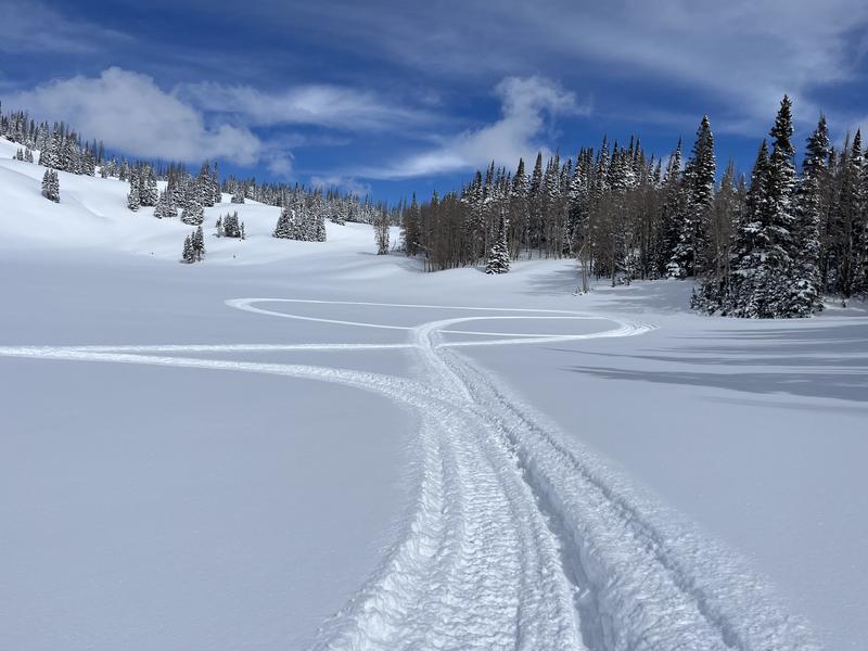
Our main man Ted Scroggin found a clean slate in the Whitney zone Wednesday and reports... "12-14 inches of nice, medium density snow that filled in the old rough surface."
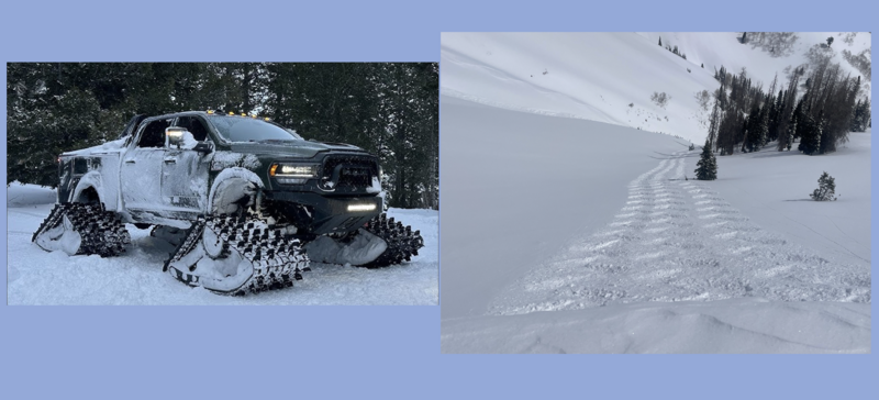
Meanwhile, I redeemed a mailer Groupon for a free Monster Truck test drive mid week and took it for a rip in Upper Weber Canyon. Precision handling for sure... though perhaps slightly faster on the up, then the down :)
 Recent Avalanches
No significant avalanche activity to report from yesterday.
Check out all trip reports, avy obs, and general intel from around the state here.

Avalanche Problem #1
Wind Drifted Snow
Type
Location

Likelihood
Size
Description
It's been pretty quiet on the eastern front, most of our April Fools storm snow issues have settled out nicely, and in general the snowpack is happy in its own skin. However, the Uinta's are a big place and I bet there's a windslab or two lurking on a steep, leeward slope in the alpine, waiting for us to test our theories. This is an easy avalanche dragon to avoid... lose the wind and you lose the problem. Yeah... simply avoid steep leeward slopes that appear fat, rounded, and pillowy in nature. I’m taking that intel and heading to mid and upper elevation, wind sheltered terrain where I know I can avoid the problem and still score an outstanding day of riding to boot!
Additional Information
General Announcements
We are always looking for snow and avalanche observations or just general riding conditions. In the meantime reach out to us with questions, concerns, or if you see anything in your travels! Contact us directly through the info below:
- Craig Gordon [email protected] 801-231-2170.
- Andrew Nassetta [email protected] 860-460-8142.
This forecast is from the U.S.D.A. Forest Service, which is solely responsible for its content. This forecast describes general avalanche conditions and local variations always occur. This forecast was issued on Saturday, April 5th at 03:00 AM and expires 24 hours after it was issued.