Join us for the 33rd Backcountry Benefit - Get Your Tickets Now!

Forecast for the Skyline Area Mountains

Brett Kobernik
Issued by Brett Kobernik on
Sunday morning, January 11, 2026

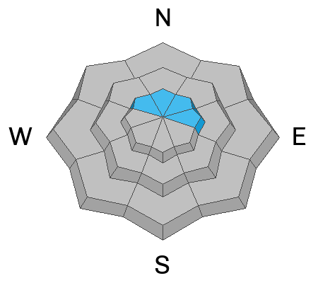
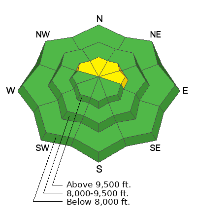
Human-triggered avalanches are possible today, but fairly unlikely. A "pockety" MODERATE avalanche danger is present on steep slopes above about 9500 feet that face NW, N, NE, and E. These areas are the most likely places to find the combination of wind drifts and slabs with facets buried beneath them.
Low
Moderate
Considerable
High
Extreme
Learn how to read the forecast here
Weather and Snow

General Conditions: Saturday was a great day to be out in the mountains with a good amount of sunshine and temperatures into the mid 20s. Moderate speed wind from the north stuck around for most of the day. The upper elevation exposed terrain has taken a bit of a hit, and there you'll find areas with stiff snow and wind crusts. In sheltered terrain, the powder remains excellent. Temperatures have been on the rise overnight with many stations in the upper 20s. The wind has really slowed down and is almost calm.

Logan Addis was prowling around Boulger Canyon near Electric Lake on Saturday and wrote up a good narrative describing what he found. DETAILS HERE

Mountain Weather: There will be plenty of sunshine today. It looks like there may be some high thin clouds. Temperatures will get into the 30s. Wind will be light and variable. A ridge of high pressure dominates the weather this upcoming week, bringing clear skies and very mild temperatures. Weather models hint at a storm around Jan 23.
Avalanche Problem #1
Persistent Weak Layer
Type
Location
Likelihood
Size
Description

There are many areas with loose, weak, faceted snow near the ground. While there is weak snow within the snowpack, I'm finding that most locations are currently stable and won't avalanche. The wind has been blowing enough to drift snow. Areas where the snow has landed and formed slabs with loose facets under them is where you could find trouble. This is really the only thing you need to be concerned with out there today.

For more thoughts on the current snowpack strucure, check out the backcountry observation I compiled from Saturday. DETAILS HERE

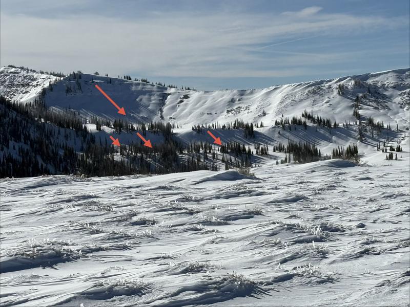
Photo below: Rolfson Canyon with examples of where you might be able to trigger an avalanche today - Kobernik

General Announcements
This forecast is from the U.S.D.A. Forest Service, which is solely responsible for its content. This forecast describes general avalanche conditions and local variations always occur.