Forecast for the Salt Lake Area Mountains

Mark Staples
Issued by Mark Staples for
Saturday, April 6, 2019
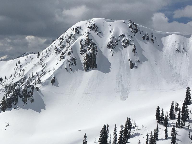
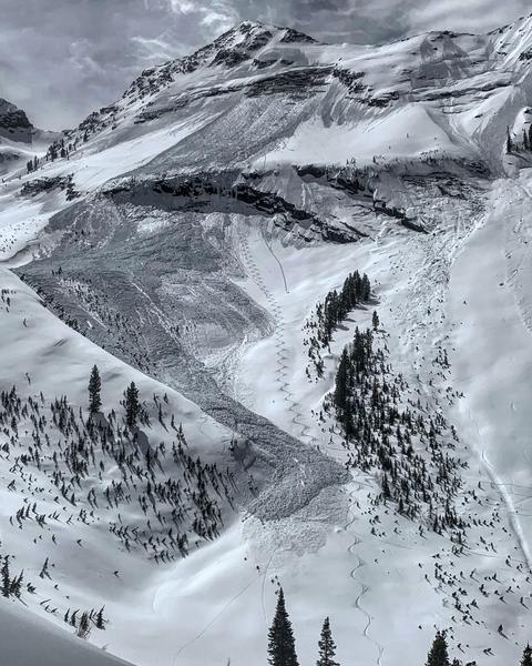
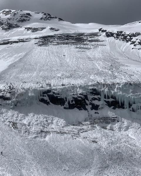
Today the avalanche danger is MODERATE. The main issue will be wet avalanches at mid and low elevations. The mostly likely ones will be wet loose slides at low elevations, but wet slabs will be possible at mid elevations. At upper elevations shallow avalanches of wind drifted snow are possible. Lastly there is a chance for very large glide avalanches in very specific places.
Low
Moderate
Considerable
High
Extreme
Learn how to read the forecast here
Special Announcements
Grizzly Gulch will be closed on Sunday April 7 and Monday April 8 as Alta conducts rescue training.

Summer is a busy time for the UAC working on our fall and winter planning, putting together the Fall Fundraiser and the Utah Snow and Avalanche Workshop (USAW), and updating our education programs. In addition, this summer we will be finishing up the website redesign project. Your donation shows you’re invested in this community all year round! You can still be part of the UAC’s success in 2019.
Weather and Snow
Currently: Precipitation started at about 3 a.m. with rain in the valleys and wet snow falling in the mountains above 7500 feet. As of 6 a.m. only about a half inch of wet snow (0.1-0.17 inches of water) has fallen in most places. Upper Little Cottonwood received 2 inches of snow at 9700 feet.
Mountain temperatures at lower elevations this morning are in the mid 30s F. Above 9000 ft, temperatures are in the upper 20s F. Westerly winds at ridgetops are averging 10 mph gusting 15-25 mph. They were gusty at low elevations as well.
Today: Snow and rain will continue through the morning with rain below 7500 feet. By mid day most precipitation will taper off and end tonight as dry air enters the area through the weekend. Winds today will continue from the west at similar speeds. An additional 1-3 inches of snow should accumulate
Next week: A very promising storm is on schedule for Tuesday night into Wednesday. It will bring cold air and some snow to the valley by Wednesday morning with a decent amount of snow in the mountains.
The Week in Review can be found by clicking here.
Recent Avalanches
Avalanche activity this week has mostly been wet slides involving snow that fell last Friday (12-24 inches) and then snow that fell Wednesday (6 inches).
Yesterday there were several decent sized wet avalanches on south facing slopes in Little Cottonwood Canyon. One under the Hellgate cliffs dribbled onto the road. The main weather factor with these slides was the lack of a refreeze Thursday night. Ski Patrols reported small wet loose avalanches. A snowmobiler in American Fork Canyon triggered a shallow wet avalanche that released as a slab and was sliding on a recently formed ice crust. Below is an example of small wet avalanches yesterday on a north facing slope on Mt Tuscarora in Big Cottonwood Canyon.
Also in Broads Fork, Mark White spotted a large glide avalanche that released sometime Thursday afternoon.
Ad
Avalanche Problem #1
Wet Snow
Type
Location
Likelihood
Size
Description
The main avalanche problem to look for will be wet avalanches. These will be most likely at low elevations where rain falling on the snow will cause loose wet avalanches. The main thing to do is avoid being under steep slopes.
As you climb higher into mid elevations there will be a transition zone where some rain fell followed by a little snow. Both wet loose and shallow wet slab avalanches are possible.
The best strategy will be to climb to higher elevations where you no longer find wet snow underneath today's new snow.
Avalanche Problem #2
Wind Drifted Snow
Type
Location
Likelihood
Size
Description
As you climb higher and find dry snow, watch for shallow wind drifts from westerly winds this morning.
Avalanche Problem #3
Gliding Snow
Type
Location
Likelihood
Size
Description
In specific places, the entire snowpack glides downhill and can release at unpredictable times. Before releasing, the snowpack produces large, visible cracks in the snow which tell us where these avalanches can occur. They often happen where the snowpack rests on top of rock slabs or other smooth ground surfaces.
Common places to find these cracks and the resulting glide avalanches are Broads Fork, Stairs Gulch, and Mill B South of BCC, upper Porter Fork (Raymond Slabs), as well as one spotted on Cardiac Ridge.
Knowing when they will occur is very tough.
Knowing where they will occur is easy because they typically produce large cracks prior to avalanching.
Photo of glide avalanche in Broads Fork (M. White).
General Announcements
This information does not apply to developed ski areas or highways where avalanche control is normally done. This forecast is from the U.S.D.A. Forest Service, which is solely responsible for its content. This forecast describes general avalanche conditions and local variations always occur.