Forecast for the Salt Lake Area Mountains

Nikki Champion
Issued by Nikki Champion for
Thursday, April 16, 2020
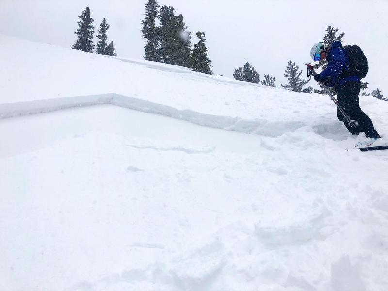
This morning the overall avalanche danger is MODERATE at all mid and upper elevations. The strong westerly winds in combination with new snow will create unstable slabs of wind-drifted snow. Look for any signs of wind drifted snow, and avoid these slopes. Additionally, the new snow may produce shallow soft slab avalanches or long-running sluffs.
Evaluate snow and terrain carefully, and pay attention to changing weather patterns.
Low
Moderate
Considerable
High
Extreme
Learn how to read the forecast here
Special Announcements
The Avalanche Research Program at Simon Fraser University is conducting an online survey to examine how people use avalanche safety information. They want to hear from all backcountry users to understand how they process information provided in public avalanche forecasts. Anyone who completes the survey before May 15th will be entered to win cash prizes.
Chapter 7 of the Low Danger Series - The Crossing
Weather and Snow
This morning feels like a return of winter. Mountain temperatures in the mid-20s F at trailheads and upper teens F at ridgelines. Winds are currently westerly averaging 10-15 mph with gusts near 20 mph at mid-elevations, at upper elevations winds are averaging near 35 mph with gusts above 50 mph. Skies are overcast, and it is still currently snowing. Since yesterday morning the Central Wasatch has picked up 6-10 inches of snow (0.4-0.7 inches of water).
Today, these snow showers will continue through the midafternoon before the skies clear tonight and temperatures drop. Mountain temperatures will be in the low to mid-20s F and winds will continue to be westerly averaging 10-25 mph with gusts up to 40 mph at the upper elevations. The Central Wasatch could get another 2-4 inches of snow throughout the day.
Yesterday, both Drew and Trent found the best riding conditions to be in the low angle smooth terrain.
Recent Avalanches
Yesterday there were reports of a few shallow avalanches in the new snow.
Most of these were reported as fast running sluffs, failing on the firm melt-freeze crust below the new snow. While these avalanches were reported to be running fast and far, they were not entertaining very much snow.
Below is a photo of a shallow soft slab of new snow on a NE Aspect at 9,700' in East Bowl of Silver Fork. (Photo: Cf)
Find full list of observations HERE.
Ad
Avalanche Problem #1
Wind Drifted Snow
Type
Location
Likelihood
Size
Description
The westerly winds continue to blow across the upper elevations at speeds above 35 mph and now have some new snow to move around. Shallow drifts of windblown snow will be the biggest concern for today. These shallow drifts will be most pronounced just off the ridgelines and on steep slopes that face easterly, but with elevated winds, cross-loading is possible on any aspect. As well look for these shallow drifts around terrain features like cliff bands, scoops, gully walls, and sub-ridges at mid-elevations.
Look for obvious signs of wind-drifted snow, such as pillow-shaped slopes, cracking and whumpfing, and avoid those slopes.

Cornices: The cornices are large and growing, and can't be forgotten. While the cold temperatures should lock them into the place the added load and increased winds could push them to their tipping point. Give ridge top cornices a wide berth, which can break much further back than expected and could start avalanches on slopes below.
Below is a cornice from the Cottonwood Ridgeline, and the red line indicts the area of margin you should give while traveling near these large cornices.
Avalanche Problem #2
New Snow
Type
Location
Likelihood
Size
Description
Since yesterday up to 10 inches of light snow has fallen on an array of firm snow surfaces in the backcountry, and I expect to continue seeing shallow new snow avalanches today.
Any area that still held any lingering soft snow, before yesterday, will be suspect as I would expect some shallow soft slabs to form in these zones, But predominately, fast running sluffs are likely to continue today on the prior melt-freeze crusts that covered the range. While these far running sluffs don't entrain much snow they can be dangerous in areas they could knock you off your feet and sweep you through complex terrain, or into terrain features where the shallow snow could pile up deeply.
Watch for obvious signs of instability such as cracking and sluffing.
Photo of a far running sluff from the Cottonwood Ridgeline yesterday.
Additional Information
Information on outdoor recreation - The State of Utah created this webpage with information about recreating on both state and federal public lands during the current health crisis.

Skiing and riding at closed ski resorts - Some resorts allow access now, and some do not. Please check HERE for the latest info on ski area access.

New to the backcountry (including riding at closed resorts) - Watch the award-winning, 15 minute Know Before You Go video, or take the 5-part, free online-learning series.
General Announcements
This information does not apply to developed ski areas or highways where avalanche control is normally done. This forecast is from the U.S.D.A. Forest Service, which is solely responsible for its content. This forecast describes general avalanche conditions and local variations always occur.