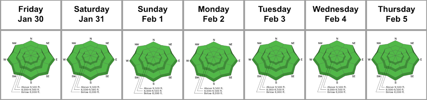
Forecast for the Salt Lake Area Mountains

Bo Torrey
Issued by Bo Torrey on
Saturday morning, February 7, 2026

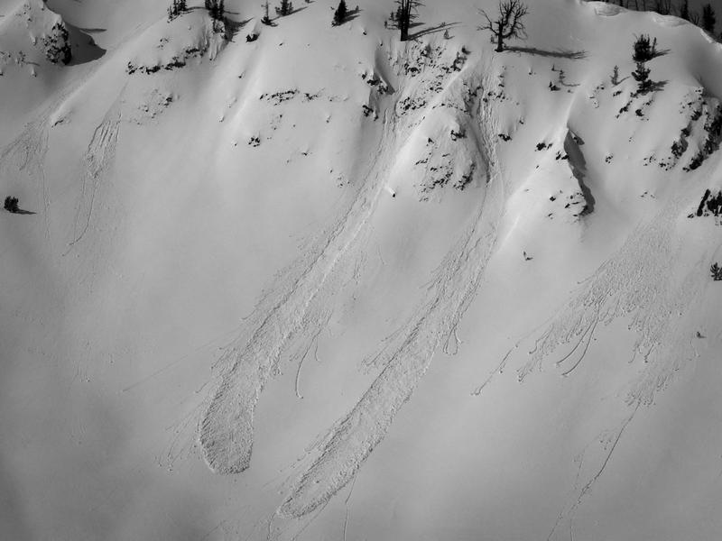
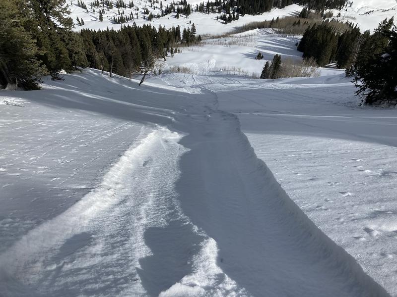
Avalanche conditions are generally safe, and the danger is LOW. You may trigger wet-loose avalanches on sunny slopes as temperatures rise. Conversely, you may trigger dry-loose avalanches on shaded slopes where the surface snow is soft and weak.

Grey on low elevation southerly aspects indicates that there is little to no snow in this terrain.

Low
Moderate
Considerable
High
Extreme
Learn how to read the forecast here
Special Announcements

Greatest Rain on Earth?!?: Forecaster Drew Hardesty penned a new essay about high-elevation rain and the warm-snow drought HERE.

Weak Snow: Today's Surface, Tomorrow's Avalanche Problem: Essay by UAC Director Paige Pagnucco HERE.

Weather and Snow

Currently, the skies are mostly clear. Temperatures are hovering around 30°F, and most stations only dropped below freezing for a few short hours. This will create a shallow refreeze and a brief window for supportable travel on sunny slopes. Overnight, winds blew from the SW at 10–20 mph, with some gusts reaching into the 30s at 11,000 feet.

Today, we'll see mostly sunny skies, with daytime temperatures warming into the mid-40s °F by the afternoon. The wind continues to blow from the SW, at 10-20 mph.

Starting on Monday, we will see a change in the weather as snowfall returns. The initial waves of precipitation, from Monday to Wednesday, don't look like blockbusters, but they may be the first in a series. Stay tuned.

The Week in Review is hot off the press. You can find it HERE.

Recent Avalanches

No avalanches were reported from the backcountry yesterday. You can view recent observations here.

Avalanche Problem #1
Normal Caution
Type
Location
Likelihood
Size
Description

The snowpack is generally stable; however, that does not mean avalanches are impossible. The main considerations for your mountain travels today will be:

  • Loose wet avalanches: Unseasonably warm temperatures are causing the snowpack to become isothermic and lose strength. Be alert on slopes with wet and unsupportable surfaces, where you could trigger a small but commanding wet snow avalanche.

  • Loose dry avalanches: Several weeks of mostly clear weather have severely weakened the snow surface, especially on slopes protected from the sun and wind. If you're heading out to find soft turns in steep, protected terrain, watch for loose surface sluff to entrain additional snow, becoming larger and faster-moving than you might anticipate.

General Announcements

This information does not apply to developed ski areas or highways where avalanche control is normally done. This forecast is from the U.S.D.A. Forest Service, which is solely responsible for its content. This forecast describes general avalanche conditions and local variations always occur.