Holiday Auction is Live!

Forecast for the Salt Lake Area Mountains

Trent Meisenheimer
Issued by Trent Meisenheimer on
Tuesday morning, November 17, 2026

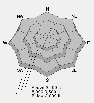
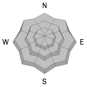
Avalanche danger will rise throughout the day as strong southerly winds and accumulating snowfall create a fresh batch of wind-drifted soft slab avalanches. Some avalanches could break into buried faceted weak layers, potentially producing slides large enough to bury a person as the snow stacks up. Avoid steep mid- and upper-elevation slopes, especially those facing northwest through east.

Low
Moderate
Considerable
High
Extreme
Learn how to read the forecast here
Special Announcements

Each resort in Utah has its own uphill travel policies. Check out the summary of each resort's policy before traveling uphill. For further questions, contact the resort directly.

SAVE THE DATE!

Weather and Snow

Mountain temperatures currently range from 39-26 °F between 7,000 and 10,000 feet. Southerly winds increased overnight and are now blowing 15–25 mph, with gusts into the 20s and 30s along upper-elevation ridgelines. I suspect a few snowflakes are already flying in the mountains as I type this morning.

A progressive Pacific trough will move across northern Utah today, bringing two distinct periods of snowfall to the Wasatch. The first round arrives this morning as increasing large-scale ascent and southwest flow that should favor snowfall in areas that like southwest flow. Precipitation should become more widespread through the afternoon as the system moves across the region.

A cold front will sweep through northern Utah this afternoon and evening, with winds veering from the south and southwest to west-northwest. A second period of enhanced snowfall is expected this evening as the mid-level trough axis moves overhead, accompanied by stronger cold-air advection and increasingly favorable conditions for postfrontal orographic snowfall.

Temperatures at 700 mb (roughly 10,000 feet) will fall from near 0°C this morning to around -8°C by this evening, with additional cooling possible into Wednesday. This colder air mass will lower snow levels considerably and should improve snow-to-liquid ratios as the storm progresses.

The biggest wildcard remains the duration and orientation of the postfrontal flow. Persistent west-northwest to northwest winds could prolong orographic snowfall overnight, particularly in favored terrain like the Cottonwoods.

My best estimate is 6–12 inches of snow containing 0.50–1.25 inches of water by the time the storm wraps up overnight. If the postfrontal moisture and orographic enhancement linger longer than anticipated, we could squeeze out a few additional inches.

Recent Avalanches

No new observations were submitted. You can find all recent observations HERE.

Avalanche Problem #1
Normal Caution
Type
Location
Likelihood
Size
Description

Today will bring increasing avalanche danger as a storm moves into northern Utah. Strong southerly winds and accumulating snowfall will create fresh wind-drifted soft slabs that could break within the new snow or potentially step down into buried faceted weak layers. Avalanches will grow in size throughout the day, and with enough snowfall, we could see avalanches large enough to bury a person.

My advice is to let the snow stack up and avoid steep slopes today, especially those facing northwest, north, northeast, and east at the mid and upper elevations. I know these slopes look best for riding and turning, but they're also where avalanches could break into deeper weak layers in the snowpack.

It's still early season, and the snowpack remains shallow. Keep it mellow, dust off your avalanche gear, and practice with your beacon, shovel, and probe. Give the new snow time to settle and stabilize over the next few days. The riding will only get better, and there's no reason to rush onto steep terrain today.

Video: Greg showing us some weak faceted snow.

Additional Information

It's never too early to start thinking about avalanches. Here are a few things to consider doing:

  • Learn online. We have over 5 hours of free online learning at the Know Before You Go website
  • Check out the upcoming in-person Know Before You Go events HERE
  • Sign up for an on-snow class
  • Check out the UAC's education progression HERE
  • Get your avalanche rescue gear ready for winter. Put fresh batteries in your transceiver and update the firmware. Inspect your shovel and probe. Get your airbag backpack ready by possibly doing a test deployment and updating the firmware if it is an electric version or getting your canister refilled if it's not electronic.