Many ski areas are now closed to uphill travel in order to prepare for winter operations. Resort uphill travel policies can be found
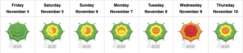
HERE. As of 5am, skies are clear with mountain temps in the mid to upper 20s up high, the single digits and low teens down low. Winds backed to the south overnight with some of the more exposed anemometers recording hourly averages of 25-30mph with gusts to 35.
A weak and diving storm system will bring high and then mid-level clouds to the Wasatch range today, along with warm temperatures and increasing southerly winds along the higher elevations. Mountain temperatures will rise to the upper 20s up high, the low 30s down low. Winds will blow 25-35mph with occasional gusts to 40. The weather looks "non-eventful' through the rest of the weekend and into next week.
The GOOD NEWS is that coverage is excellent for this time of year and riding conditions on the northerly aspects are almost as good as it gets. Solar aspects suffered some damage yesterday and will be crusted over this morning.
Storm totals since Monday in the Cottonwoods are 2-3' of snow containing 2.9-4.6" of water.
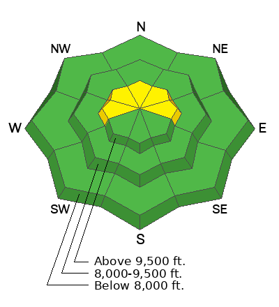
Snowpack depths are
3-4' in the Park City mountains;
4-5' in the Cottonwoods;
the highest snow totals for early November since 2004.
Yesterday's avalanche activity was limited to some shallow wet sluffs in the steepest south facing terrain in mid-Little Cottonwood Canyon.
With good visibility and easy travel, more evidence of the mid-week avalanche cycle is pouring in.
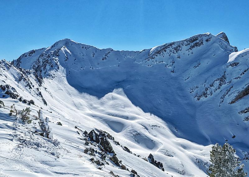
- Wednesday natural avalanche on north facing Monte Cristo bowl in the back bowls of Mill B South of BCC. North facing at @11,000' (photo Spencer Donovan)
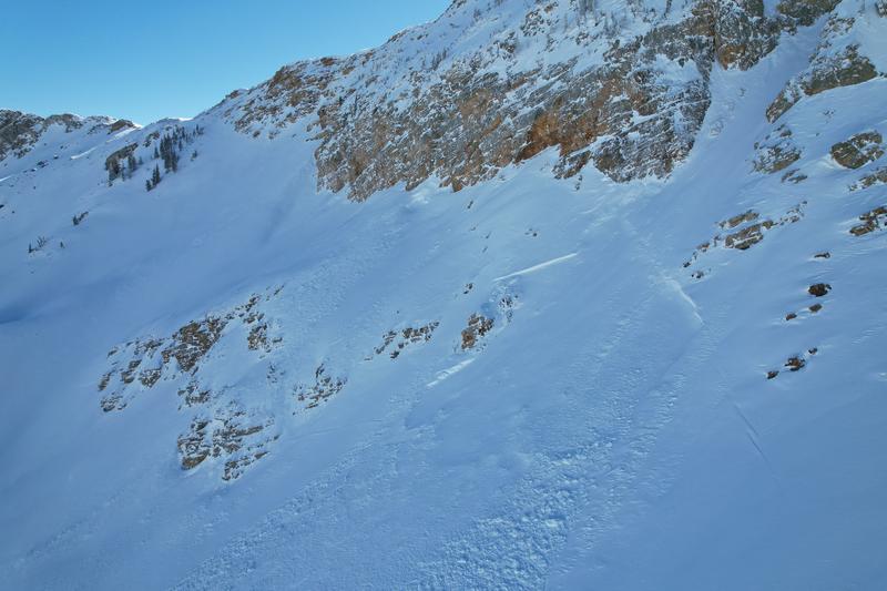
- Thursday natural avalanche on north facing Sugarloaf in upper LCC. North facing at 10,800'. (photo Dave Richards)
We received several excellent observations from Thursday and I recommend you include reviewing all observations as part of your backcountry planning.