Many ski areas are now closed to uphill travel in order to prepare for winter operations. Resort uphill travel policies can be found
HERE. Skies are clear. Winds are light from the southwest. Mountain temperatures are in the teens. A weak storm will pass to the south of us today and we'll see partly cloudy skies and light veering winds to the north. Temps will be in the low to mid-20s. Dry, cool and stable conditions are on tap for the week.
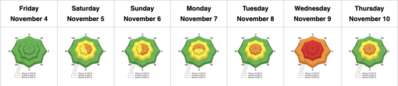
The GOOD NEWS is that coverage is excellent for this time of year and riding conditions on the northerly aspects are fair to good. Solar aspects will be crusted over this morning and yesterday's winds left some damage in the high elevations.
Storm totals since Monday in the Cottonwoods are 2-3' of snow containing 2.9-4.6" of water.
Snowpack depths are
3-4' in the Park City mountains;
4-5' in the Cottonwoods;
the highest snow totals for early November since 2004.
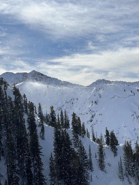
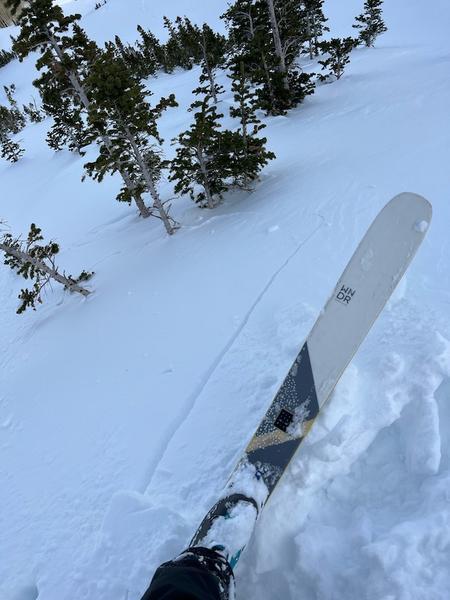
No avalanche activity was reported from the backcountry yesterday. That said, one experienced backcountry party noted wind loading in the higher elevations, experienced shooting cracks in the new wind blown snow and wisely backed out and chose different terrain. A party in the Provo mountains also turned around after finding conditions that they did not like. This is good decision making and I applaud that. Cause (wind drifting) and effect (shooting cracks) photos below (Stauss and Ratliff)
Read the most recent observations from the backcountry HERE.
If you see anything we should know about, please submit your own observations HERE.