Special Avalanche Bulletin
IN EFFECT FROM 6 AM MST THIS MORNING TO 6 AM MST MONDAY
FOR THE MOUNTAINS OF NORTHERN UTAH INCLUDING THE WASATCH RANGE...BEAR RIVER RANGE...UINTA MOUNTAINS...
THE AVALANCHE DANGER IS CONSIDERABLE TO HIGH IN MANY AREAS.
CONDITIONS ARE PERFECT FOR AVALANCHE ACCIDENTS THIS WEEKEND. DANGEROUS AVALANCHE CONDITIONS EXIST. AVALANCHES COULD BE LARGE, VERY DANGEROUS, UNEXPECTED, AND PERHAPS DEADLY.
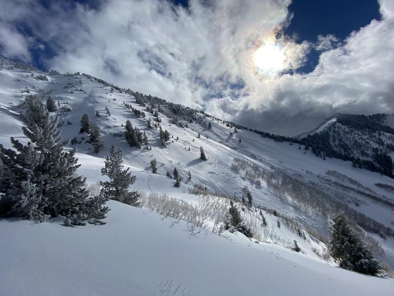
After picking up a final few inches of snow yesterday morning, the storm tapered off and high pressure began to build over the area. This morning, under clear skies we have an inversion in the mountains with temperatures ranging from the single digits to mid-teens F. Winds are almost dead calm, averaging below 10 mph with gusts near 15 mph at the highest ridgelines.
Today, high pressure will continue to build bringing sunny skies in the morning, and increasing cloud cover in the afternoon. Temperatures will be in the low 30s F, and southerly winds will remain calm with gusts below 30 mph at the upper ridgelines.
The final rough snow totals below:
Upper LCC: 15.5"-21" new snow (1.16 "-1.15" water)
Upper BCC: 12"-20" new snow (0.88"-1.20" water)
Park City Ridge: 10"-14" new snow (0.80"-1.1" water)
Provo Mountains: 10"-12" new snow (1.0"-1.51" water)
Ogden Mountains: 12.5"-24" new snow (0.95"- 2.13" water)
Week in Review: This past week has been active with lots of (1) snow, (2) wind, and (3) avalanches. Catch up by reading our latest
Week in Review.
With great sadness, the Utah Avalanche Center reports there has been an avalanche accident off of Squaretop Peak, located on the Park City Ridgeline. The preliminary information can be found
HERE. Because of the extreme danger of the area, the rescue is ongoing and will continue this morning.
Following the rescue operations, UAC Staff, along with PCMR Ski Patrol, will investigate the accident and will have the full report available in a couple of days.
Yesterday was an extremely active day in the backcountry, as of 5:00 AM this morning 17 avalanches were reported in the backcountry, including multiple catches and carries and close calls. Ski patrols also reported large class 2 avalanches triggered with explosives. A few avalanches of note:
- Main Gobblers - Northwest Aspect - 10,000 - Two skiers were caught, carried, and partially buried in an avalanche that broke 3-4' deep and 350' wide, Main Gobblers ran about 2000' vertical feet. The party sustained injuries but was able to self extract to where they were met by Search and Rescue.
- Upper Millcreek - Southeast Aspect - 9,200' - A skier was caught, carried, and partially buried in an avalanche that broke 2' deep and 80' wide. The rider pulled their airbag was able to stay on top of the debris and was extracted by their partners.
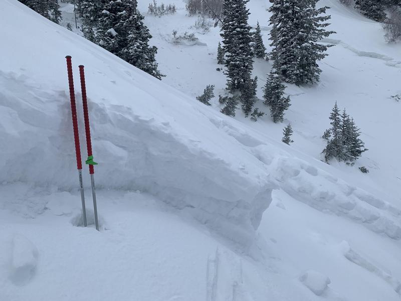
- West Porter Fork - East Aspect - 9,600' - A natural avalanche that broke 3' feet deep and 500' wide - A storm slab, likely triggered by cornice fall that stepped down more deeply into the weak faceted snow.
Photo of the Main Gobblers avalanche.
Photo of West Porter Fork avalanche. (A. Bellomy)
The avalanche list is growing, and as always, you can find all observations and recent avalanches
HERE.