Greg Gagne
Forecaster
Our Week in Review highlights significant snowfall, weather, and avalanche events of the previous week. (Review the archived forecasts for the Salt Lake mountains.)
The danger roses for the Salt Lake mountains from Friday, January 22 through Thursday, January 28:

Summary: A significant storm over Friday/Saturday, followed by a few days of benign weather. Winds begin to increase on Wednesday, January 27, ahead of a storm system on a southwest flow, leading to escalating avalanche danger.
Snow/Water Totals for the week include:
Upper Little Cottonwood 28" with 2.2" Snow Water Equivalent (SWE)
Upper Big Cottonwood 20-32" with 1.5-2.7" SWE
Park City Ridgeline 24" with 2.1" SWE
30 backcountry avalanches in the Salt Lake mountains are reported to the UAC since the onset of the storm on Saturday, January 23, but the number is likely much higher. Some of the reported slides were up to 300' wide, 6' deep, running up to 500' vertical. Avalanches were failing within storm snow, at the interface of the old snow surface prior to January 23, and down into deeper facets from November/December. Avalanches occurred on aspects facing west, through north, and east.
Look at the avalanche activity in the Salt Lake mountains, as well as all observations.
Friday, January 22: Skies cloud up ahead of a decent storm that begins later Friday evening. During the day only a few inches of new snowfall and very light winds. No avalanches from the backcountry are reported.
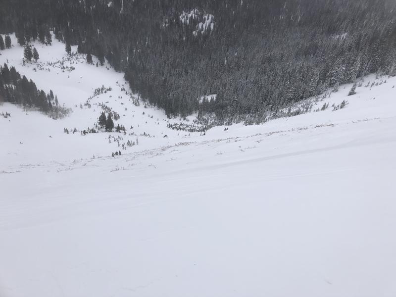
Saturday, January 23: A decent storm system with 16-20" in the Cottonwoods (containing over 1.5" of water) and 14" along the Park City ridgeline (containing 1.2" of water.) Human-triggered, as well as natural avalanches, are reported, with most of the activity within the new snow, or at the interface of the old snow surface that consisted of near-surface facets as well as some preserved surface hoar. The storm came in right-side up (that is, heavier snow initially, followed by lower-density snow) and most importantly, very little wind.
The photo below is of a natural avalanche in Red Pine trees that failed in the faceted layer at the new snow/old snow interface:
Sunday, January 24: Cloudy skies with a few additional inches of very-low-density snowfall. Six avalanches reported to the UAC. Whereas much of the avalanche activity has been within the new snow or at the interface of the old snow surface, three reported slides broke down more deeply into buried facets:
- Powder Park (2.5' deep 50' wide)
- White Pine Tri-Chutes (18" deep with rider caught and carried)
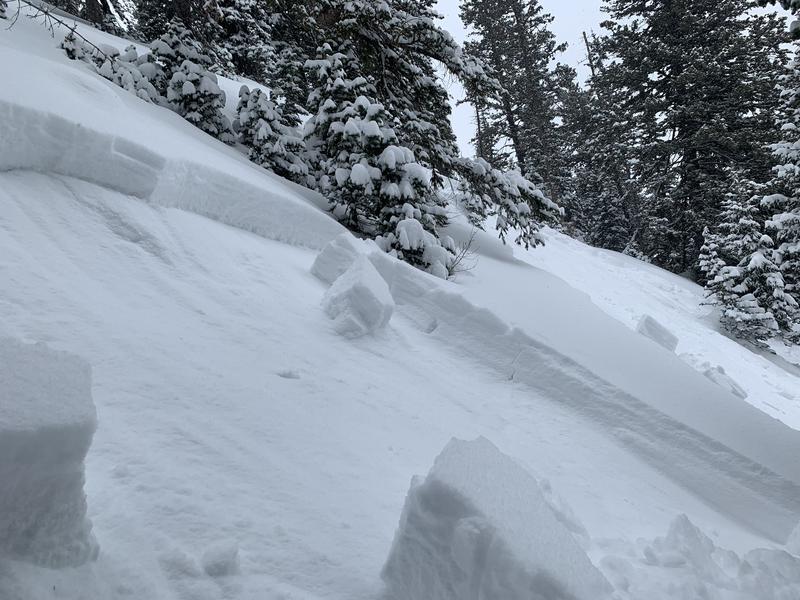
- Murdock Peak (2' deep 300' wide - photo below)
Monday, January 25: A close call/near miss in Hidden Canyon in the Brighton backcountry. Fortunately no injuries.
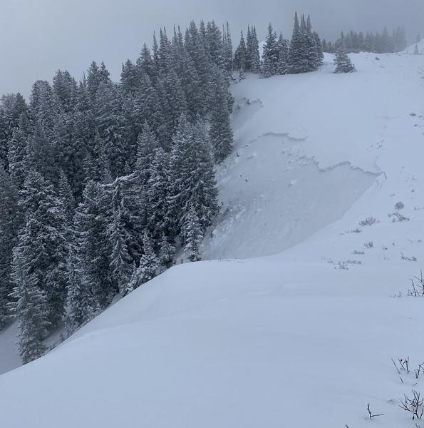
More avalanching along the Park City ridgeline, with multiple slides triggered remotely - up to 250'' away in places. These slides were 2-3' deep and 60-120' wide. (Photo below)
Other slides on Squaretop and Two Dogs in Days Fork were also reported.

Tuesday, January 26: No backcountry avalanches reported. Winds from the southeast are strong, especially at the upper elevations with gusts over 50 mph. Light snowfall with 1-3".
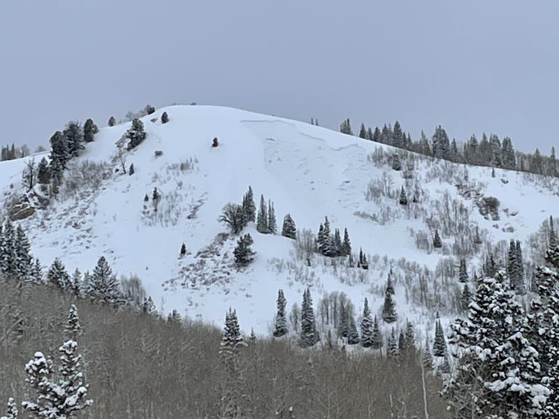
Wednesday, January 27: Snowfall picks up with heavy, dense snow. Moderate to strong southwest winds. South Monitor Bowl along Park City ridgeline had a natural avalanche on a wind-loaded slope. 3-6' deep and 350' wide. Sound of Music - and east-facing slope at 9,200' along the Park City ridgeline had a remotely-triggered slide 2-3' deep and 250' wide. (Photo below)
Thursday, January 28: Snowfall overnight into Thursday morning with totals since Wednesday are 6-10" in the upper Cottonwoods and along the Park City ridgeline containing 0.4 - 0 .8" water. Strong southwest winds continue to drift snow, creating sensitive wind slabs at the mid and upper elevations. Reported avalanches from Thursday include Willow Knob, photo of repeater avalanche in South Monitor (as well as other slopes on the Park City ridgeline), West Desolation Ridgeline and Powder Park 1 (video below)