Observer Name
Grainger, Young
Observation Date
Monday, January 25, 2021
Avalanche Date
Monday, January 25, 2021
Region
Salt Lake » Park City Ridgeline » Murdock Peak
Location Name or Route
Murdock Peak
Elevation
9,100'
Aspect
Northwest
Slope Angle
35°
Trigger
Skier
Trigger: additional info
Remotely Triggered
Avalanche Problem
Persistent Weak Layer
Weak Layer
Facets
Depth
2.5'
Comments
Traveled through upper BCC, Millcreek, Lamb's Canyon, and the N PC Ridgeline to look at areas that are harboring (weak, advanced) facets lying on top of the Nov. 19 Melt/Freeze crust.
In the Murdock/Millcreek/Lamb's area, skinning on mid and upper elevations (north half of the compass) produced large collapses with echeloned cracks shooting up to 300' laterally and 2-3' deep.
The old facets on top of that crust (early December drought layer) is continuous, very weak and still the layer of concern here. In our travels on low-30s degree slopes we remotely triggered 3 different slides on this layer. All were triggered from 50'-250' away, were 2-3' deep and ranged from 60'-120' wide. The shallowest slope was 35 degrees.
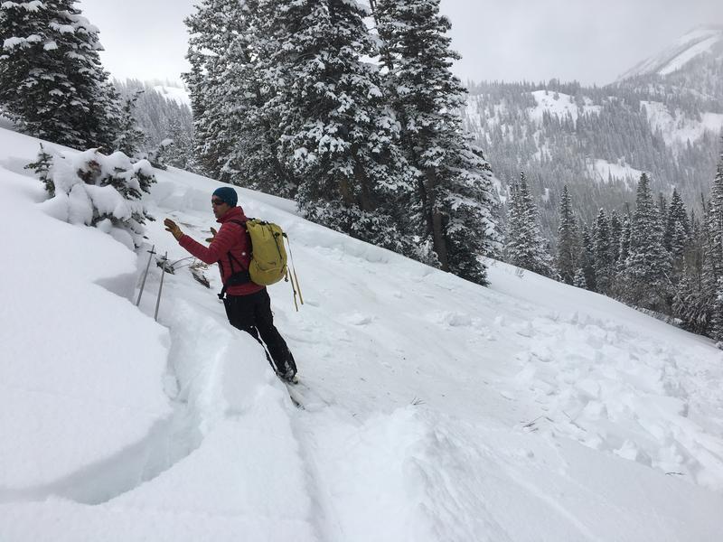
Photos 1 and 2 show a slide on a NW slope at 9100' where the early Dec. drought layer lies on a hard 4-5cm version of the Nov. M/F crust, 28" down in the snowpack.
Comments
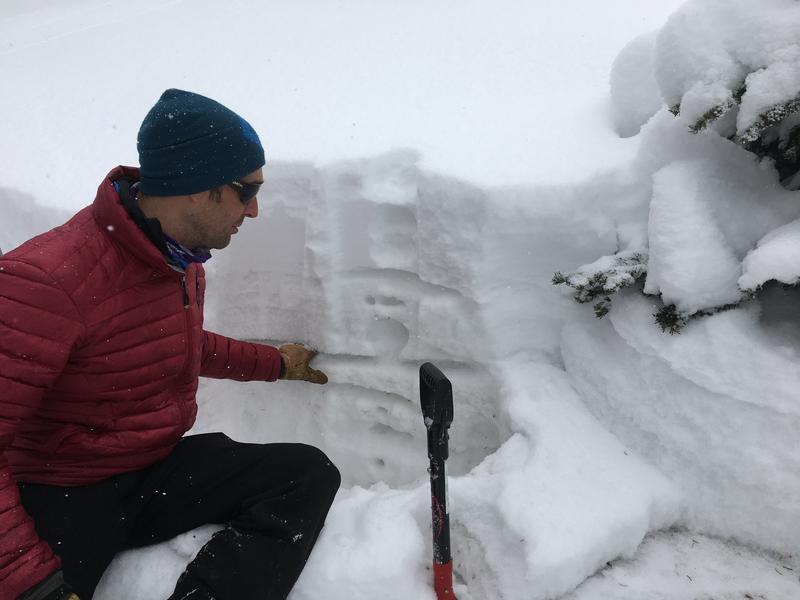
Photos 3 and 4 were slides remotely triggered from the Millcreek/Lamb's ridgeline, both wind-loaded areas and failing on 2mm chained facets 2-3' down.
Though it was not the layer of concern today, the PC ridgeline and Lamb's areas have a prominent rime crust with small near-surface facets on top just under this last Friday's storm. This will be a factor as this storm snow settles and slabs up.


Comments
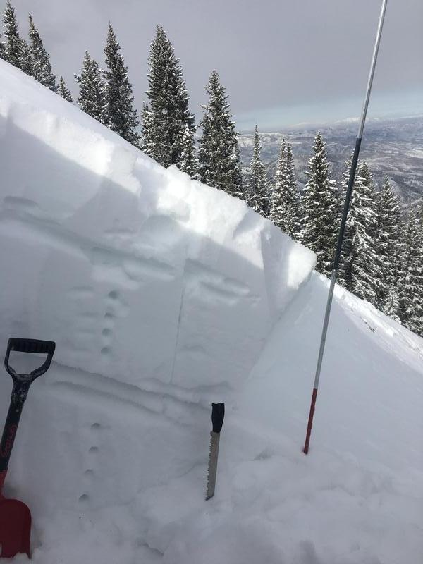
Photos 5 and 6 and the video are looking at a slide briefly reported yesterday off of NE Murdock peak.
This was D2, crown up to 30" deep, ~225' wide, and 1F- in hardness in multiple areas. The area was south wind-loaded and remotely triggered, likely by a skin track along the above ridge. Photo shows the weak early Dec. drought layer marked as the weak layer and the rime crust layer above. This photo is a good example of why the drought layer is still the player of concern in the area being mid-snowpack and well within the top meter of snow. Very possible to be triggered by humans and today's remotes showed this.
Area snow safety specialist/educator Robby Young describes the layers and the repeater possibilities with the drought facet layer as he describes this slide (video).

Video
Coordinates


