Forecast for the Provo Area Mountains

Greg Gagne
Issued by Greg Gagne for
Friday, March 29, 2019
The avalanche hazard is MODERATE on all aspects and elevations. Today's avalanche problems include sluffs and soft slabs in the new snow, and fresh wind drifts. At the lower elevations loose wet activity is possible. The avalanche hazard may change very quickly during any period of heavy snowfall, wind-drifting, or warming. Watch for rapidly changing conditions, and adjust your plans accordingly.
Low
Moderate
Considerable
High
Extreme
Learn how to read the forecast here
Special Announcements
We need your help. In an effort to increase awareness and prevent future fatalities we need to reach more people with our daily avalanche forecasts, expand the Know Before You Go program, and increase the number of on-snow avalanche courses. Please consider a donation to the UAC to help us raise $25,000 by April 8. Help your support of the UAC by making a donation HERE. Thank you for your support!
Couple of new interesting things to read and listen to: (1) The latest blog by Drew "Roping the Wind (Slab)", and (2) UAC podcast featuring Lynne Wolfe - guide, avalanche educator, editor of The Avalanche Review, mentor, role model. This is a can't-miss episode!
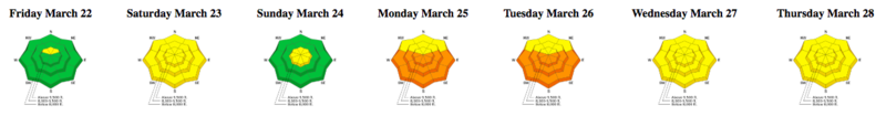
Although specific to the Salt Lake mountains, the latest Week in Review is up and live.
Weather and Snow
As of 6 am snowfall totals are 4-6" in the Provo mountains. Winds are out of the northwest, and very elevation dependent. At 11,000' winds are averaging in the 20’s mph, with gusts in the 50’s and 60's mph. However, at 10,500’ wind speeds drop off where averages are in the teens and gusts in the 20’s mph. Winds are even lighter below 10,000' averaging < 10 mph with gusts in the teens.
Snowfall should continue through the morning hours, possibly heavy at times. Snowfall rates should diminish by late morning, but convective showers may pick up in the afternoon, with rounds of on and off show showers, periodically heavy at times. We may pick up another 2-4” during the day today.
It will remain cloudy today, and mountain temperatures will be in the 20’s and low 30’s F. Greenhousing is possible, leading to denser snow on all aspects, especially at the low and mid elevations.
Recent Avalanches
No avalanche activity was reported from the Provo mountains backcountry on Thursday.
Ad
Avalanche Problem #1
New Snow
Type
Location
Likelihood
Size
Description
With 6" of new snow on the ground, and another 2-4" forecasted throughout the day, avalanches involving new snow are possible today. The new snow may sluff easily on steep slopes, as well as break out more widely as denser slabs, especially during periods of heavier snowfall or warming. Spring snowstorms are beautifully unpredictable, so pay attention to conditions where you are. Watch for signs of instability including avalanching, cracking in the new snow, and warming of the snow surface with possible greenhousing (where clouds trap warming). I am particularly suspicious of a possible density inversion within today's storm snow where you may find a denser slab on top of weaker, lower-density snow. This layer of lower-density snow can act as a weak layer for avalanching. Pay attention to how the snow feels - a hand pit can quickly determine if there is a density inversion where you will feel softer snow with denser snow on top.
Avalanche Problem #2
Wind Drifted Snow
Type
Location
Likelihood
Size
Description
West/northwest winds will drift snow primarily on aspects facing north, through east, and southeast, but drifting is possible on other aspects due to cross-loading and channeling of winds through terrain features. I am expecting most drifts will be found above 10,000'.
Today's new snow and wind will add to the cornices that are found along many upper elevation ridgelines. Be sure to avoid traveling along or underneath corniced ridges.
Avalanche Problem #3
Wet Snow
Type
Location
Likelihood
Size
Description
At lower elevations the snowpack will slowly cool with today’s lower temperatures, but wet activity is possible at the lower elevations with some slides gouging down into older wet snow.
In addition, although very unlikely today, if the sun comes out for any extended period wet loose activity will be possible on all solar aspects as well as lower elevations.
General Announcements
This information does not apply to developed ski areas or highways where avalanche control is normally done. This forecast is from the U.S.D.A. Forest Service, which is solely responsible for its content. This forecast describes general avalanche conditions and local variations always occur.