| During the month of April, Mark Miller will donate $75 to the charity of your choice (5 to chose from, including the Utah Avalanche Center!) Mark Miller Subaru has raised over $300k in the previous 6 Do Good Feel Good events. More Info here |  |
| During the month of April, Mark Miller will donate $75 to the charity of your choice (5 to chose from, including the Utah Avalanche Center!) Mark Miller Subaru has raised over $300k in the previous 6 Do Good Feel Good events. More Info here | |
| Advisory: Uintas Area Mountains | Issued by Craig Gordon for Saturday - March 21, 2015 - 5:30am |
|---|

|
bottom line The avalanche danger will rise to MODERATE and human triggered slides are possible on steep, sun exposed slopes. Remember- terrain facing the north half of the compass is getting its first taste of strong sunshine, and avalanches triggered in steep, rocky terrain have the potential to break deeper and wider than you might expect. Most other terrain offers a LOW avalanche danger.
|
 |
current conditions Skies remained clear overnight, but lows were slightly warmer than the past few mornings, currently in the low 30's. Winds have shifted to the southwest, though they're still quite light even along the highest peaks, blowing just 10-15 mph. It'll be another great day for exploring on a "go anywhere" base. The melt freeze cycle is providing bomber supportability on slopes facing the south half of the compass, but there's not much loose snow to keep your machine cool, especially early in the morning. Might be a good call to let things soften a bit before battling the frozen old tracks. Click here for real-time temperatures, snowfall, and winds.
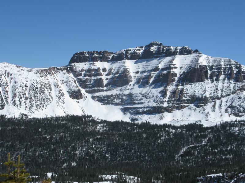
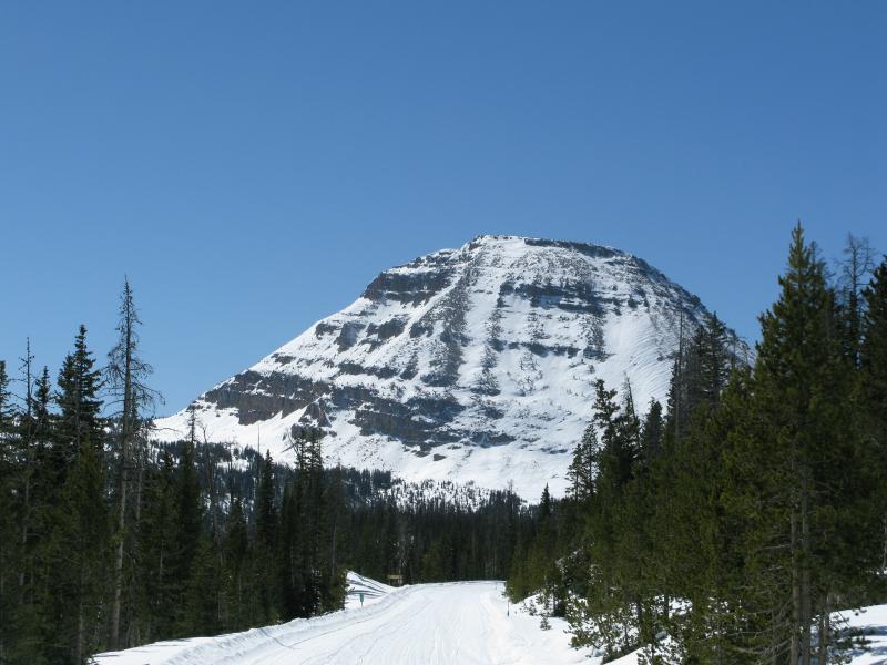
It might cost a little to get there... but the Mirror Lake Highway is offering spectacular views for free.
|
 |
recent activity
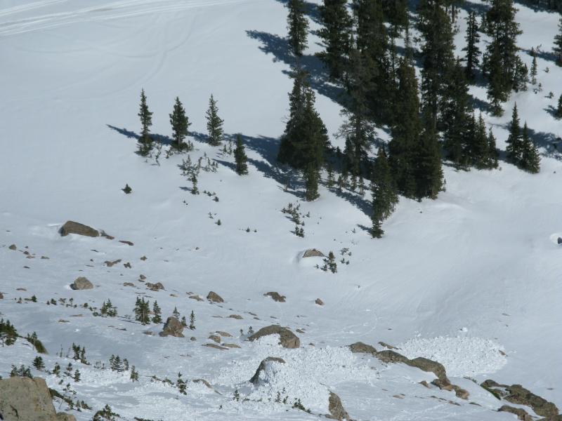
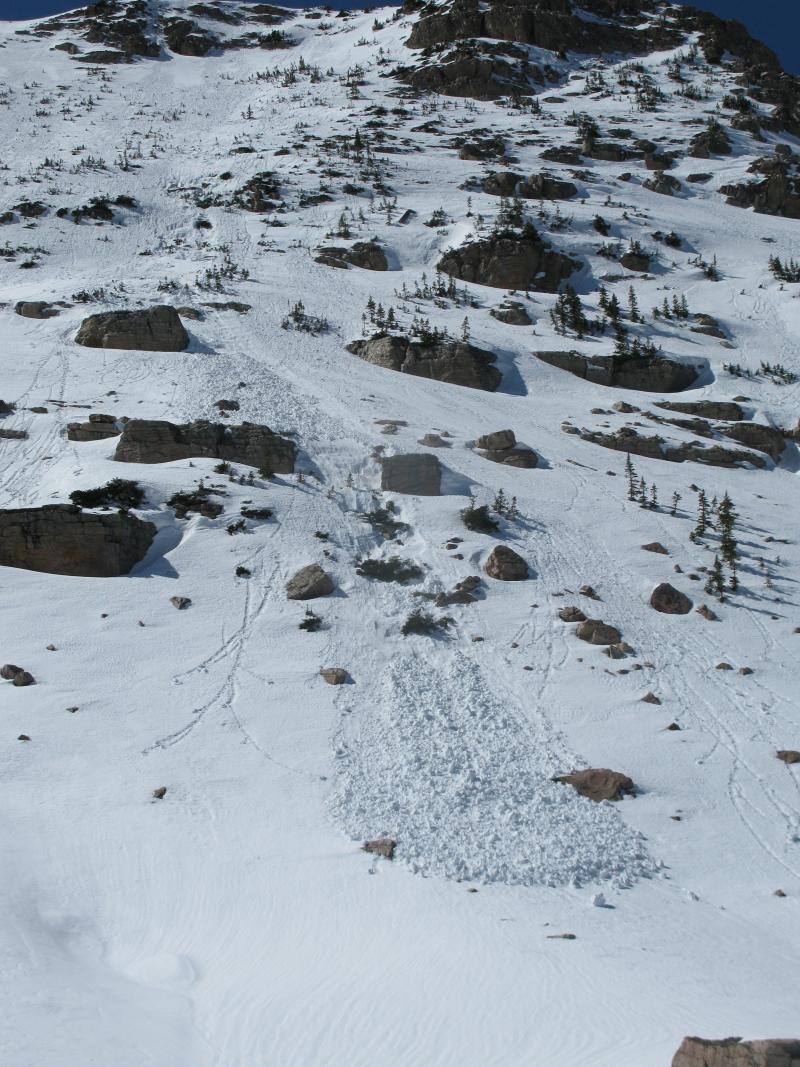
This recent wet slide on the steep, east face of Lofty Lake Peak started off as a point release which then broke into weak snow around a series of rock bands.
|
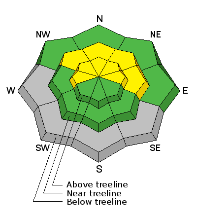
| type | aspect/elevation | characteristics |
|---|

|
|
LIKELIHOOD
 LIKELY
UNLIKELY
SIZE
 LARGE
SMALL
TREND
 INCREASING DANGER
SAME
DECREASING DANGER
|
|
description
Midweek temperatures in the teens helped put a lid on the big melt down, essentially welding the snowpack in place. In general avalanche conditions are pretty straight-forward, though steep, rocky slopes, facing the north half of the snowpack still have issues. In steep terrain that has had a thin, weak snowpack all season, it's possible to trigger a shallow wet sluff that then breaks into weak snow as it descends the slope. Not a big issue unless you're in technical, unforgiving terrain or where the avalanche debris gets channeled into a terrain trap like a gully or road cut. Best rule of thumb is- if you feel the snow getting damp or punchy, simply move to a cooler aspect, get off of and out from steep, sunny slopes, or just call it a day.
|
 |
weather A weak cold front slides through the region during the day, allowing a few clouds to drift through the area. Southwest winds blow in the teens and 20's before switching to the north late in the day. High temperatures climb into the 40's and dip into the low 30's overnight. Another system works into the region Sunday with similar features. Unsettled weather makes a rare appearance on Monday and Tuesday and we should see a welcome return to winter and a fresh coat of white paint. I'll have a better handle on the timing and strength of this system for Sunday's update.
|
| general announcements Remember your information can save lives. If you see anything we should know about, please participate in the creation of our own community avalanche advisory by submitting snow and avalanche conditions. You can call me directly at 801-231-2170, email [email protected], or email by clicking HERE This is a great time of year to schedule a free avalanche awareness presentation for your group or club. You can contact me at 801-231-2170 or email [email protected] Donate to your favorite non-profit –The Utah Avalanche Center. The UAC depends on contributions from users like you to support our work. Benefit the Utah Avalanche Center when you buy or sell on ebay - set the Utah Avalanche Center as a favorite non-profit in your ebay account here and click on ebay gives when you buy or sell. You can choose to have your seller fees donated to the UAC, which doesn't cost you a penny. Utah Avalanche Center mobile app - Get your advisory on your iPhone along with great navigation and rescue tools. The information in this advisory is from the US Forest Service which is solely responsible for its content. This advisory describes general avalanche conditions and local variations always occur. I will update this advisory by 7:00 AM Sunday Mar. 22, 2015. |


_0.jpg)