Donate to Our Spring Campaign or Bid on our Spring Auction to Support Forecasting

Forecast for the Ogden Area Mountains

Dave Kelly
Issued by Dave Kelly on
Monday morning, March 31, 2025
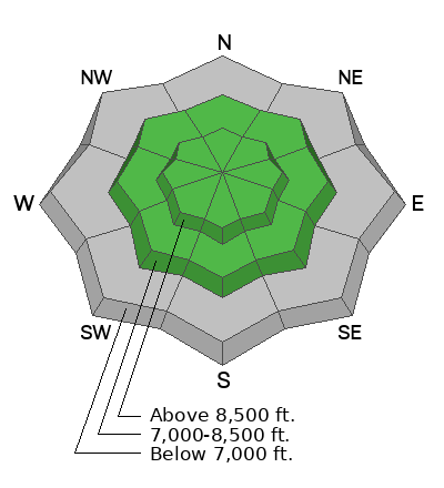
The avalanche danger is MODERATE in upper elevation terrain where it will be possible for humans to trigger small soft slab avalanches made up of new or wind-drifted snow. The avalanche danger is LOW in mid and lower elevations, but could rise to MODERATE later this afternoon with increased snowfall and wind speeds.
Keep an eye out for changing conditions and avoid any steep slope that could have shallow drifts of new or wind-blown snow.
Low
Moderate
Considerable
High
Extreme
Learn how to read the forecast here
Special Announcements
Our Spring Campaign is in full swing, and there are two great ways to support forecasting, awareness, and education across Utah. Donate to our Spring Campaign, or Bid on items in our Spring Auction. Every dollar donated helps keep the backcountry community on top.
Weather and Snow
Currently, under partly cloudy skies it is snowing lightly in some locations in the Ogden forecast region. Temperatures are in the high 20's °F and low 30's °F. Wind speeds have picked up since yesterday and are blowing from the south and southwest in the 20's gusting to the 40's MPH at the highest ridgelines. There was a trace of snow overnight.
Today, look for cloudy skies. Temperatures will be in the high 40's to the low 50's °F. Winds will blow from the south and southwest 15 gusting to 25 MPH at the lower ridgelines and from the southwest 30 gusting to 40 MPH at the highest ridgelines. Wind speeds will increase throughout the day with gusts up to 65 MPH possible at the highest ridgelines. There is a chance of a trace to 2" snow and .10"-.20" snow water equivalent (SWE) expected during the day.
The storm is forecast to really get rolling with the passage of the cold front around 6PM tonight where we can expect to see increased wind speeds with 6"-12" snow and .60"-1.20" SWE. Don't discount the chance of thunder and lightning with the passage of the cold front.
Recent Avalanches
There were no reports of backcountry avalanches from the Ogden Region from yesterday.
Check out all recent avalanches and observations HERE.
Ad
Avalanche Problem #1
Wind Drifted Snow
Type
Location
Likelihood
Size
Description
Look for and avoid pillowy wind features and avoid steep slopes that have signs of wind loading such as cracking in the new snow. These drifts will be on the downwind side of ridges and gully features and you will want to stay back from sensitive new cornices on ridgelines.
Avalanche Problem #2
New Snow
Type
Location
Likelihood
Size
Description
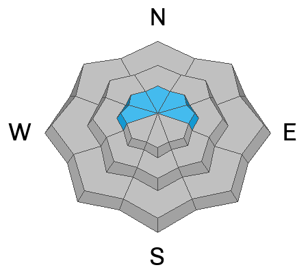
With increased snowfall this afternoon you may see or trigger shallow new snow avalanches. These will be a couple of inches deep and are not of much harm to humans. Where this changes is in steep terrain where new snow has the ability to entrain more snow and run a long distance. These new snow slides could pack enough power to push you off your feet, and in extreme terrain overhanging cliffs or into steep trees even a shallow dry loose avalanche could be enough to take you for a nasty ride.
General Announcements
This information does not apply to developed ski areas or highways where avalanche control is normally done. This forecast is from the U.S.D.A. Forest Service, which is solely responsible for its content. This forecast describes general avalanche conditions and local variations always occur.