| During the month of April, Mark Miller will donate $75 to the charity of your choice (5 to chose from, including the Utah Avalanche Center!) Mark Miller Subaru has raised over $300k in the previous 6 Do Good Feel Good events. More Info here |  |
| During the month of April, Mark Miller will donate $75 to the charity of your choice (5 to chose from, including the Utah Avalanche Center!) Mark Miller Subaru has raised over $300k in the previous 6 Do Good Feel Good events. More Info here | |
| Advisory: Uintas Area Mountains | Issued by Craig Gordon for Wednesday - April 9, 2014 - 6:24am |
|---|

|
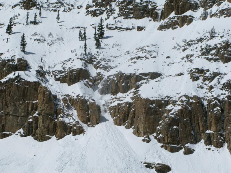
bottom line The danger of wet avalanches will rise to CONSIDERABLE with daytime heating. Both human triggered and natural avalanches are likely on steep, sun exposed slopes, especially during the heat of the day. Avoid terrain traps like gullies and road cuts where even a small slide can stack up huge piles of bone snapping debris.
.
|
 |
special announcement Sunday April 13th will be the last of our regularly scheduled advisories for the 2013-14 season. |
 |
current conditions It's pretty balmy out there this morning. Even under clear skies, overnight low temperatures only dipped into the mid 30's. Westerly winds are increasing, currently blowing 20-30 mph along the high ridges. Riding and turning conditions are a bit hit or miss, but a few patches of cold, dry snow can still be found on high elevation north facing slopes.
Recent winds have hammered much of our upper elevation wind exposed terrain. Click here for current winds, temperatures, and snowfall throughout the range. Click here for trip reports.
|
 |
recent activity
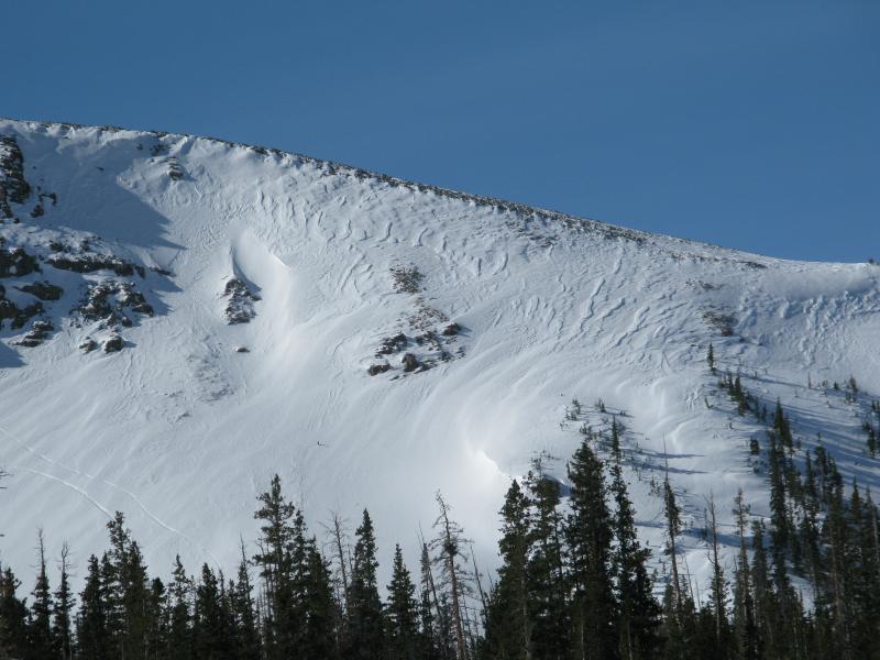
From a safe location Ted and I watched as wet sluffs peeled off the cliff bands of Reids Peak during the heat of the day Tuesday. Archived avalanche activity is found here.
|
| type | aspect/elevation | characteristics |
|---|

|
|
LIKELIHOOD
 LIKELY
UNLIKELY
SIZE
 LARGE
SMALL
TREND
 INCREASING DANGER
SAME
DECREASING DANGER
|
|
description
The snowpack will take on a lot of heat today and with a superficial overnight refreeze the danger of wet avalanches will be on the rise. While cloud cover and winds may help to temper the natural avalanche activity, fact is, the sun is very intense this time of year. If you're feeling like an ant under a magnifying glass... so is the snowpack. A good rule of thumb is to get off and out from under steep, sun exposed slopes and avoid terrain traps like gullies, especially during the heat of the day.
.
|
| type | aspect/elevation | characteristics |
|---|

|
|
LIKELIHOOD
LIKELY
UNLIKELY
SIZE
 LARGE
SMALL
TREND
INCREASING DANGER
SAME
DECREASING DANGER
|
|
description
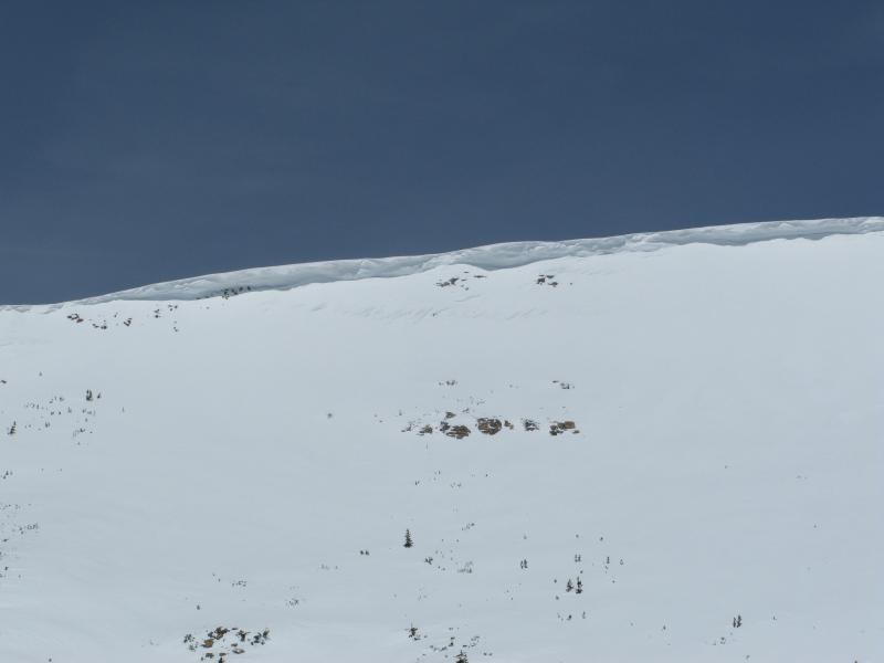
Overhanging cornices are fat and connected and have the possibility to break back further than you might expect. |
 |
weather High clouds and westerly winds will be on the increase throughout the day as a weak, dry, cold front slides through the region tonight. In the meantime it'll be sweltering, with today's high temperatures climbing into the low 50's. Overnight lows dip into the low 30's. High pressure begins to build back into the area Thursday afternoon and winds diminish. Another cold front dives into the region late Saturday.
|
| general announcements Remember your information can save lives. If you see anything we should know about, please participate in the creation of our own community avalanche advisory by submitting snow and avalanche conditions. You can call me directly at 801-231-2170, email [email protected], or email by clicking HERE This is a great time of year to schedule a free avalanche awareness presentation for your group or club. You can contact me at 801-231-2170 or email [email protected] Donate to your favorite non-profit –The Utah Avalanche Center. The UAC depends on contributions from users like you to support our work. Benefit the Utah Avalanche Center when you buy or sell on ebay - set the Utah Avalanche Center as a favorite non-profit in your ebay account here and click on ebay gives when you buy or sell. You can choose to have your seller fees donated to the UAC, which doesn't cost you a penny. Utah Avalanche Center mobile app - Get your advisory on your iPhone along with great navigation and rescue tools. The information in this advisory is from the US Forest Service which is solely responsible for its content. This advisory describes general avalanche conditions and local variations always occur. I will update this advisory by 7:00 AM on Saturday Apr. 12, 2014 or sooner if conditions warrant. |


_0.jpg)