| During the month of April, Mark Miller will donate $75 to the charity of your choice (5 to chose from, including the Utah Avalanche Center!) Mark Miller Subaru has raised over $300k in the previous 6 Do Good Feel Good events. More Info here |  |
| During the month of April, Mark Miller will donate $75 to the charity of your choice (5 to chose from, including the Utah Avalanche Center!) Mark Miller Subaru has raised over $300k in the previous 6 Do Good Feel Good events. More Info here | |
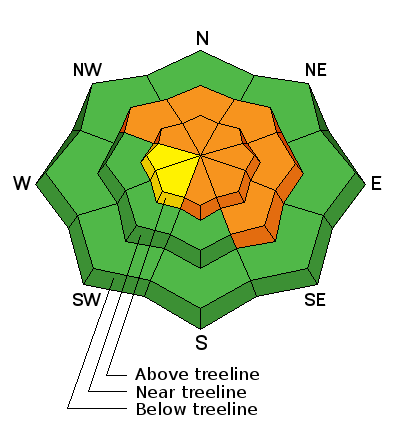
| Advisory: Uintas Area Mountains | Issued by Craig Gordon for Wednesday - February 26, 2014 - 5:56am |
|---|

|
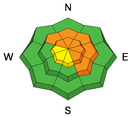
bottom line In the wind zone at upper elevations, the avalanche danger is CONSIDERABLE today. Human triggered avalanches are probable on all steep, wind drifted slopes, particularly those facing the north half of the compass and especially those with an easterly component to their aspect. Once triggered, today's avalanches can break deep and wide, creating a very dangerous slide. A MODERATE avalanche danger is found at mid elevations and human triggered avalanches are possible on steep, wind drifted slopes. LOW avalanche danger is found on gentle slopes with no steep terrain above or adjacent to where you're riding. .
|
 |
current conditions Skies are clear and winds have finally subsided, blowing a more reasonable 10-20 mph along the high peaks. Temperatures are mild, in the low 30's at the trailheads and mid to upper 20's along the ridges. Low elevation terrain has taken on a lot of heat recently, leaving a wide variety of breakable crusts which soften during the heat of the day. If you're looking for powder head to wind sheltered, mid and upper elevation terrain where you'll find soft, creamy snow, on a go anywhere kinda base.
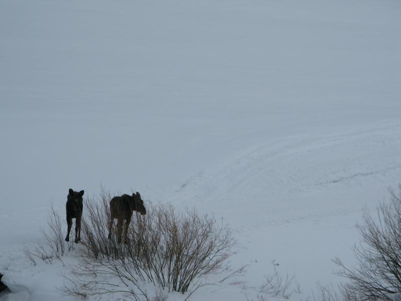
Spring has sprung and the moose is loose! A couple of my vegan brethren enjoying an afternoon by the river, munching on willows and soaking in the warm temperatures. Click here for current winds, temperatures, and snowfall throughout the range. Click here for trip reports and avalanche observations.
|
 |
recent activity
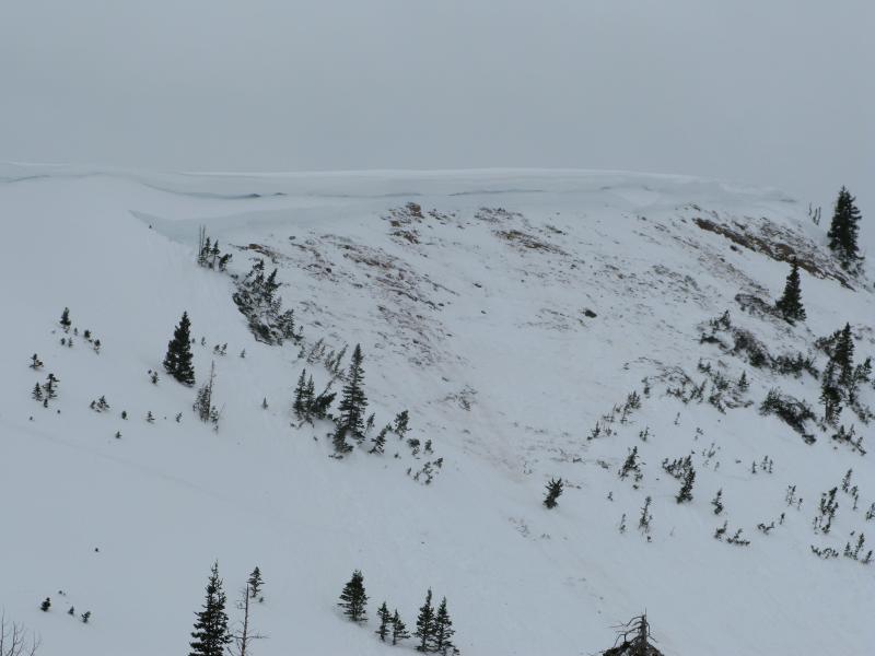
Avalanche are still breaking to the ground. This slide was triggered in Upper Weber Canyon yesterday. 8' deep, 300' wide, running 400' vertically, failing on weak, sugary snow.
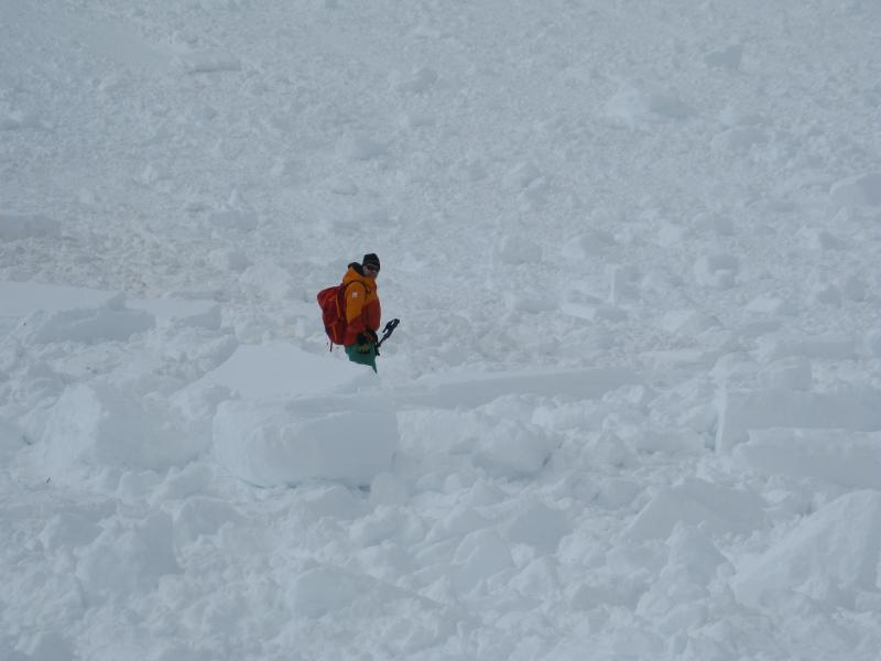
Joe Devo standing next to dense, freezer sized blocks of avalanche debris. Getting body slammed by one of these chunks would ruin your day in a hurry. More avalanche activity is found here.
|
| type | aspect/elevation | characteristics |
|---|

|
|
LIKELIHOOD
 LIKELY
UNLIKELY
SIZE
 LARGE
SMALL
TREND
 INCREASING DANGER
SAME
DECREASING DANGER
|
|
description
The good news is... the snowpack is slowly gaining strength and the chance of triggering a big, deep, scary avalanche is diminishing somewhat. As a matter of fact you can ride plenty of slopes across the range and be good to go and therein lays the bad news. The snow structure remains questionable, especially in steep, rocky terrain facing the north half of the compass. While the surface snow feels strong and solid underneath us, it's the bad mojo near the ground that's the big red flag. Strong snow over weak snow often suggests false green light conditions, allowing us to get well out onto the slope or put several sets of tracks on the hill before we find a weakness, collapse the slope, and now all bets are off. Cornice drops and slope cuts are ineffective ways to test the stability of a slope. Best way to deal with this type of avalanche dragon is with terrain management. Steep, rocky, leeward terrain remains suspect and should be avoided. Remember- there are plenty of days left this season to get after it. Right now we have to exercise some patience.
.
|
| type | aspect/elevation | characteristics |
|---|

|
|
LIKELIHOOD
LIKELY
UNLIKELY
SIZE
 LARGE
SMALL
TREND
INCREASING DANGER
SAME
DECREASING DANGER
|
|
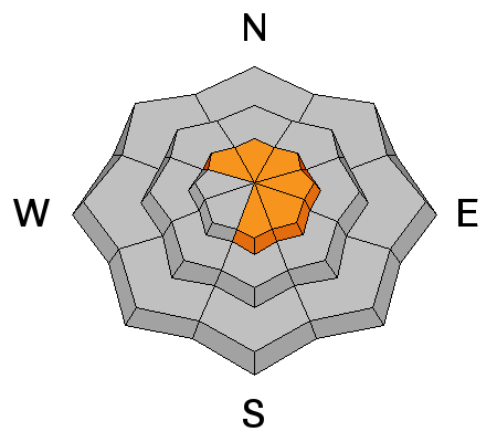
description
Cornices have grown quite large and will break back further than you might expect. You'll definitely want to give these boxcar sized monsters the respect they deserve. |
 |
weather A beautiful day is on tap with mostly sunny skies and temperatures soaring into the low 40's. West winds remain reasonable, blowing in the teens and low 20's. Clouds thicken throughout the day and a few scattered snow showers are possible around sunset, Moisture increases Thursday and a quick hitting storm delivers 4"-8" of snow by late Thursday night. A break in the action for Friday, then a moist unsettled pattern is slated for the weekend.
|
| general announcements Remember your information can save lives. If you see anything we should know about, please participate in the creation of our own community avalanche advisory by submitting snow and avalanche conditions. You can call me directly at 801-231-2170, email [email protected], or email by clicking HERE This is a great time of year to schedule a free avalanche awareness presentation for your group or club. You can contact me at 801-231-2170 or email [email protected] Donate to your favorite non-profit –The Utah Avalanche Center. The UAC depends on contributions from users like you to support our work. Benefit the Utah Avalanche Center when you buy or sell on ebay - set the Utah Avalanche Center as a favorite non-profit in your ebay account here and click on ebay gives when you buy or sell. You can choose to have your seller fees donated to the UAC, which doesn't cost you a penny. Utah Avalanche Center mobile app - Get your advisory on your iPhone along with great navigation and rescue tools. The information in this advisory is from the US Forest Service which is solely responsible for its content. This advisory describes general avalanche conditions and local variations always occur. I will update this advisory by 7:00 AM on Saturday Mar. 1, 2014 |


_0.jpg)