| During the month of April, Mark Miller will donate $75 to the charity of your choice (5 to chose from, including the Utah Avalanche Center!) Mark Miller Subaru has raised over $300k in the previous 6 Do Good Feel Good events. More Info here |  |
| During the month of April, Mark Miller will donate $75 to the charity of your choice (5 to chose from, including the Utah Avalanche Center!) Mark Miller Subaru has raised over $300k in the previous 6 Do Good Feel Good events. More Info here | |
| Advisory: Uintas Area Mountains | Issued by Craig Gordon for Saturday - November 16, 2013 - 6:39am |
|---|

|
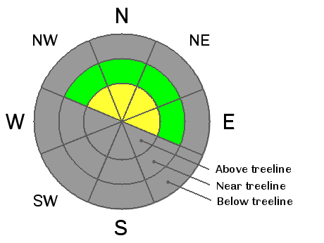
bottom line The avalanche danger will rise to MODERATE and human triggered avalanches are possible on steep, upper elevation, north facing slopes, especially those that had pre-existing snow prior to today's storm. Remember- even a small piece of snow can break to the ground, creating an unmanageable and possibly season ending situation.
|
 |
special announcement
|
 |
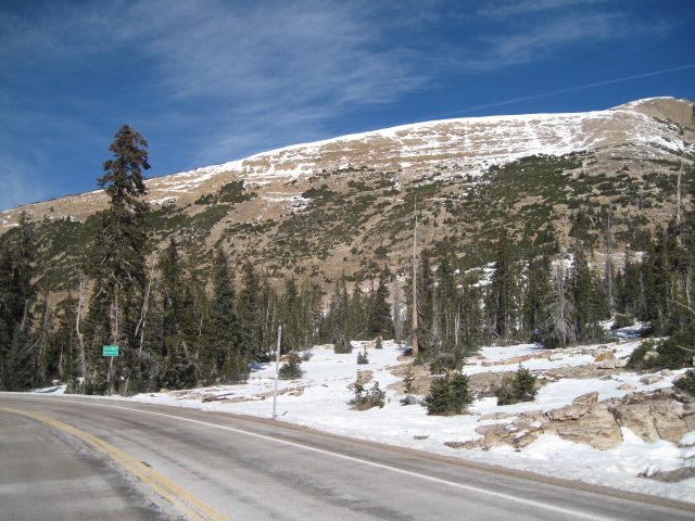
current conditions Friday's storm laid down a couple inches of new snow throughout the range, but it looks like the main event is just a few hours away. An energetic storm is setting its sights on northern Utah and ahead of this system southwest winds are blowing 20-35 mph along the ridges. Temperatures are in the mid teens and low 20's. With average snow depths hovering just around 12"-18" it's still very thin out there. Riding and turning conditions are limited to a few rock free meadows. Click here for current winds, temperatures, and snowfall throughout the range.
Warm temperatures and strong sun have nuked the south facing slopes.
North facing terrain holds more promise, but most of the usual suspects are still too thin to ride.
|
 |
recent activity No recent avalanche activity to report.
|
| type | aspect/elevation | characteristics |
|---|

|

|
LIKELIHOOD
 LIKELY
UNLIKELY
SIZE
 LARGE
SMALL
TREND
 INCREASING DANGER
SAME
DECREASING DANGER
|
|
description
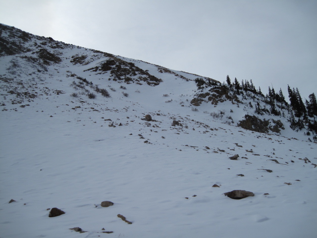
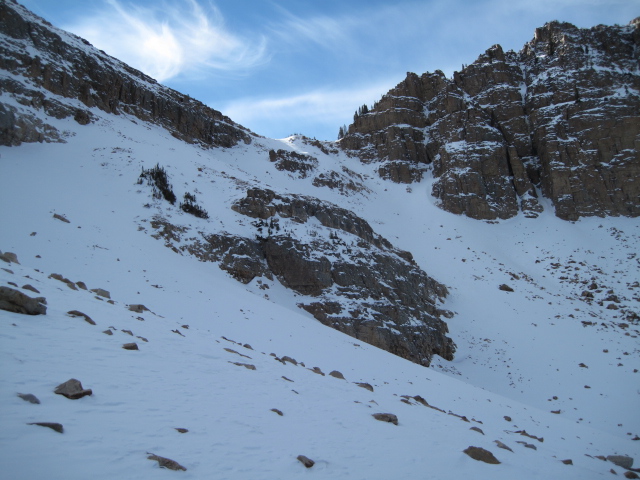
With new snow and strong gusty winds on tap, avalanche danger will rise throughout the day. Your choices for riding or turning will be limited to the few patches of high elevation snow facing the north half of the compass. Underneath this white facade is old October snow that grew weak and sugary during the recent dry spell. Today's avalanches won't be particularly large, but they could take you for a nasty ride through rocks and stumps barely hidden underneath the snow, resulting in a season ending injury.
The Uintas are a rocky place and terrain like this could lure us in for an early season lap or two. Remember- the season is young and triggering a slide in this type of terrain would ruin your day in a hurry.
|
 |
weather Snow develops later this morning and 4"-8" is expected to stack up throughout the day. Winds shift from southwest to west and gust into the 40's and 50's along the high ridges. Temperatures vary little from where we're at this morning. A few more inches of snow is expected late today before Northwest winds increase and gust into the 60's as they usher this system out of the region tonight. High pressure and warming temperatures are on tap for Sunday and Monday with another small storm mid week. |
| general announcements Remember your information can save lives. If you see anything we should know about, please participate in the creation of our own community avalanche advisory by submitting snow and avalanche conditions. You can call me directly at 801-231-2170, email [email protected], or email by clicking HERE This is a great time of year to schedule a free avalanche awareness presentation for your group or club. You can contact me at 801-231-2170 or email [email protected] Donate to your favorite non-profit –The Friends of the Utah Avalanche Center. The UAC depends on contributions from users like you to support our work. The information in this advisory is from the US Forest Service which is solely responsible for its content. This advisory describes general avalanche conditions and local variations always occur. I will update this advisory by 7:00 AM on Sunday Nov. 17, 2013 |


_0.jpg)