| During the month of April, Mark Miller will donate $75 to the charity of your choice (5 to chose from, including the Utah Avalanche Center!) Mark Miller Subaru has raised over $300k in the previous 6 Do Good Feel Good events. More Info here |  |
| During the month of April, Mark Miller will donate $75 to the charity of your choice (5 to chose from, including the Utah Avalanche Center!) Mark Miller Subaru has raised over $300k in the previous 6 Do Good Feel Good events. More Info here | |
| Advisory: Uintas Area Mountains | Issued by Craig Gordon for Saturday - November 9, 2013 - 6:32am |
|---|

|
bottom line In general there's a LOW avalanche danger and you'd really have to go out of your way to trigger an avalanche today, but the danger will be rising the next couple of days. Remember- even a small piece of snow can break to the ground, creating an unmanageable and possibly season ending situation.
|
 |
special announcement
|
 |
current conditions Nearly all the weather stations in our network are up and running. Click here for current winds, temperatures, and snowfall throughout the range. High pressure is building across the region, giving us clear skies and rather balmy temperatures this morning. Currently, most locations are reporting temperatures in the upper 20's and low 30's. After two days of Southwesterly winds gusting into the 50's and 60's along the high ridges, they finally mellowed out yesterday afternoon to a more reasonable 20-30 mph along the high peaks. With an average of only a foot or so of total snow, coverage is thin, but you can still get out for a walk on the snow or a gentle ride on your sled in a rock free meadow..
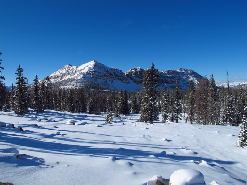
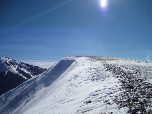
JG submitted this image from Bald Mountain which clearly shows lots of land mines poking through the snow.
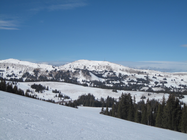
Ted was in the Whitney area yesterday, which is a bit more rock free...
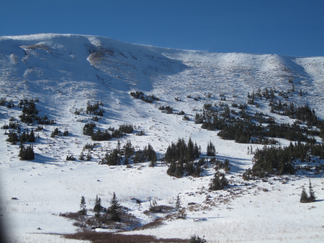
But most of the usual suspects are still too thin to ride.
|
 |
recent activity
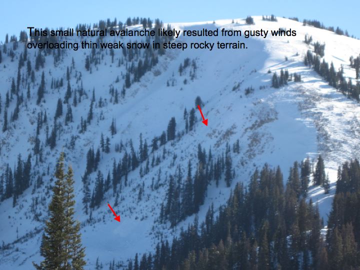
Ted spotted this natural near Moffit Peak in his travels yesterday.
|
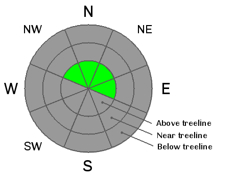
| type | aspect/elevation | characteristics |
|---|

|
|
LIKELIHOOD
 LIKELY
UNLIKELY
SIZE
 LARGE
SMALL
TREND
 INCREASING DANGER
SAME
DECREASING DANGER
|
|
description
You'd be pretty hard pressed to trigger an avalanche today, but it's not impossible. Your choices for riding or turning will be limited to the few patches of high elevation snow facing the north half of the compass. Underneath this white facade is old October snow that grew weak and sugary and the strong gusty winds Wednesday and Thursday found enough snow to blow around and form a stout, supportable wind slab. Today's avalanches won't be particularly large, but they could take you for a nasty ride through rocks and stumps barely hidden underneath the snow, resulting in a season ending injury.
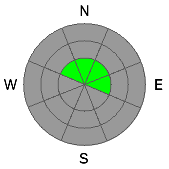
Look for and avoid fat looking pockets like this one which are going to be found on the leeward side of upper elevation ridges.
|
 |
weather It'll be a beautiful day in the mountains with clear skies and temperatures climbing into the low 40's. Winds diminish throughout the day and overnight lows dip into the upper 20's. Not much going on until late next week when we could see a pattern change to wetter and colder weather. |
| general announcements Remember your information can save lives. If you see anything we should know about, please participate in the creation of our own community avalanche advisory by submitting snow and avalanche conditions. You can call me directly at 801-231-2170, email [email protected], or email by clicking HERE This is a great time of year to schedule a free avalanche awareness presentation for your group or club. You can contact me at 801-231-2170 or email [email protected] Donate to your favorite non-profit –The Friends of the Utah Avalanche Center. The UAC depends on contributions from users like you to support our work. The information in this advisory is from the US Forest Service which is solely responsible for its content. This advisory describes general avalanche conditions and local variations always occur. I will update this advisory by 7:00 AM on Saturday Nov. 16, 2013 |


_0.jpg)