| During the month of April, Mark Miller will donate $75 to the charity of your choice (5 to chose from, including the Utah Avalanche Center!) Mark Miller Subaru has raised over $300k in the previous 6 Do Good Feel Good events. More Info here |  |
| During the month of April, Mark Miller will donate $75 to the charity of your choice (5 to chose from, including the Utah Avalanche Center!) Mark Miller Subaru has raised over $300k in the previous 6 Do Good Feel Good events. More Info here | |
| Advisory: Skyline Area Mountains | Issued by Craig Gordon for Friday - December 13, 2013 - 6:30pm |
|---|

|
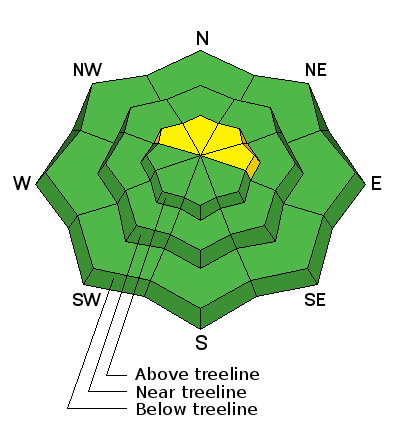
bottom line In the wind zone at upper elevations this weekend you'll find a MODERATE avalanche danger on the Skyline and human triggered avalanches are possible. Terrain to avoid is- steep, wind drifted slopes, especially those facing the north half of the compass. Once triggered avalanches can break deeper and wider than you might anticipate. Keep in mind that even small avalanches are more dangerous this time of year due to rocks, logs, and stumps just under the snow surface. Out of the wind zone the avalanche danger is generally LOW.
|
 |
current conditions
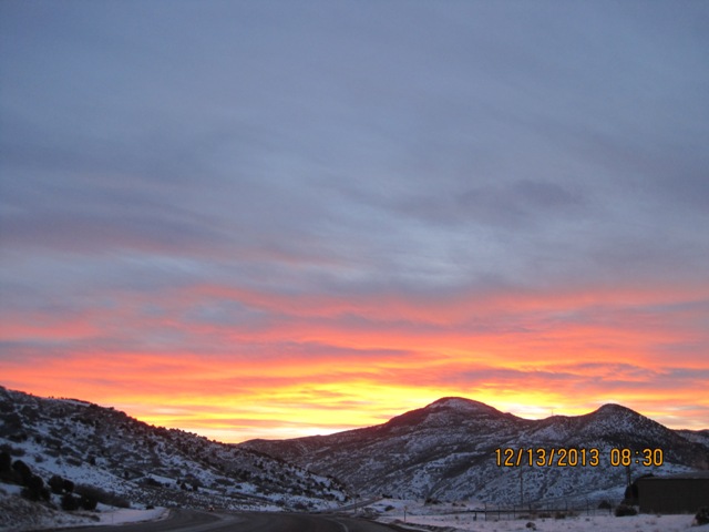
Get out of the hazy, cold valleys and head to the hills, where you'll be treated to clean air and warm temperatures this weekend. Riding and turning conditions aren't quite as spectacular as this sunrise that Darce caught on Friday, but you can still find fun snow, on low angle, rock free meadows and roads. Of course Steve and Darce have been gettin' after it, supplying us with amazing BETA... click here for recent trip reports.
|
 |
recent activity
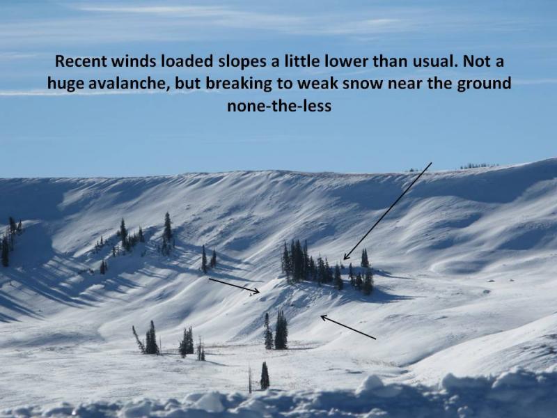
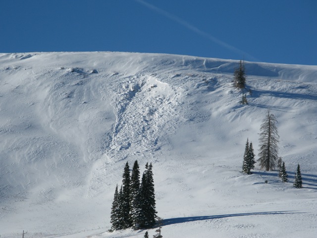
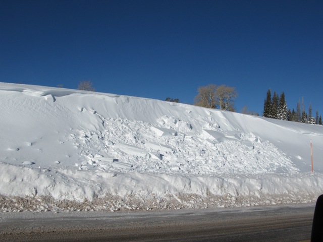
West and northwest winds kicked into gear early Monday morning, loading the usual suspects and leading to a pockety avalanche cycle on the Skyline |
| type | aspect/elevation | characteristics |
|---|

|

|
LIKELIHOOD
 LIKELY
UNLIKELY
SIZE
 LARGE
SMALL
TREND
 INCREASING DANGER
SAME
DECREASING DANGER
|
|
description
Last weekends storm snow settled nicely and in general the snowpack seems pretty comfortable in its own skin. The past few days we've found the snow to be unreactive to our additional weight and our snow stability tests confirm this. However, we've only seen a small portion of a ginormous region and I'm not gonna bet the farm on a thumbnails worth of information. Sure, you'd really have to go out of your way to trigger an avalanche on the Skyline this weekend, but it isn't out of the question. The type terrain we flock to early in the season (upper elevation, shady slopes, facing the north half of the compass) is exactly the type of terrain where you could trigger an avalanche the next couple of days. Remember- these slopes are more dangerous because the old snow near the ground has grown weak and sugary. And with the addition of last weekends storm... now there's a cohesive slab on top. This isn't a widespread avalanche problem. In fact, it's more pockety in nature. Problem is- any avalanche that breaks to old snow will be more dangerous because of all the obstacles it uncovers. It's a long season and we're barely getting started. Best to avoid a game ending injury by steering clear of steep, upper elevation slopes, especially those that face the north half of the compass, where strong feeling snow overlays weak snow near the ground.
|
 |
weather
This graphic pretty much sums it up. A weak storm system exits the region tonight, leaving a dry and increasingly mild northwest flow. Skies will be sunny and daytime highs reach into the mid 30's with overnight lows dipping into the teens. Northwest winds gust into the 20's along the high ridges. The next chance for snow is slated for Thursday. |
| general announcements Remember your information can save lives. Please let us and the rest of the community know what your are seeing out there by submitting snow and avalanche conditions. This is a great time of year to schedule a free avalanche awareness presentation for your group or club. Contact either Craig Gordon or Brett Kobernik by emailing us: Donate to your favorite non-profit –The Friends of the Utah Avalanche Center. The UAC depends on contributions from users like you to support our work. The information in this advisory is from the US Forest Service which is solely responsible for its content. This advisory describes general avalanche conditions and local variations always occur. This advisory will be updated by 8:00 PM December 20th or sooner if conditions warrant. |


.jpg)