


Forecast for the Skyline Area Mountains

Issued by Brett Kobernik on
Saturday morning, March 29, 2025
Saturday morning, March 29, 2025
CONDITIONS ARE CHANGING BUT THIS WON'T AFFECT THE AVALANCHE DANGER MUCH.
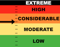
The majority of the terrain on the Skyline has a LOW to MODERATE avalanche danger.
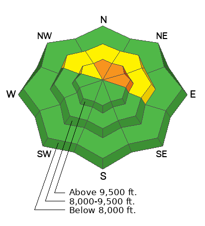
There is still a chance of triggering an avalanche that breaks deep into older sugary weak snow. The danger rating is CONSIDERABLE on very steep slopes that face north, northeast and east.
Chances of triggering something continue to be come less but consequences remain serious.
Low
Moderate
Considerable
High
Extreme
Learn how to read the forecast here
 Weather and Snow
Current Conditions: Temperatures have been cooling down after a VERY warm week. The snowpack settled 12 to 18" over the week. Ultimately, this should help stabilize the deeply buried weak layers. Overnight temperatures got down around freezing and wind has been light from the west.
Mountain Weather: Unsettled weather starts today and lasts through the week. A small storm system moves through today bringing 2 to 4 inches of new snow by Sunday. Wind starts out light from the southwest then increases into the moderate speed category more from the west. Temperatures will get into the mid 30s. Sunday will have partly cloudy skies with temperatures into the mid 30s. Another potentially more potent system moves through Monday into Tuesday.

Avalanche Problem #1
Persistent Weak Layer
Type
Location
Likelihood
Size
Description
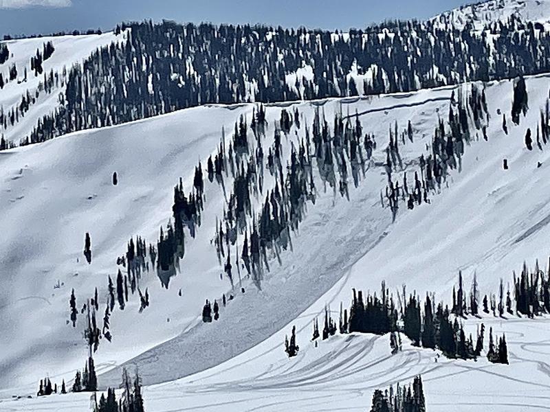
Older deeply buried weak layers remain the biggest threat. The big question is "when are the old weak layers considered stable"? This is a difficult question to answer. In 2022, we had avalanches in March breaking into old faceted weak layers. The last deep avalanche that year was April 2 and was snowmobile triggered. DETAILS HERE
This year's snowpack has similarities to 2022. While the snowpack should be stabilizing right now, experience has continued to show me that often, deeply buried faceted weak layers will release long after I think things are becoming stable. They persist for long periods of time, hence the name "Persistent Weak Layer". I'm not trusting any steep slopes with my life right now.
PHOTO: Snowmobile triggered avalanche on April 2, 2022 that broke deep into old weak sugary snow.
General Announcements
This forecast is from the U.S.D.A. Forest Service, which is solely responsible for its content. This forecast describes general avalanche conditions and local variations always occur.