


Forecast for the Uintas Area Mountains

Issued by Craig Gordon on
Saturday morning, March 29, 2025
Saturday morning, March 29, 2025
A sea of green blankets the danger rose, suggesting LOW avalanche hazard and a c'mon in... let's party, kinda mindset. However, don't remove this tag, because there's a disclaimer here- LOW avy danger doesn't mean NO avy danger-
Even though human triggered avalanches are UNLIKELY, as we stretch our wings and think of bigger objectives, let's keep in mind that even a small slide can ruin our day in steep, technical, committing terrain.
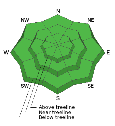
Low
Moderate
Considerable
High
Extreme
Learn how to read the forecast here
 Special Announcements
The final report for the Hoyt Peak avalanche accident on March 7th has been published and is available, here.
Our Spring Campaign is in full swing, and there are two great ways to support forecasting, awareness, and education across Utah: Donate to our Spring Campaign or bid on items in our Spring Auction. Every dollar helps keep the backcountry community on top. Thank you for your support!
 Weather and Snow
Nowcast- Cooler air settled into the Uinta region overnight delivering a trace of snow and more seasonal temperatures registering in the low to mid 20's. West and northwest winds blow in teens near the high peaks, while high clouds drift through the northern half of the state.
Forecast- Look for increasing clouds with scattered snow showers through late morning. A more organized, though relatively weak impulse slides through late in the day. I'm still cautiously optimistic this North Slope favored system delivers 3"-6" of snow, with about half that amount along the south half of the range. Westerly winds bump into the 20's, while temperatures climb into the mid 30's. Skies clear overnight and the mercury dives into the upper teens and low 20's.
Futurecast- A beautiful Sunday is on tap with mostly sunny skies, light winds, and temperatures climbing into the 40's. Increasing clouds Monday with a colder, more potent storm expected to kick off the workweek. We could see a nice shot of snow materializing for Tuesday... stay tuned for more deets!
Travel & Riding Conditions- Until we stack up some cushion, today's snow surface is gonna be a bit on the rugged side. Perhaps get a few projects off your plate this morning and consider a dusk patrol.
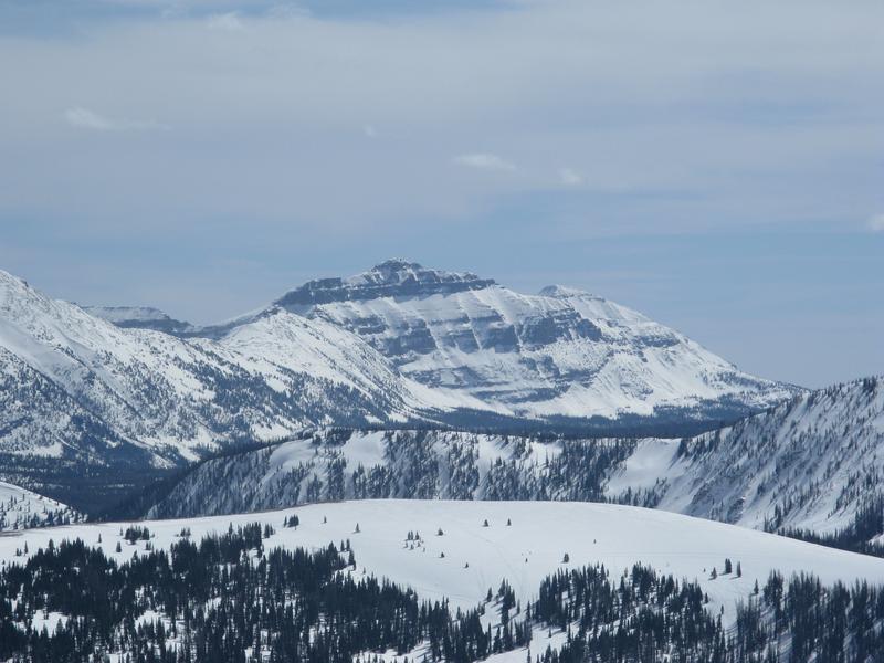
Hayden Peak, looming large and keeping a watchful eye on Upper Moffit Basin.
 Recent Avalanches
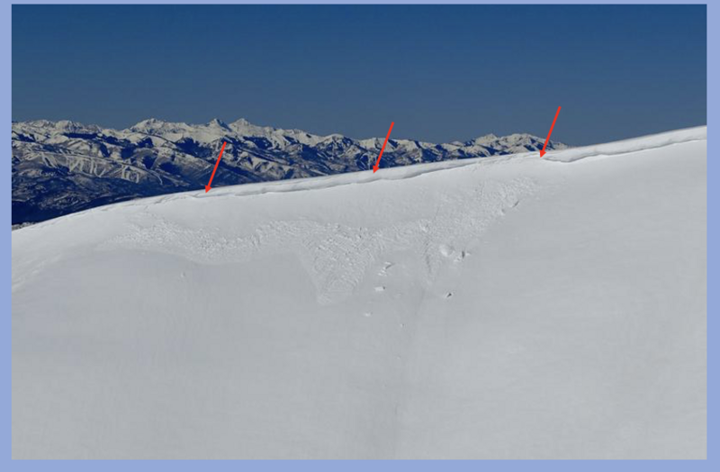
Pretty quiet recently, though Trevor spotted this couple day old, natural cornice release in Upper Weber Canyon. After trundling onto the slope below, this piece of corni released a small, damp avalanche.
Check out all the action, info and intel for the Uinta range and beyond, here.

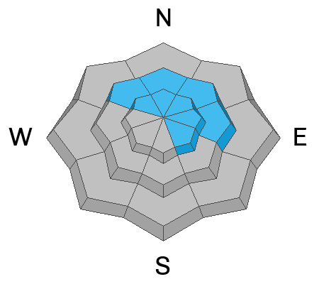
Avalanche Problem #1
Wet Snow
Type
Location

Likelihood
Size
Description
I suspect most of our terrain is solid and locked up. But if the sun comes out and starts baking the snow, be flexible with your game plan and move to another activity before the snow gets too manky. In addition, think about your end of the day exit strategy and avoid terrain traps like gullies and road cuts, where even a small slide can pile up unusually impressive piles of tree snapping debris.
Avalanche Problem #2
Persistent Weak Layer
Type
Location
Likelihood
Size
Description
The jury is still out, but I think we may be getting closer to done with our persistent weak layers. However, shallow snowpack zones like terrain that has avalanched multiple times this season is guilty until proven otherwise. Remember... our PWL problem child is still trying to figure itself out and isn't entirely comfortable in its own skin, so here's some considerations-
- Steep, rocky slopes with a shallow snowpack are prime suspects.
- This problem exists in a small and isolated portion of our terrain and is easily avoidable.
- Big triggers can produce big avalanches -- Watch out for cornice failure or rapid change... anything that could help pry out one of these nasty slides.
Additional Information
General Announcements
We are always looking for snow and avalanche observations or just general riding conditions. In the meantime reach out to us with questions, concerns, or if you see anything in your travels! Contact us directly through the info below:
- Craig Gordon [email protected] 801-231-2170.
- Andrew Nassetta [email protected] 860-460-8142.
This forecast is from the U.S.D.A. Forest Service, which is solely responsible for its content. This forecast describes general avalanche conditions and local variations always occur. This forecast was issued on Saturday, March 29th at 03:00 AM and expires 24 hours after it was issued.