Alta Ski Area has closed the Summer Road and access to Catherine's for lift area operations. Grizzly Gulch remains open.
Many ski areas are now closed to uphill travel in order to prepare for winter operations. Resort uphill travel policies can be found
HERE. Under overcast skies resorts are reporting a trace of snow at the higher elevations. The 9000' ridgeline winds are currently light from the northwest gusting into the mid-teens. The 11,000' ridgeline winds are north/northwest in the high 20's (mph) gusting to the high 40's (mph). Temperatures are in the mid-teens (F) at the lower elevations and in the single digits at the higher elevations.
Today temperatures should warm into the mid 20's (F) at lower elevations and into the high teens at higher elevations. Winds will remain northerly. Skies will be partly to mostly cloudy. Light snow is forecast to taper off throughout the day.
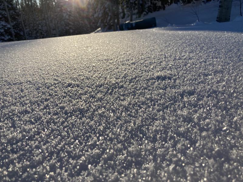
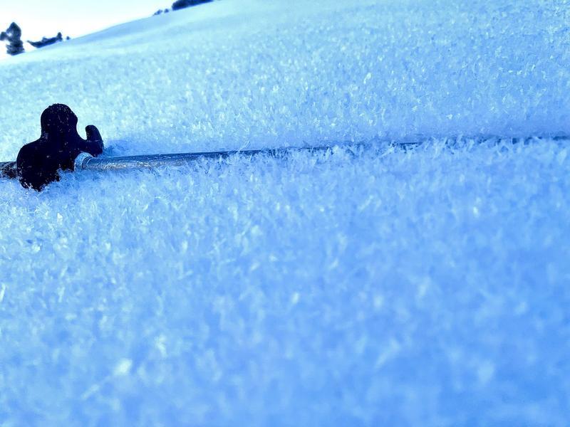
As we move into a high pressure cycle, skiers are noting feathery crystals forming on the snow surface throughout the Central Wasatch. Cold clear nights with higher humidity and light winds create surface hoar, which is the wintertime equivalent of dew. While these crystals are fun to ski and pretty to look at, they can create a future persistent weak layer if they are not destroyed prior to being buried. If you're out and about take note of where you find these crystals and submit an observation
here.
Read more about Surface Hoar
here.Photo of Surface Hoar from the Park City side (Crandall)
Photo of Surface Hoar from Broads Fork (Grainger)
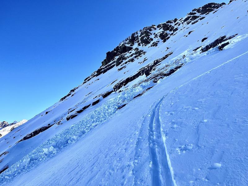
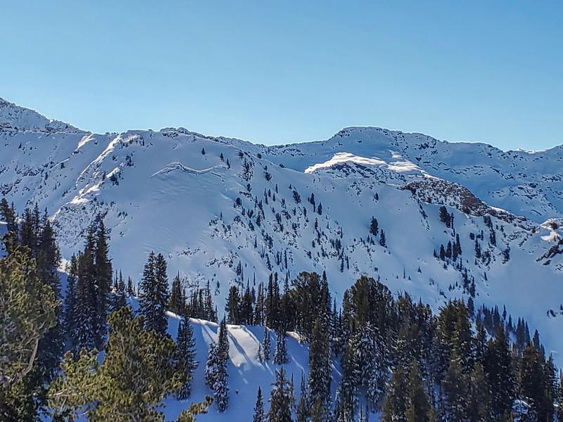
There were reports of gliding snow in the upper reaches of Mineral Fork, Broads, and Stairs. Gliding snow is un-predicable and generally something we see in the spring with a more homogenous snowpack. Avoid being on or traveling underneath these slopes. They are unpredictable and it's worth giving gliding snow a wider berth.
Broads Glide Crack (Grainger)
Mineral Glide Crack ( Steve)
Read the most recent observations from the backcountry HERE.
If you see anything we should know about, please submit your own observations HERE.