Forecast for the Uintas Area Mountains

Issued by Craig Gordon on
Sunday morning, April 2, 2023
Sunday morning, April 2, 2023
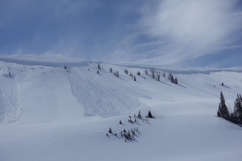
Yesterday's warmth, wind, and strong sunshine draped a cargo net on our snowpack, but it's not completely straight-forward-
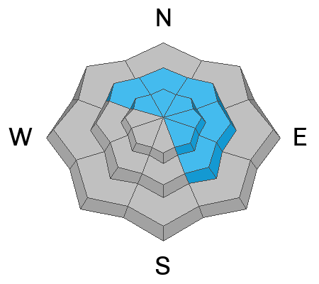
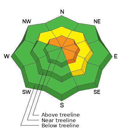
In the wind zone, above treeline, you'll find pockets of CONSIDERABLE avalanche danger. On steep, rocky, upper elevation slopes, human triggered avalanches are LIKELY. Terrain facing the north half of the compass, especially steep slopes with an easterly component to its aspect have the potential to produce avalanches that'll pack a punch and could easily ruin your day. MODERATE avalanche danger is found near treeline and human triggered avalanches are POSSIBLE on steep slopes with recent deposits of wind drifted snow.
Today's exit strategy- Avoid the wind funk... simply steer your snow vehicle towards mid and lower elevation wind sheltered terrain where you'll find soft, creamy snow and predictable avy hazard.
Low
Moderate
Considerable
High
Extreme
Learn how to read the forecast here