Forecast for the Uintas Area Mountains

Craig Gordon
Issued by Craig Gordon for
Saturday, March 30, 2019
Limited to a small percentage of the terrain available to ride in today, at and above treeline you'll find MODERATE avalanche danger. Human triggered DRY SNOW avalanches are POSSIBLE, especially on steep leeward slopes facing the north half of the compass.
In addition, if the sun comes out for any length of time the danger of WET SNOW avalanches will rapidly rise to MODERATE and human triggered avalanches become POSSIBLE on all steep, snow covered slopes.
Low
Moderate
Considerable
High
Extreme
Learn how to read the forecast here
Special Announcements
We need your help. In an effort to increase awareness and prevent future fatalities we need to reach more people with our daily avalanche forecasts, expand the Know Before You Go program, and increase the number of on-snow avalanche courses. Please consider a donation to the UAC to help us raise $25,000 by April 8. Show your support of the UAC by making a donation
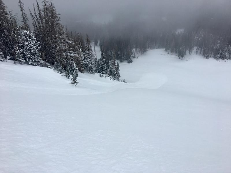
 HERE
Weather and Snow
Wow... a nice little sleeper storm for the eastern front developed early Friday morning setting its sights on the North Slope, where 12"-18" of light density snow stacked up in just a couple hours. From Trial Lake southward, storm totals are about 1/2 that amount. Currently, winds are light, skies are generally clear, and temperatures in the teens and low 20's. Riding and turning conditions vastly improved yesterday and I think low angle slopes are the ticket, as our recent coat of white paint will help cushion some of the old, hard snow surfaces.
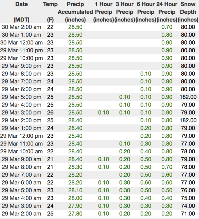
Above is hourly data from Chalk Creek (9,169')
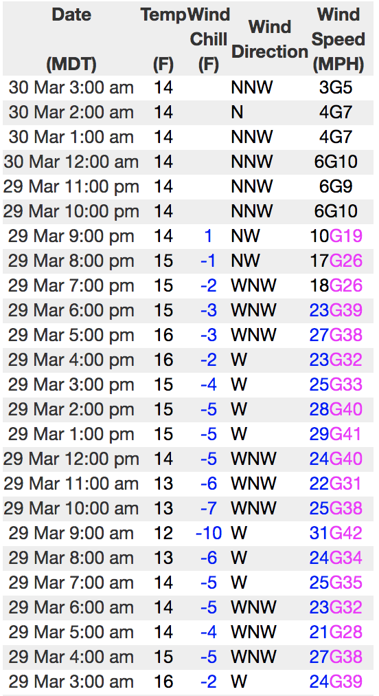
And Windy Peak (10,662')
To view more regional weather stations click here.
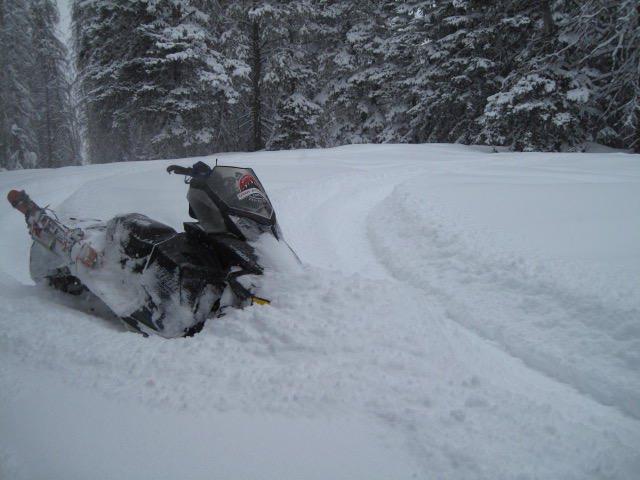
Our main man Ted Scroggin was near Gold Hill yesterday and notes... "It was back to winter conditions with a nice foot and a half of new snow in the Gold Hill area. The snow throughout the day fell straight down with little wind, unless you were up along the ridge lines. A great sleeper of a storm. The new snow improved the riding conditions and it was best to stay on lower angle slopes where the old tracks and crusts were less of an issue." More on Ted's travels and insights are found here.
Recent Avalanches
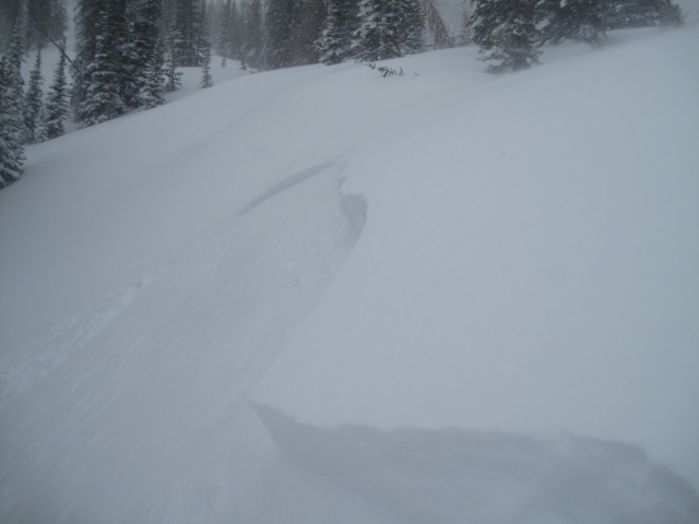
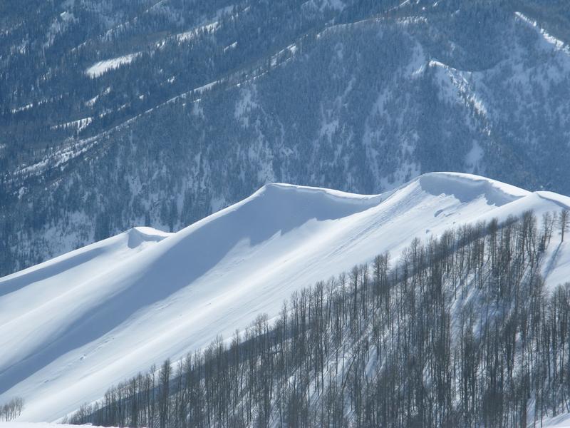
A couple drainages away from each other, both Ted and Dave Kikkert found similar conditions.... sensitive drifts, breaking 12"-24" deep, along the leeward side of upper elevation ridges. While isolated to the wind zone, once initiated, yesterday's soft slabs and shallow sluffs had no problem picking up speed on the slick bed surfaces formed during last weeks warm spell and ran faster and further than you might expect.
Recent trip reports and avy activity found HERE.
Ad
Avalanche Problem #1
Wind Drifted Snow
Type
Location
Likelihood
Size
Description
I think most of our new snow instabilities settled out overnight and the storm snow isn't going to be quite as reactive as it was yesterday. However, as you know, the Uinta's are a big place and I bet there's still a wind drift or two lurking out there that'll react to our additional weight. The good news is, this avalanche problem is small in scope and limited to steep, upper elevation, leeward slopes in the wind zone. So today you'll want to continue looking for and avoiding any fat, rounded piece of snow, especially if it sounds hollow like a drum. Easier yet... lose some elevation and you'll lose the problem.
And finally don't forget-
Cornices are ginormous and may break back further than you might expect. You definitely wanna give these large, unpredictable pieces of snow a wide berth and not ruin someones day below by inadvertently knocking a boxcar size piece of snow down on them.
Avalanche Problem #2
Wet Snow
Type
Location
Likelihood
Size
Description
If the sun comes out for any length of time the danger of wet avalanches will rapidly rise. It doesn't take much provocation to get a wet sluff to move slowly downhill. Problem is... when all that damp, cement-like snow piles up deeply in a terrain trap like a gully or a road cut. The good news is... this is a totally manageable avalanche problem, but we need to stay ahead of the curve. If the snow you're riding gets wet and manky, or if it feels punchy or like a trap door under your skis, board, or sled... simply get off of and out from under steep terrain.
Additional Information
A break in the action is slated for a good portion of the morning and we should see partly cloudy skies with a few snow flurries and temperatures rising into the low 30's. Winds are gonna be light and variable, blowing less than 25 mph even along the high peaks. Skies clear early Sunday and a short-lived ridge of high pressure builds for the beginning of the workweek. Another good shot of snow is on tap for midweek.
General Announcements
The information in this advisory expires 24 hours after the date and time posted, but will be updated by 7:00 AM Sunday March 31st, 2019.
If you're getting out and about, please let me know what you're seeing especially if you see or trigger and avalanche. I can be reached at [email protected] or 801-231-2170
It's also a good time to set up one of our very popular avalanche awareness classes. Reach out to me and I'll make it happen.
This information does not apply to developed ski areas or highways where avalanche control is normally done. This advisory is from the U.S.D.A. Forest Service, which is solely responsible for its content. This advisory describes general avalanche conditions and local variations always occur.