Wondering who hijacked our winter, where weak layers in the snowpack are trending, or perhaps you're just PWL curious? Well then, please join UAC Forecaster Craig Gordon (that's me :) at
Ecker Hill Middle School, Tuesday February 11th from 6:30-8:00 PM for a State of the Snowpack presentation hosted by Park City Professional Ski Patrol Association (PCPSPA). Guaranteed to be informative, educational, and perhaps even entertaining!
Sad news to report from the Monte Cristo area where a snowmobiler was caught, carried, and killed in an avalanche Monday. An accident summary is found
here. Please know our hearts hurt and our collective energy goes out to friends, family, and everyone involved in this very tragic accident.
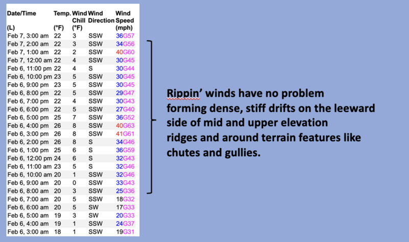
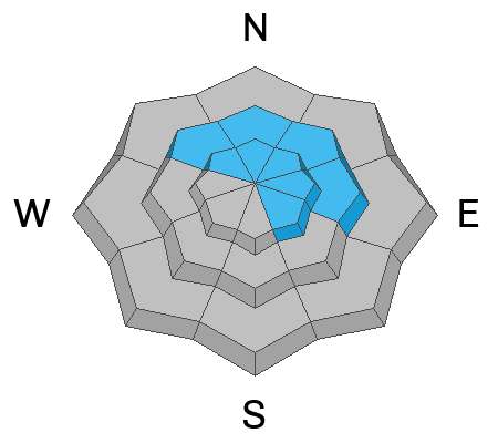
Nowcast- South and southwest winds nuke into the 50's and 60's near the high peaks, ushering in high clouds, and the warm before the storm. Currently, temperatures hover near freezing at the trailheads and register in the mid 20's along the ridges. Riding and turning conditions have taken a hard hit, but swaths of shallow powder are found on low angle, mid elevation, wind sheltered slopes.
Forecast - A rough, rowdy, and rather robust, albeit short-lived storm, harnesses the use of alliteration, taps into its inner Beowulf and sets its sights on the Uinta zone late this afternoon. Expect increasing clouds, continued strong southwesterly winds and light snow showers this morning, becoming heavier as the day progresses. High temperatures bump into the mid 30's and crash into the teens overnight once cold air blasts through the region.
Futurecast-
Look for a good shot of snow with frontal passage coinciding with the afternoon commute, continuing through tonight, but tapering off rapidly early Saturday morning. I'm cautiously optimistic this storm produces 8"-10" of snow with an inch of water. Cool high pressure with a few weak storms embedded in the flow is on tap for next week.
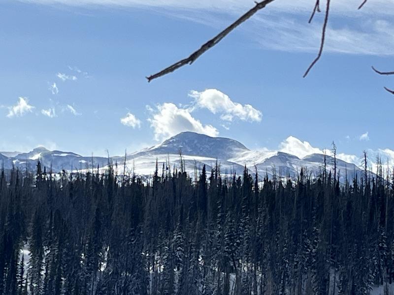
Ted took a rip towards
Elizabeth Pass yesterday and reports... "Pretty classic High Uinta weather day with strong winds blowing across the upper elevations, looks like a Colorado continental snow pack up there."
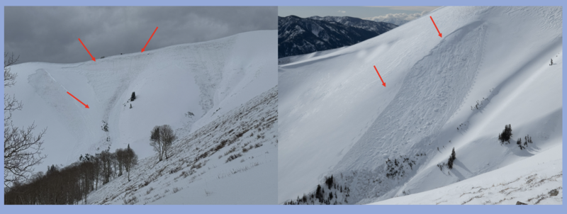
I'm still not trusting our current snowpack structure, especially in steep rocky terrain or slopes that avalanched earlier this season like the Dec. 29th (before) and Feb. 6th (after) images above.
Look for this years slides cataloged
here. As always, gain more intel and info via obs, avalanches and trip reports from across the range and beyond,
here!