Forecast for the Uintas Area Mountains

Issued by Craig Gordon on
Saturday morning, February 8, 2025
Saturday morning, February 8, 2025
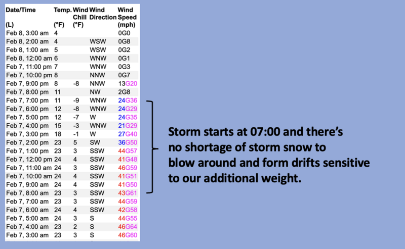
Heads up... today's sunny skies and fresh pow is gonna red-line our stoke-meter, but don't let that cloud our judgment. Nearly two feet of fresh snow, raging wind, and a solid dose of water weight elevates the avy hazard from a little sketchy to game on!
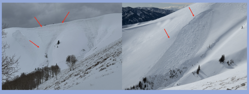
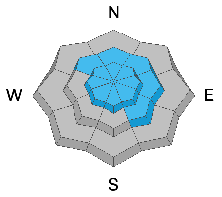
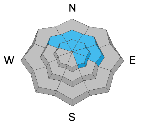
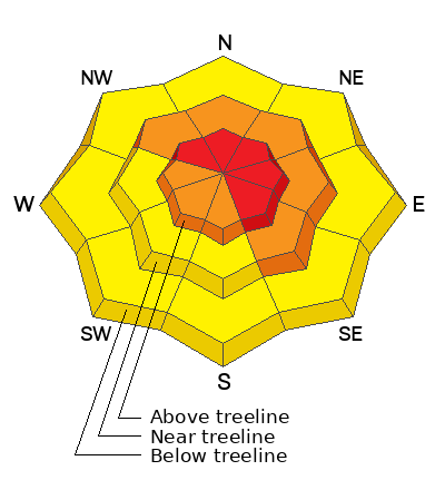
Recent strong winds and heavy snow, team up to deliver a one-two punch along with HIGH avalanche danger on wind drifted slopes, especially those in the wind zone above treeline. Human triggered avalanches are VERY LIKELY, particularly on steep slopes facing the north half of the compass. Remember... any slide triggered today has the potential to break deeper and wider than we might expect, delivering a massive curve ball that'll instantly ruin my day.
Mid elevation terrain remains guilty until proven otherwise and CONSIDERABLE hazard in found in steep terrain with recent deposits of wind drifted snow. Human triggered avalanches packing a significant punch are LIKELY
Lower elevation shady slopes and mid elevation solars are now a player where you'll find MODERATE avalanche danger. Perhaps a little more predictable, none-the-less, human triggered avalanches are POSSIBLE on steep wind drifted slopes.
There's a lot going on today, but we don't have to hide under the beds. In fact, you'll find a day of epic riding and straight-forward avy hazard in big open meadows with no steep slopes above or adjacent to where you're riding.
Low
Moderate
Considerable
High
Extreme
Learn how to read the forecast here