Forecast for the Uintas Area Mountains

Andrew Nassetta
Issued by Andrew Nassetta on
Sunday morning, February 9, 2025
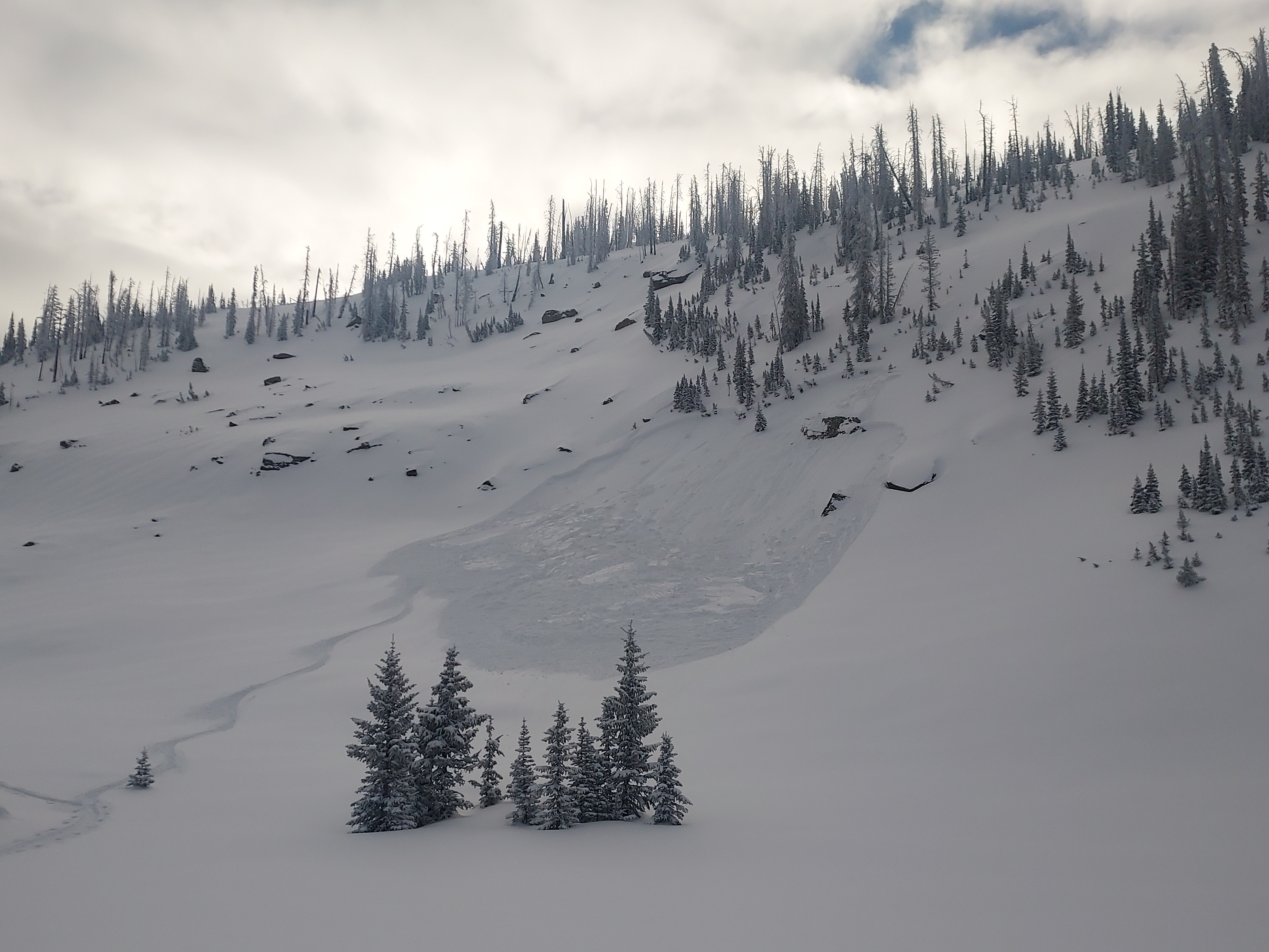
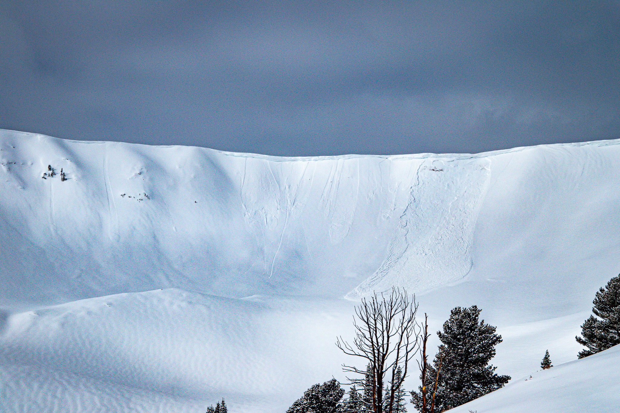
It is tricky out there, and today's avalanche danger is CONSIDERABLE. The recent fresh snow is deceptive, and at mid and upper-elevations human-triggered avalanches are LIKELY and we can trigger a persistent slab avalanche 2-5' up to a few hundred feet wide. Suspect slopes are thin, steep, and rocky, many of which are repeaters or slopes that have already avalanched this season.
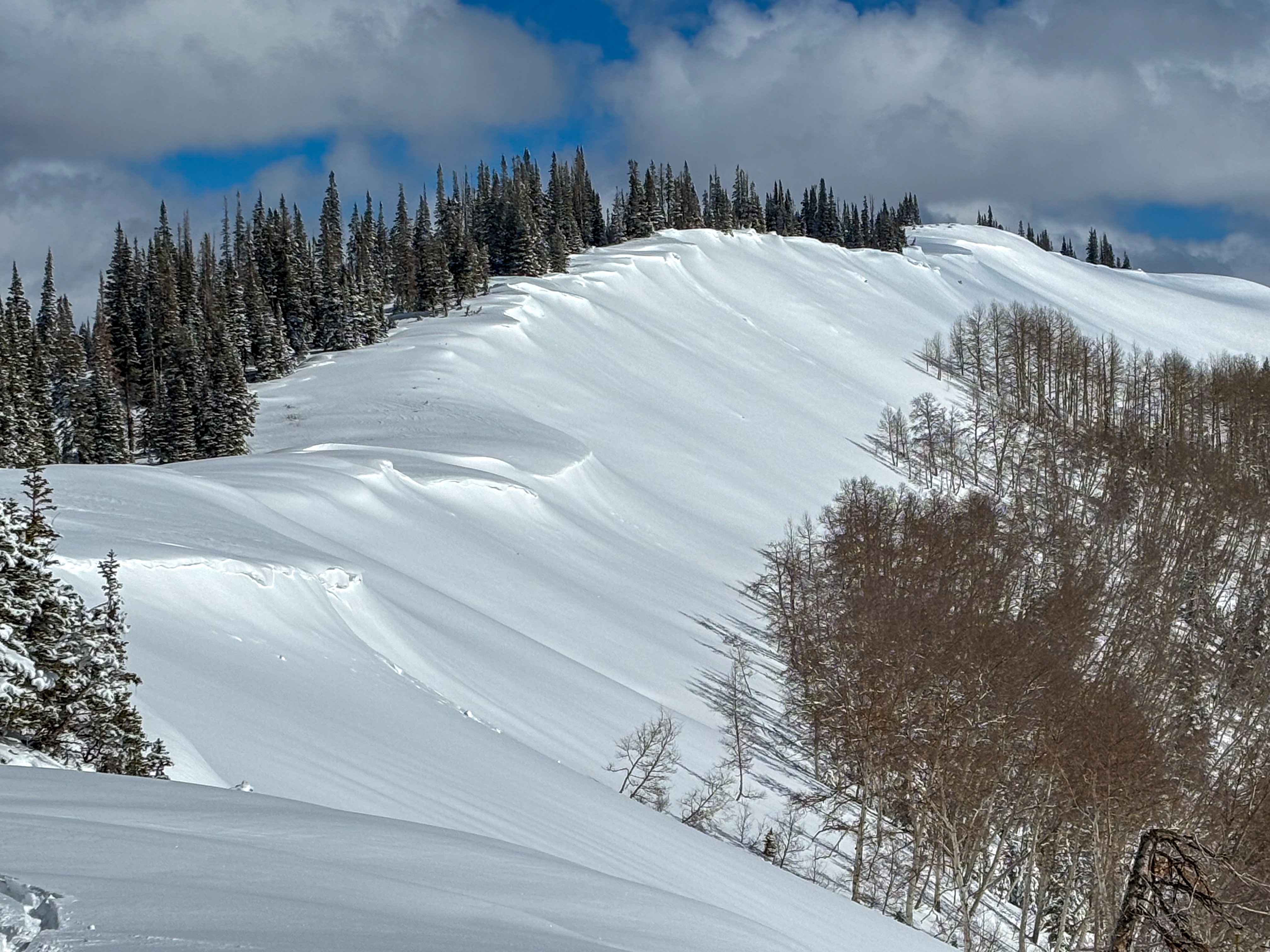
Today, I'm avoiding avalanche terrain and any overhead hazard on northerly aspects and gunning for sunny, south-facing, low-hanging fruit that has reduced avalanche hazard and stellar riding conditions.
Low
Moderate
Considerable
High
Extreme
Learn how to read the forecast here
Special Announcements
Wondering who hijacked our winter, where weak layers in the snowpack are trending, or perhaps you're just PWL curious? Well then, please join UAC Forecaster Craig Gordon at Ecker Hill Middle School, Tuesday February 11th from 6:30-8:00 PM for a State of the Snowpack presentation hosted by Park City Professional Ski Patrol Association -- Reserve a spot, here!
Weather and Snow
Nowcast
A late afternoon cold front yesterday quickly piled up 2-3” of additional snow in some areas. Right now a few clouds kick-off the morning as the return of winter is capped off by crisp temperatures with many trailheads in the single digits as of 0500 AM. Winds are blowing out of the west northwest in the moderate, 20 MPH range, with gusts around 25MPH.
Forecast
For today, expect to continue in the same fashion as this morning. Cold temperatures maxing out in the high teens(℉), light to moderate winds from the northwest nearing 20 MPH, and clear, sunny skies to boot – A beautiful Uinta day!
Futurecast
A few days of calm are on tap for us, before things look to get active again on Tuesday with a larger shot of water coming in towards the end of the week, stay tuned!
Recent Avalanches
Yesterday, avalanches breaking 1-2' were reported on upper elevation slopes facing the north half of the compass. Bo observed a natural avalanche from the wind zone in Upper Weber Canyon, while Michael J found a few pockets in more protected terrain near. As always, gain more intel and info via obs, avalanches and trip reports from across the range and beyond, here!
Michael J triggered two similar pockets breaking into recent storm snow and failing into the January PWL. Get the scoop, here.
Ad
Avalanche Problem #1
Persistent Weak Layer
Type
Location
Likelihood
Size
Description
Recent avalanches suggest two layers of faceted snow that are beginning the reveal their hand... one developed during the mid-January cold, dry spell and the other during the mid-December drought. In both cases, Friday's dense snow (nearly 2" of SWE) and strong winds over the past week have activated these layers. Recent slides have been triggered on slope, as well as from a distance, failing 1-3' deep on January's PWL. Remember any avalanche triggered today has the potential to break even deeper and wider than we might expect gouging into old, basal snow close to the ground.
We still need persistent patience in dealing with this persistent dragon. The only way to manage the unmanageable is avoidance, and my crew and I are steering clear of slopes that have this nasty slab/weak layer combo.
East facing slope in the windzone that nautraled overnight on Feb. 7th. This slope is a repeater, and has avalanche multiple times this season like many others across the range.
Avalanche Problem #2
Wind Drifted Snow
Type
Location
Likelihood
Size
Description
The weekends storm combined with sustained west and southwest winds cranking 50 MPH created stiff drifts 1-2' deep. Expect today's wind slabs to be stubborn and on their way to settling out, but you know what they say about lingerers. Keep your program tight as any old drifts are now hidden by fresh snow and could lure you in to their den with ease.
Look for drifts to be most sensitive on steep, upper-elevation ridgelines and keep an eye out for cornices, wind pillows, and scouring to help you nail down their exact location and avoide the,.
A wind-drifted ridge at 10,000', with cornices formed above the leeward facing slopes -- A likely place to trigger a wind slab.
Additional Information
Sad news to report from the Central Wasatch, Salt Lake Area Mountains where a skier was caught, carried, and killed in an avalanche, yesterday. A preliminary report can be found found here. Please know our hearts hurt and our collective energy goes out to friends, family, and everyone involved in this very tragic accident.
General Announcements
We are always looking for snow and avalanche observations or just general riding conditions. In the meantime reach out to us with questions, concerns, or if you see anything in your travels! Contact us directly through the info below:
This forecast is from the U.S.D.A. Forest Service, which is solely responsible for its content. This forecast describes general avalanche conditions and local variations always occur. This forecast was issued on Sunday, February 9th at 05:00AM and expires 24 hours after it was issued.