UDOT PLANNED AVALANCHE CLOSURES!!

Observation: Elizabeth Pass

Observation Date
2/6/2025
Observer Name
Ted Scroggin
Region
Uintas » Elizabeth Pass
Location Name or Route
Elizabeth Ridge
Weather
Sky
Scattered
Wind Direction
South
Wind Speed
Moderate
Weather Comments
Partly cloudy start to the day with some cooler temperatures this morning, but it was already 35 degrees at the trailhead at 9:00. The south winds were light until I reached Elizabeth Pass and it stayed fairly gusty all day at that location.
Snow Characteristics
New Snow Depth
5"
New Snow Density
Medium
Snow Surface Conditions
Powder
Wind Crust
Snow Characteristics Comments
Around three inches new snow from yesterdays quick shot of snow and plenty of wind to go along with it. A little more snow as I gained some elevation and it seemed like 4-5" on the pass. The medium density snow helped cushion some of the old tracks, but it did little out in the exposed terrain where the wind has been quite steady for a few days.
Red Flags
Red Flags
Wind Loading
Red Flags Comments
Just more wind and more fresh wind drifts along the high ridges. I only found the fresh drifts to crack and not do all that much as they broke and moved down hill. Noticed some old large chunks of cornice that broke off and hit the slope below, but did not appear to trigger any large deep avalanches.
Avalanche Problem #1
Problem
Wind Drifted Snow
Trend
Increasing Danger
Problem #1 Comments
The wind drifted avalanche problem did not seem to reactive while I was out, but the south winds continued to blow and the speeds even increased as the day went on. There was just enough new snow to create fresh wind drifts and small soft slabs, but the hazard felt mostly moderate for the few hours I was in the field.
Comments
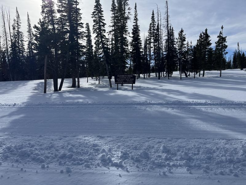
The Elizabeth Pass sign is usually a good indicator of how the winter is going and it is often times fully buried or just the top is exposed.
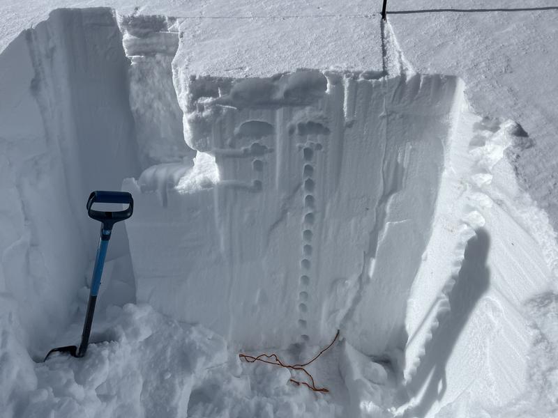
A snow pit on an east facing slope at 10,180' north of the pass showed 125cm/50" and generally a decent looking snowpack at that location. There was a couple layers that failed in the upper part of the snow pit with hits from the elbow. These weak layers were the old snow surface prior to recent snow and wind events. I did not get any layers to propagate a crack across the column.
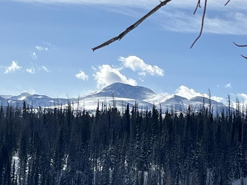
Pretty classic High Uinta weather day with strong winds blowing across the upper elevations, looks like a Colorado continental snow pack up there.
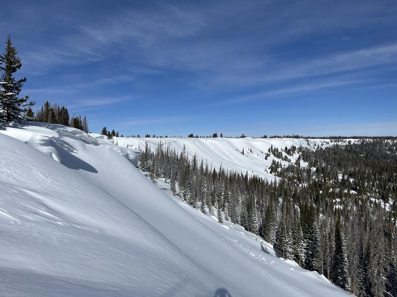
The north side of Elizabeth Pass is a large flat area where there is very little to stop the wind and large amounts of wind drifted snow are deposited onto the north facing slopes. I think some of the riders call this area " Airplane Flats".
Today's Observed Danger Rating
Moderate
Tomorrows Estimated Danger Rating
Moderate
Coordinates