Sad news to report from the Monte Cristo area where a snowmobiler was caught, carried, and killed in an avalanche Monday. An accident summary is found
here. Please know our hearts hurt and our collective energy goes out to friends, family, and everyone involved in this very tragic accident.
Nowcast-
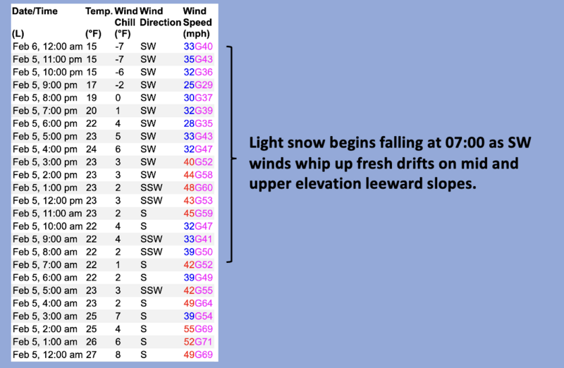
Whelp... it's been a good run and of course we need the wind, but it appears hourly averages are beginning to taper into the 20's and 30's near the peaks. Skies are clear in the wake of yesterday's storm that delivered 3" of medium density snow with .30" ish H2O to the north half of the range with about half that amount further south towards Wolf Creek. Overnight, temperatures cooled into the teens and mid 20's where they sit at o'dark thirty this morning. Riding and turning conditions have taken a hard hit, but swaths of shallow powder are found on low angle, mid elevation, wind sheltered slopes.
Forecast -
A break in the action is on tap for this morning and we can expect mostly sunny skies with high temperatures climbing into the mid 30's. Clouds increase by early afternoon with a weak system sliding through as southwest winds blow in the 20's and 30's near the high peaks. A bump in moisture favors the south half of the range with a couple inches of snow piling up by sunset.
Futurecast-
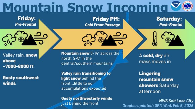
Expect a good shot of snow for late Friday through Saturday morning. I'm cautiously optimistic this storm produces 8"-10" of snow with an inch of water. More deets and better timing to follow for tomorrow's update.
No significant avalanche activity to report from Wednesday, but the weekend storm provided no shortage of slides cataloged
here.As always, gain more intel and info via obs, avalanches and trip reports from across the range and beyond,
here!