Forecast for the Salt Lake Area Mountains

Nikki Champion
Issued by Nikki Champion for
Wednesday, April 13, 2022
The avalanche danger is CONSIDERABLE on all upper elevation steep slopes. Human-triggered avalanches are likely where soft slabs of new snow combined with fresh wind drifts are the main avalanche problems. Careful snowpack evaluation, cautious route-finding, and conservative decision-making will be essential in this terrain today.
Low and mid-elevation slopes generally had less wind, but human-triggered avalanches remain possible within the new snow, and the avalanche danger is MODERATE.
Keep in mind that if it starts snowing harder than expected or the wind speeds increase the avalanche danger can spike rapidly.
Low
Moderate
Considerable
High
Extreme
Learn how to read the forecast here
Special Announcements
Our last regular forecast is Sunday, April 17th. Intermittent forecasts will be issued through April based upon weather conditions which affect avalanche danger.
Weather and Snow
Snow: As of 5 a.m. an additional 2-6 inches of snow fell overnight and it is still coming down. Snowfall totals since Monday evening:
Little Cottonwood Canyon: 17-19.5" snow (1.36-1.43" H20)
Big Cottonwood Canyon: 12.5-17" snow (1.07-1.25 H20)
Park City Ridgeline: 11-19" snow (1.00-1.40" H20)
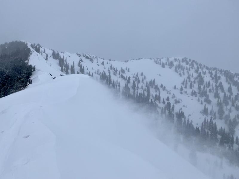
This morning, it is overcast with light snowfall in the mountains. Temperatures are in the single digits to mid-teens F and winds are primarily from the west-northwest and moderate. At mid-elevations winds are averaging 5-15 mph with gusts between 20-30 mph. At the upper elevations, winds are averaging in the low 30s with gusts up to 40 mph.
Today, there will be periods of occasional snowfall throughout the day, with an accumulation of up to 4" of new snow. Temperatures will be in the mid-20s F. Winds will stay elevated and west-northwesterly, gusting up to 30 mph at the mid-elevations and up to 50 mph at the upper elevations. Final storm totals could bring us close to 20-28" of snow, and up to 2.0” of water by this evening.
Later in the week, a series of weak systems will move through the area Thursday into Friday bringing additional chances of snow. Accumulation with these waves is not expected to be significant.
Recent Avalanches
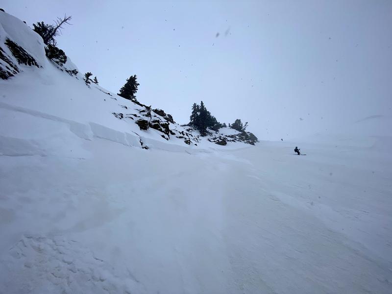
Yesterday, ski resorts reported widespread storm slabs sensitive to both ski cuts and explosives failing on the firm new snow/old snow interface. In the backcountry, multiple parties encountered skier-triggered avalanches within the new snow.
  • Two Dogs - 10,200' - North Aspect - Soft slab failing 18" deep, 50' wide, and running 400' vertical feet. Excellent write-up talking about the margin of risk when "managing" avalanche terrain in the backcountry.
  • Wolverine Bowl - 10,600' - North Aspect - Soft slab failing 9" deep, and 30' wide.
  • Scotties Bowl - 9,700' - North Aspect - Soft slab failing 11" deep, and 30' wide.
  • Scotties Bowl - 10,000' - North Aspect - Soft slab failing 12" deep, and 70' wide.

Photo of the crown from the Two Dogs avalanche report (B. Nalli)
Ad
Avalanche Problem #1
Wind Drifted Snow
Type
Location
Likelihood
Size
Description
In the wind zone, the new snow problem will be amplified by additional loading by the wind. Due to the elevated winds that have accompanied this front, you'll likely find slabs of wind drifted snow at the upper elevations, and some mid-elevation sub ridges as well. Winds have mostly been blowing from the northwest and west, but look for drifting on all aspects which can be loaded from the tops of ridges or across the sides of ridges in a process known as cross-loading.
Look for obvious signs of wind-drifted snow, such as pillow-shaped slopes, cracking, and whumping, and avoid those slopes.
Photo of winds actively transporting snow above Two Dogs (B. Nalli)
Avalanche Problem #2
New Snow
Type
Location
Likelihood
Size
Description
Roughly 11"-20" inches of new snow has fallen throughout the Wasatch range. All of this new snow fell on a variety of excellent bed surfaces, and today we will continue seeing new snow avalanches in the backcountry. With the elevated winds, the new snow seemed to become relatively cohesive yesterday and today I would expect to see more shallow soft slabs, but this doesn't mean that fast running sluffs are out of the picture, particularly in protected upper elevations. Look for both types of new snow instabilities today.
The good news - this new snow issue should be easy to get a handle on how stable or unstable the snow is today. Use test slopes to see how the new snow is behaving, take your shovel out, and perform a shovel tilt test or an extended column test to see if there is any propagation within the new snow. Look for the obvious clues, recent avalanche activity, and shooting cracks.
As the first-round of snow showers wraps up this afternoon another system moves in tomorrow. During either of these snow showers, the sensitivity of the new snow will increase during any periods of high rates of snowfall. Pay attention to changing weather and increased snowfall rates. If the snowfall rates rapily increase at any point, the avalanche danger will increase as well.
General Announcements
Who's up for some free avalanche training? Get a refresher, become better prepared for an upcoming avalanche class, or just boost your skills. Go to https://learn.kbyg.org/ and scroll down to Step 2 for a series of interactive online avalanche courses produced by the UAC.
This information does not apply to developed ski areas or highways where avalanche control is normally done. This forecast is from the U.S.D.A. Forest Service, which is solely responsible for its content. This forecast describes general avalanche conditions and local variations always occur.