Forecast for the Salt Lake Area Mountains

Dave Kelly
Issued by Dave Kelly for
Monday, February 6, 2023
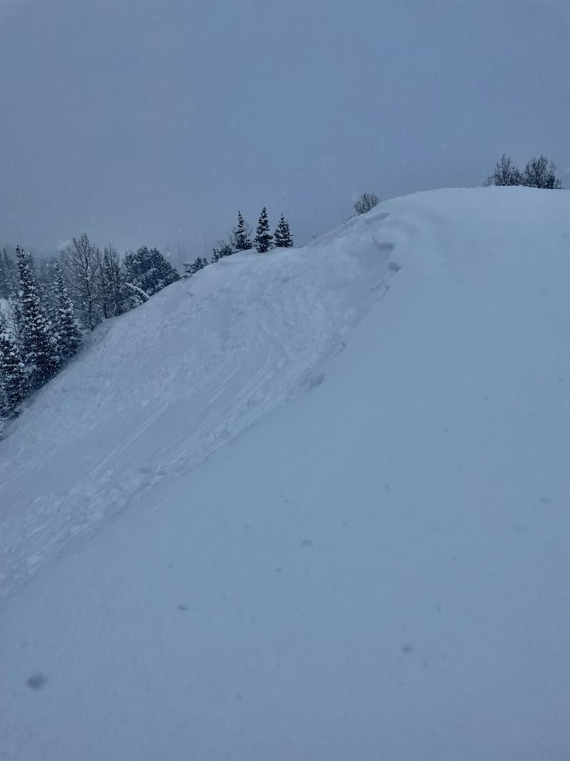
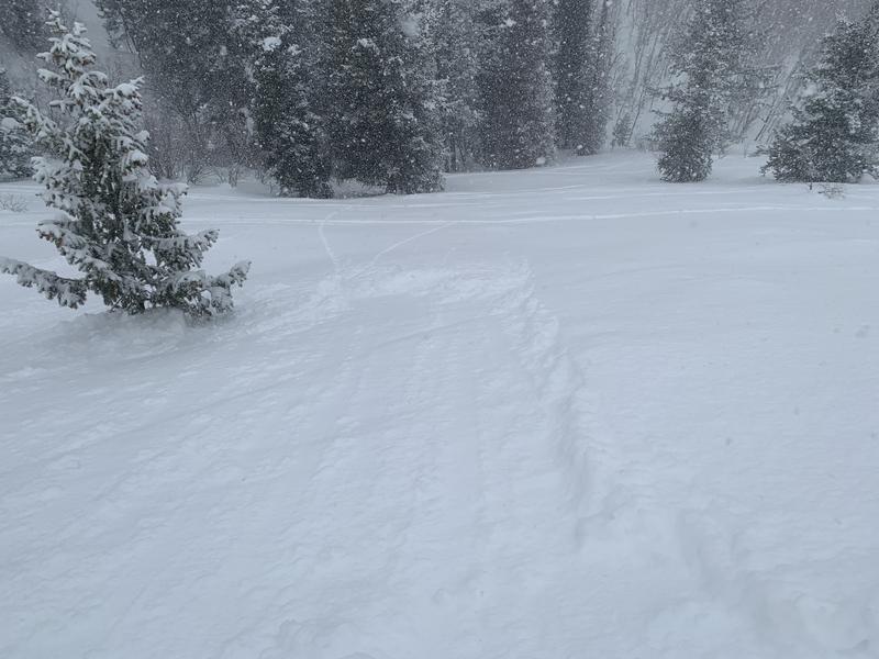
Today there is a CONSIDERABLE avalanche danger on upper-elevation slopes for triggering a wind-drifted snow avalanche. There is a MODERATE danger on mid elevation slopes for new-snow avalanches. There is a LOW danger for new snow avalanches on lower elevation terrain where there has been less snow.

In the highest elevation terrain riders can expect soft and hard slabs of wind-drifted snow 1-2' deep. Out of the wind zone riders can expect to see loose dry avalanches running on density changes within the storm snow.

These are the types of new snow avalanches that will be very sensitive to riders while ascending and descending. Practice good travel technique and only expose one person to a slope at a time while traveling in avalanche terrain.
Low
Moderate
Considerable
High
Extreme
Learn how to read the forecast here
Weather and Snow
Under overcast skies it is currently snowing. Trailhead temperatures are 15-22 F while the highest ridgeline temperatures are in the single digits F. Winds are blowing from the west northwest 10 gusting to 20 MPH at the 9000' ridgelines and 40 gusting to 60 MPH at the 11,000' ridgelines. Today, winds will blow from the northwest 20 gusting to 25 MPH at the 9000' ridgelines and 45 gusting to 60 MPH at the 11,000' ridgelines. Winds will shift to the north and decrease throughout the day. Snow will continue through the afternoon with 5-8" of snow expected.

Overnight and Storm Totals (total height of snow)
  • Big and Little Cottonwood Canyons 8-13" snow/ .35-.65" water storm totals with 2-4" snow overnight (total depth 60-145")
  • Park City Ridgelines 4-8"snow/ .3-.45" water storm totals with 2-3" snow overnight (total depth 70-100")
  • Ogden Area Mountains 4-8" snow/ .3-.9" water storm totals with 2-3" snow overnight (total depth 90-120")
  • Provo Area Mountains 5" snow/ .3-.5" water storm totals with 1-2" snow overnight (total depth 100-110")

The National Weather Service has issued a Winter Weather Advisory effective until 5:00 pm Monday.
Recent Avalanches
Two skiers were caught while ascending in the Ogden area mountains near Willard Peak. While this avalanche is not in the Central Wasatch area mountains it is similar to conditions you might find in wind-loaded areas. There was one report of collapsing on southeast facing USA Bowl at 9700'. This southeast aspect is an area where we had a run of avalanches running on a persistent weak layer above a crust last week. While we haven't seen any activity on this layer in the last few days there are still places where you may trigger an avalanche on this persistent weak layer on a southeast facing aspect. Dig down and determine if there is a crust present with weak grains of faceted snow. If you get propagation results with an extended column test then I would avoid traveling on that slope.

See the full list of avalanche activity where you can filter avalanches by region and date.
Ad
Avalanche Problem #1
Wind Drifted Snow
Type
Location
Likelihood
Size
Description
With 12" of new snow in higher elevation terrain I would expect sensitive slabs of soft and hard wind-drifted snow 1-2' deep that will be sensitive to backcountry travelers at higher elevations and in cross-loaded areas and terrain features.
Yesterday in Big and Little Cottonwood Canyons I found sensitive avalanche conditions on east facing slopes that had been and were being loaded by the west winds. These drifts will be deeper today.
Avalanche Problem #2
New Snow
Type
Location
Likelihood
Size
Description
Yesterday there were natural soft slab avalanches running on steep slopes and riders were able to trigger loose-dry avalanches on steep north facing terrain running on a density change within the new snow. I would expect this density change to be the most reactive when it is snowing hard and this new snow storm instability to settle throughout the day. At this point in the season any hint of sun is more than enough to trigger natural loose avalanches on steep slopes, road cuts, or roofs.

These are the types of new snow avalanches that will be very sensitive to riders while ascending and descending. You may trigger a soft slab avalanche on your ascent as you work into higher elevation terrain.
Photo of new snow instabilities on Mt Aire where a weak temperature crust buried under the new snow was noted on northeast aspects (Paradis)
Additional Information
Updated 8:05AM
Ed LaChapelle and Monty Atwater worked in Little Cottonwood Canyon in the 1950's. Atwater put together Ten Contributory Factors for avalanche hazard evaluation in 1954. Check out his typewritten notes on direct action slab avalanches that are still relevant to today's avalanche problems HERE.
General Announcements
This information does not apply to developed ski areas or highways where avalanche control is normally done. This forecast is from the U.S.D.A. Forest Service, which is solely responsible for its content. This forecast describes general avalanche conditions and local variations always occur.