Check out our Holiday Auction - Sign Up for the Utah Snow and Avalanche Workshop (USAW)

Observation: Emma Ridges

Observation Date
2/5/2023
Observer Name
Kelly, Pressman, Basham, McCoy-Sulentic
Region
Salt Lake » Little Cottonwood Canyon » Emma Ridges
Location Name or Route
Culps-Silver Fork
Weather
Sky
Obscured
Precipitation
Moderate Snowfall
Wind Direction
West
Wind Speed
Moderate
Weather Comments
2" an hour snowfall rate for the start of the tour. Approximately 7-8" new snow by the time we exited the Emma's at 400PM. Winds were moderate from the west with light snow transport at the ridgetop.
Snow Characteristics
New Snow Depth
7"
New Snow Density
Low
Snow Surface Conditions
Powder
Melt-Freeze Crust
Snow Characteristics Comments
Old snow surface on south facing slopes was firm and solidly refrozen.
Red Flags
Red Flags
Heavy Snowfall
Red Flags Comments
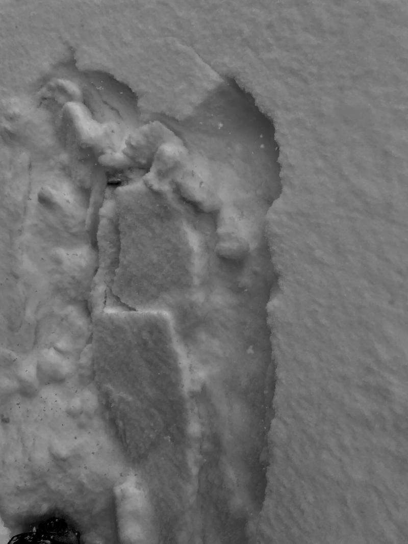
Heavy snowfall-lower density snow fell in the first 1-2" and this was the layer that the new snow avalanches were sliding on. Areas over 37-38 degrees had avalanched naturally while terrain around 35 degrees avalanched with ski cuts. We noted no avalanche activity breaking down below the new snow. North facing slopes had loose dry sloughing isolated to steep terrain.
Avalanche Problem #1
Problem
New Snow
Trend
Same
Avalanche Problem #2
Problem
Wind Drifted Snow
Trend
Same
Problem #2 Comments
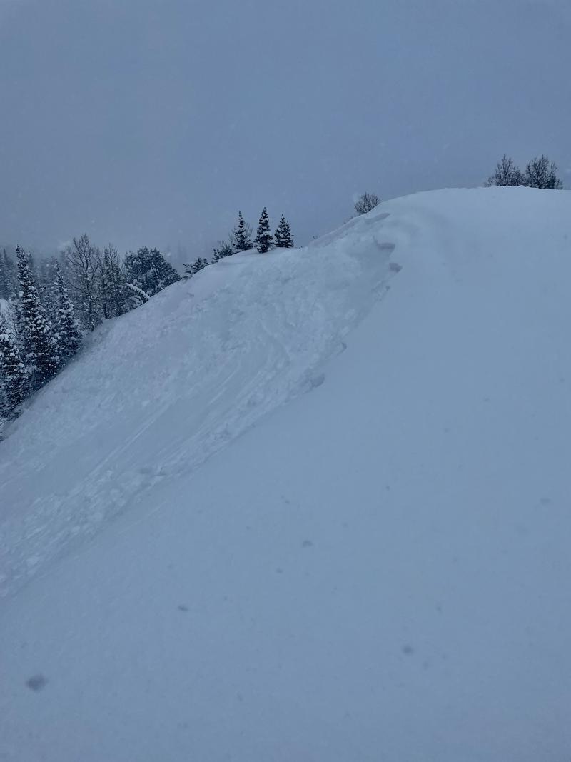
New snow that had bit of wind was propagating further with ski cuts than areas without wind-affected snow.
Snow Profile
Aspect
South
Elevation
9,400'
Slope Angle
27°
Comments
Extended column test results with non-planar propagation above the ice lens.
Photo 1- Density inversion within the new snow
Photo 2- Skier triggered new snow/wind-drifted soft slab avalanche on east facing slope 9400' 4-6" deep, 60' wide
Today's Observed Danger Rating
Moderate
Tomorrows Estimated Danger Rating
Moderate
Coordinates