Forecast for the Salt Lake Area Mountains

Drew Hardesty
Issued by Drew Hardesty on
Thursday morning, February 5, 2026

The avalanche danger remains LOW. With skyrocketing temperatures today, you may trigger shallow wet loose sluffs in steep sunny terrain. On the colder side of the compass, you may trigger longer running loose dry sugar-sluffs that are increasingly packing a punch. Remember that risk is inherent in mountain travel.

Note that the grey on low elevation solar aspects indicates that there is little to no snow in this terrain.

Low
Moderate
Considerable
High
Extreme
Learn how to read the forecast here
Special Announcements

Greatest Rain on Earth?!?: Forecaster Drew Hardesty riddled us a new blog about high-elevation rain and the warm-snow drought HERE.

Weak Snow: Today's Surface, Tomorrow's Avalanche Problem: Essay by UAC Director Paige Pagnucco HERE.

Weather and Snow

Skies are clear.

Winds are light from the northeast. Mountain temperatures hover at or just above freezing.

For today, we'll have mostly sunny skies, light winds from the northeast, and soaring/scalding temperatures to 40°F up high and the low to mid-50s down low.

The ridge of high pressure starts to shift to the east late weekend, signalling a much-desired pattern change. A cold front is slated to sweep through late Monday, but that's as far out on the weather limb that I'll go.

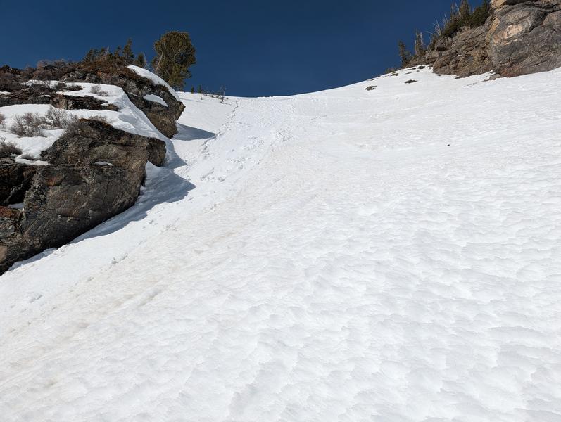
Skiing and riding conditions remain fair with soft recrystallized snow in the wind and sun-sheltered terrain and something akin to corn on the solar aspects. While coverage sits at 50-70" of snow up high, low elevation trailheads and solar aspects are grim. The silver lining of the holiday crusts is that at least we're not stepping off our skis or ride and plunging to the ground in unsupportable facets. So we have that going for us. Which is nice.

Sean Zimmerman-Wall finding a backcountry that looks like a ski area, upper BCC

Recent Avalanches

A skier in steep solar terrain in Mary Ellen (American Fork) triggered a shallow wet loose sluff yesterday. While it was not a large avalanche, it would have been enough to knock you over and cause trouble in unforgiving terrain.

Despite the lack of interesting weather, we continue to receive thoughtful and interesting observations.

Avalanche Problem #1
Normal Caution
Type
Location
Likelihood
Size
Description

The snowpack is generally stable, however that never means completely stable. The main consideration for your mountain travels today will be:

  • Loose dry avalanches of weak snow, or facet-lanches, on shady slopes. These will likely not be large enough to fully bury a person, however they can run fast, far, and gain enough speed and mass as they gouge into the snowpack to certainly knock you off balance. Being above cliffs, rocks, trees, and other people should have you considering the consequences of one of these before entering terrain.

There remains the possibility for:

  • Isolated pockets of wind-drifted snow near ridgelines. These have largely proved unreactive, but recent transport is liable to have developed some new small pockets, potentially atop weak snow.
  • Small, point-releases of wet snow
General Announcements

This information does not apply to developed ski areas or highways where avalanche control is normally done. This forecast is from the U.S.D.A. Forest Service, which is solely responsible for its content. This forecast describes general avalanche conditions and local variations always occur.