Forecast for the Salt Lake Area Mountains

Brooke Maushund
Issued by Brooke Maushund on
Wednesday morning, February 4, 2026

The snowpack is generally stable and the avalanche danger LOW. Expect dry loose sluffing of weak snow on sheltered, shady slopes that can gain speed and mass quickly. Be aware of the consequences of a fall above cliffs, rocks, and trees—and mindful of who is below you. Keep an eye out for isolated pockets of wind-drifted snow near ridgelines.

Low
Moderate
Considerable
High
Extreme
Learn how to read the forecast here
Special Announcements

Attention PC Ridgeline Backcountry Tourers: Canyons Snow Safety will be firing their avalauncher near Murdock Peak today and conducting avalanche mitigation.

Greatest Rain on Earth: Forecaster Drew Hardesty riddled us a new blog about cake, high-elevation rain, and Evelyn Lees HERE.

Weak Snow: Today's Surface, Tomorrow's Avalanche Problem: New essay by UAC Director Paige Pagnucco HERE.

Weather and Snow

The past several days were mostly sunny with intermittent periods of high clouds. Larry Dunn's "ferocious ridge" continued, with light to moderate winds from the west and the north, with mountain highs in the low to mid 30s F.

Today skies will become mostly sunny by late morning, with mountain temps rising into the mid to high 30s F. Expect light to moderate winds from the W/NW, with gusts into the teens mph.

Days like today can feel a bit like we're waking up in another day of Bill Murray's same nightmare. While it might be to some, skiing isn’t just about powder. Go make some memories, have a laugh, learn the mountains from a new drainage, and build some character on a good ole-fashioned bushwhack while you’re at it.

Recent Avalanches

We are hearing of more long-running sluffs in the weak snow at the surface (aka "facet-lanches"), including a skier being caught and carried in steep terrain in Barietto in Mineral Fork on Saturday. Thanks to the reporting party for their honest assessment of this avalanche occurrence which highlights the importance of making sure no one is below you before dropping into a steeper slope.

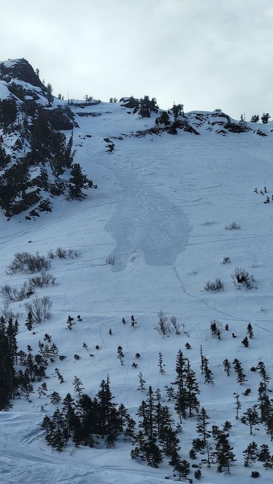
Sluffing in steep terrain on Barietto [photo: Joe]

Despite the lack of interesting weather, we continue to receive thoughtful and interesting observations.

Avalanche Problem #1
Normal Caution
Type
Location
Likelihood
Size
Description

The snowpack is generally stable, however that never means completely stable. The main consideration for your mountain travels today will be:

  • Loose dry avalanches of weak snow, or facet-lanches, on shady slopes. These will likely not be large enough to fully bury a person, however they can run fast, far, and gain enough speed and mass as they gouge into the snowpack to certainly knock you off balance. Being above cliffs, rocks, trees, and other people should have you considering the consequences of one of these before entering terrain.

There remains the possibility for:

  • Isolated pockets of wind-drifted snow near ridgelines. These have largely proved unreactive, but recent transport is liable to have developed some new small pockets, potentially atop weak snow.
  • Small, point-releases of wet snow if temperatures rise higher than forecast.
General Announcements

This information does not apply to developed ski areas or highways where avalanche control is normally done. This forecast is from the U.S.D.A. Forest Service, which is solely responsible for its content. This forecast describes general avalanche conditions and local variations always occur.