Forecast for the Salt Lake Area Mountains

Nikki Champion
Issued by Nikki Champion for
Monday, February 15, 2021
DANGEROUS AVALANCHE CONDITIONS WILL EXIST FOR THE NEXT SEVERAL DAYS.
Heavy snowfall and increasing winds have overloaded our weak faceted snow and created a HIGH avalanche danger. The danger may rise to EXTREME in some areas in the next day or two. Pay attention to changing weather - avalanche danger will increase as this storm intensifies.
Natural and human triggered avalanches are very likely. Even unusual avalanches are possible in atypical terrain on atypical aspects and elevations.

What to do? The only viable strategy today is to ride slopes less than 30 degrees in slope steepness, well out from under and not connected to slopes steeper than about 30 degrees.
Low
Moderate
Considerable
High
Extreme
Learn how to read the forecast here
Avalanche Warning
WARNING ISSUED
THE AVALANCHE DANGER FOR THE WARNING AREA IS HIGH
IN EFFECT FROM 6 AM MST THIS MORNING TO 6 PM MST TUESDAY
FOR THE MOUNTAINS OF MUCH OF THE STATE OF UTAH, INCLUDING THE WASATCH RANGE...BEAR RIVER RANGE...UINTA MOUNTAINS...MANTI-SKYLINE...THE FISH LAKE REGION…PAHVANTS…TUSHARS…AND THE CEDAR CITY AREA MOUNTAINS.
VERY DANGEROUS AVALANCHE CONDITIONS EXIST. NATURAL AND HUMAN TRIGGERED AVALANCHES ARE LIKELY OVER THE NEXT SEVERAL DAYS. STAY OFF OF AND OUT FROM UNDER SLOPES STEEPER THAN 30 DEGREES.
Special Announcements
The final report about the Wilson Glade avalanche in Millcreek Canyon has been published. Our deepest condolences go out to the friends and families involved in this tragic accident.
NOTE: FEB 1-8th was one of the deadlier weeks on record with 15 backcountry fatalities in the US.
Yesterday, two more avalanche fatalities occurred in Colorado. You can read more on each accident HERE.
Dangerous avalanche conditions still exist.
Weather and Snow
This morning, it is lightly snowing. Mountain temperatures are in the single digits to low teens F. After increasing overnight, the westerly winds have decreased again briefly, averaging below 15 mph and gusting up to 35 mph at the highest elevations.
Today, snow will be developing this morning and increasing into the afternoon. Temperatures will be in the low 20s F and southwesterly winds should continue to increase throughout the day averaging 20-30 mph and gusting up to 60 mph at the highest elevations. The cottonwoods could pick up another 5-9" of snow by this evening, and another 8-14" of snow overnight as the flow transitions to northwesterly.
For this storm, the period of maximized orographics within northwesterly flow is expected during the day Tuesday into the overnight hours. We could 2-3'+ of snow by Wednesday morning.

Storm totals since Thursday night are now up to 26-32" with snow water equivalents pushing 2.50" in the Cottonwoods. Snow totals are16-20" along the PC ridgeline.
Recent Avalanches
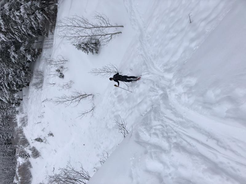
Yesterday, the skies finally cleared and we got reports of multiple natural triggered avalanches in the backcountry. While the time is unknown for most of these, it is assumed many occurred Saturday evening into Sunday morning. While many of the reported avalanches only failed within the new snow interface. A few avalanches broke down into the weak faceted snow near the ground.
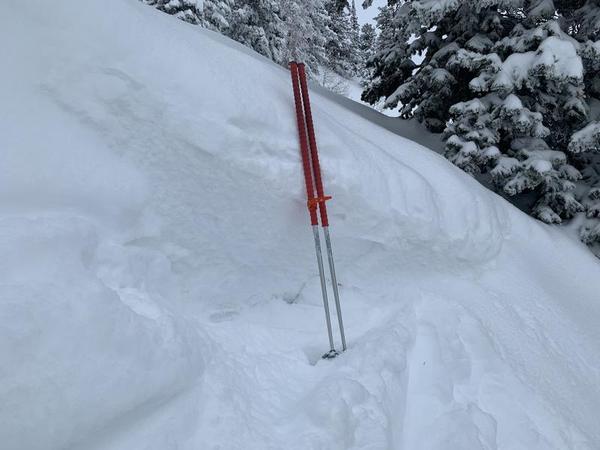
One impressive avalanche reported was in West Porter Fork. This massive avalanche broke 3' deep, over 3000' wide, and ran over 1500' vertical. This hard slab avalanche failed within the faceted snow near the ground and broke trees up to 12" in diameter. Read the full observation HERE.
Photos of the crown and some of the debris (A. Bellomy)

Our Week in Review - where we highlight significant avalanche and snow events for the past week - is published.
Ad
Avalanche Problem #1
Persistent Weak Layer
Type
Location
Likelihood
Size
Description
You can still trigger deep and destructive avalanches 3-5'+ deep and hundreds of feet wide.
The most suspect terrain continues to be the west through north through southeast facing aspects at mid and upper elevations. HOWEVER, with the recent snowfall, the expected snowfall, and the increasing winds - I am worried that some upper elevation south-facing terrain and low elevation north-facing terrain will become active. I am not sure about timing, it could happen today, tomorrow, or even Wednesday - but the dangerous set up is there.

These types of avalanches are most pronounced in steep, thin rocky terrain...and areas that have previously avalanched this winter. They may be more prevalent along the Park City Ridgeline, Upper Mill Creek, Upper American Fork, and the Snake Creek drainages.
Keep in mind:
  • Existing tracks on the slope offer zero signs of stability.
  • Avalanches can be triggered from a distance or below.
  • Any fresh wind slab or new snow avalanche may step down several feet into older snow.
Avalanche Problem #2
New Snow
Type
Location
Likelihood
Size
Description
New snow avalanches are still possible on all aspects and elevations. While the likelihood of triggering an avalanche within the new snow has decreased this morning, the incoming new snow and high winds will increase the likelihood, size and activity once again.
Today, the sensitivity of the new snow largely depends on the rate of snowfall. During higher rates of snowfall (greater than 1 inch per hour) avalanches will be easier to trigger. Periods of snowfall exceeding 1 inch per hour are possible during this storm especially this afternoon into Tuesday. Pay attention to changing weather and increased snowfall rates.
Extreme caution is required.

WINDS: The increased westerly winds today may begin creating fresh wind drifts at the mid and upper elevations, primarily on aspects facing East, but cross-loading is possible on any aspect. Look for obvious signs of wind-drifted snow, and avoid those slopes.
Additionally, these elevated winds will increase the size of our cornices adorning many ridgelines, making them possibly even more sensitive. Stay well back from - and avoid travel below - corniced ridges.
General Announcements
Please visit this website with information about Responsible Winter Recreation by the Utah Office of Outdoor Recreation.

This information does not apply to developed ski areas or highways where avalanche control is normally done. This forecast is from the U.S.D.A. Forest Service, which is solely responsible for its content. This forecast describes general avalanche conditions and local variations always occur.