Join us at our 2nd Annual Blizzard Ball

Forecast for the Salt Lake Area Mountains

Nikki Champion
Issued by Nikki Champion on
Tuesday morning, November 10, 2020
The avalanche danger will be more pronounced in the upper reaches of the Cottonwoods and Provo mountains where they received the most snow. Human triggered avalanches may be possible in localized wind drifted terrain, particularly in the upper elevations. Keep an eye out for sluffing in the steepest terrain.
REMEMBER two things:
1- The old adage - if there's enough snow to ride, there's enough snow to slide.
2- Traumatic injury due to the early season conditions is likely with any - even minor - avalanche incident.
We will be issuing intermittent updates and publishing backcountry observations as they arrive.
You can find these observations HERE.
Low
Moderate
Considerable
High
Extreme
Learn how to read the forecast here
Special Announcements
ALTA SKI AREA CLOSED TO ALL UPHILL TRAVEL FROM 4 PM TO 8 AM DAILY BEGINNING TUESDAY NOV. 10TH . THE ALBION BASIN SUMMER ROAD IS OPEN WITH ACCESS TO THE SUPREME AREA AND CATHERINES PASS BACKCOUNTRY CONDITIONS EXIST.

The 13th annual Utah Snow and Avalanche Workshop open session will be held virtually on Nov 10, 11, 12th from 630pm-9pm. We have a great lineup with something for everyone - beginners to experts.
Get more details on each session, and sign up HERE.

Covid and the Backcountry - Even in the backcountry and in parking lots, please follow CDC guidelines like limiting group size and keeping a distance of at least 6 feet from other people to protect yourself and others. More info HERE.
Taking risks - Be extra conservative to avoid the risk of accidents which can stress the capacity of our medical system.
Weather and Snow
This morning, it is overcast and lightly snowing. Mountain temperatures are in the low teens F at trailheads and single digits at upper elevations. Winds have bumped up a little bit, currently westerly and gusting up to 20 mph at mid-elevations and near 50 mph at the uppermost elevation. Since yesterday we have picked up a bit more snow.
Updated storm totals below.
Upper Little Cottonwood Canyon: 26-32" (2-2.5" Snow Water Equivalent SWE)
Upper Big Cottonwood Canyon: 12-20" (1-1.25" SWE) with about 12" in the mid-canyon Spruces lot at 7400'.
Park City Ridgeline: 12-14" (1-1.14" SWE)
Ogden area mountains: 10-18" (1.5"-2.00" SWE)
Provo area mountains: 15-19" (1.6-2.09" SWE)
Today, expect light snowfall as warm advection pushes ahead of the next approaching storm. Overall totals will be relatively low, between 3-6" by Thursday afternoon. Mountain temperatures will be in the mid-teens F, and winds will continue to be Westerly averaging 10-20 mph at mid-elevations, with gusts below 25 mph. At the upper elevations, winds will average 25-35 mph and gust up to 45 mph.

The weather pattern looks fairly active for the next couple of weeks with a weak storm mid-week and something perhaps more interesting over the weekend.
Recent Avalanches
Yesterday, there were a few reports of shallow soft slabs in the new snow at upper elevations.
Below is a photo of a shallow soft slab of new snow on a North Aspect at 10,400' on Fantasy Ridge.
(Photo: B. Nalli)
Ad
Avalanche Problem #1
Wind Drifted Snow
Type
Location
Likelihood
Size
Description
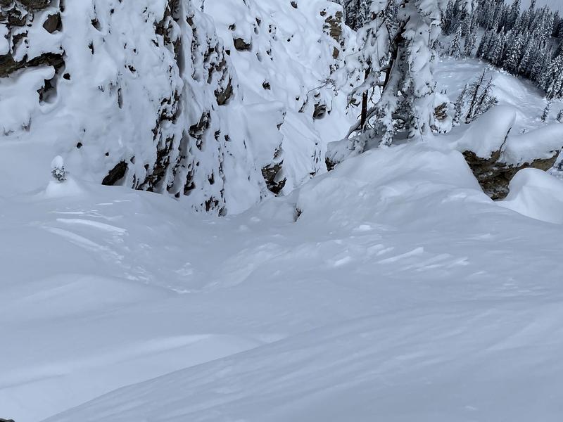
The westerly winds have bumped up at the upper elevations and there is new light snow for them to move around. Shallow drifts of windblown snow could be found today. These shallow drifts will be most pronounced above 9500' just off the ridgelines and on steep slopes that face north and east, but with elevated winds, cross-loading is possible on any aspect.
Look for obvious signs of wind-drifted snow, such as pillow-shaped slopes, cracking and whumpfing, and avoid those slopes today.
Avalanche Problem #2
New Snow
Type
Location
Likelihood
Size
Description
With the increasing snow totals, sluffing can still be expected in the most recent 5-6% low-density snow in the steepest terrain approaching 40° and steeper.
Additional Information
There are a few things to remember:
  1. Hitting rocks and stumps is a real danger. Don't end your season before it starts with an injury from hitting one of these obstacles.
  2. Early season avalanches are a real possibility. It doesn't matter if you are hiking, hunting, skiing, etc., be prepared with rescue gear and a partner. Many people have died during early season snowstorms. Listen to our UAC podcast episode The Day of Madness in Little Cottonwood Canyon about a bad day in November 2011 when many avalanches were triggered resulting in a tragic fatality.
  3. Ski resorts all have different uphill travel policies. These closed resorts that allow uphill travel can be great places to get in a little skiing especially in you know of a rock-free slope, but it should be treated as backcountry terrain. We will soon have an up to date resource on all the ski resorts individual policies.
Until more snow begins to fall, there are plenty of resources available to begin thinking about the season today:
  1. Check out the free online avalanche course material and e-learning materials available.
  2. Start looking at weather patterns in areas you plan to ski this upcoming winter. A full list of mountain weather stations can be found HERE.
  3. Freshen up on how to read the forecast page.
  4. Look over all of your gear and make sure everything is in good, working order.
  5. Sign up for an avalanche class! Get it on the schedule early.
Bonus Material! Listen to our podcast on Early Season Essentials with Bo Torrey
General Announcements
This information does not apply to developed ski areas or highways where avalanche control is normally done. This forecast is from the U.S.D.A. Forest Service, which is solely responsible for its content. This forecast describes general avalanche conditions and local variations always occur.