Forecast for the Salt Lake Area Mountains

Mark Staples
Issued by Mark Staples for
Wednesday, January 30, 2019
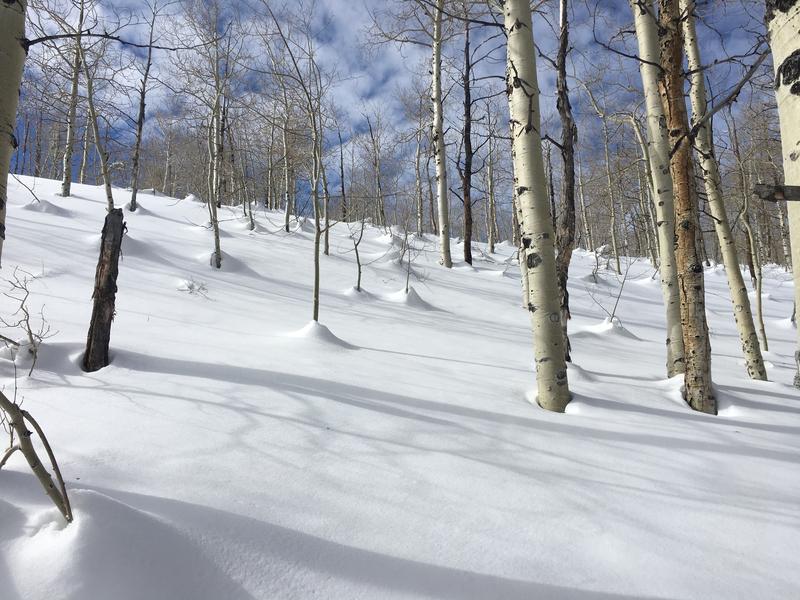
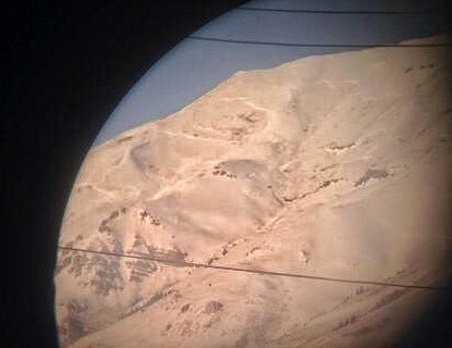
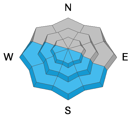
The avalanche danger is LOW on all aspects and elevations. There could be a few slabs of wind drifted snow or some small loose wet avalanches to watch for especially in extreme terrain where even a small avalanche can have severe consequences. There is the smallest chance of a deeper avalanche breaking on a persistent weak layer 3-5 feet deep; however, this problem is much more of an issue in other forecast zones.
Low
Moderate
Considerable
High
Extreme
Learn how to read the forecast here
Special Announcements
The report from Friday's avalanche accident is finished and can be found HERE. Our deepest condolences go out to the family and friends that are effected by this accident.
Weather and Snow
This morning under mostly clear skies, mountain temperatures are in the mid teens to upper teens F. A few trail heads have temperatures in the single digits F. Light winds are only blowing 10-15 mph from the west at 11,000 feet with a few higher gusts. Lower ridgelines have winds blowing 5-10 mph.
Today high temperatures should climb into the mid 30's F but it will feel a warmer than that in the strong sunshine. Winds should increase by about five mph.
Big picture - The ridge of high pressure is starting to flatten and move east. Snow should arrive Saturday morning and last into early next week. Fingers crossed.
Recent northerly winds damaged the powder on some slopes and southerly facing slopes have a crust. However, soft settled powder can still be found on many slopes. Easterly facing slopes may have the best snow.
Settlement cones around trees at 8500 feet in Snake Creek in the photo below show how much last week's snow has settled since then. It doesn't mean to much avalanche-wise but is pretty to look at.
Recent Avalanches
No new avalanches were reported from the backcountry in the central Wasatch. However, there have been some large, deep, slab avalanches breaking on a persistent weak layer of facets in the Uinta Mountains. If you're headed into those mountains check out some of the recent slides in that area HERE. One large avalanche was spotted on the west side of Mt. Timpanogos yesterday (photo below). It is unclear when it happened but seems recent.
Ad
Avalanche Problem #1
Wind Drifted Snow
Type
Location
Likelihood
Size
Description
If I were headed out today, the number one thing I'd be looking for is older wind drifts. The most recent winds that transported snow blew from the north. Most of these slabs of wind drifted snow are stable and bonded to underlying snow. Be especially watchful for old drifts if you're heading into more extreme terrain where the consequences of a very small avalanche can be severe.
Avalanche Problem #2
Persistent Weak Layer
Type
Location
Likelihood
Size
Description
The odds of triggering an avalanche on faceted layers buried 3-5 feet deep in the snowpack are very small. In many places in the central Wasatch mountains, I wouldn't worry about this problem too much especially in the upper Cottonwoods or places with a very deep snowpack. Last weekend in upper Cardiff, I found snow over 9 feet deep. Yesterday at a low elevations (7,900 ft) in Snake Creek, I found over 5 feet of strong stable snow. There was evidence of some weak, faceted layers, but they have gained a lot of strength and were of no concern to me.
This problem is a greater issue in the Provo area mountains (check out this recent avalanche). It is certainly an issue in the Uintas and the Skyline. In the central Wasatch, I think you'd have to get very unlucky to find a slope where this remains an issue. There were several deep avalanches that occurred about a week ago. See a summary in the last "Week in Review".
Looking ahead - warm sunny days and clear cold nights are a good recipe for creating facets near the snow surface which may become a new persistent weak layer. We'll be watching the snow surface this week and watching what this weekend's snow falls on. If the powder this week seems to "dry out" or get better, that's a good sign that the faceting process is occurring. Stay tuned.
Avalanche Problem #3
Wet Snow
Type
Location
Likelihood
Size
Description
With more strong sunshine, some loose wet snow avalanches are possible. The surface snow on many slopes has been through several melt-freeze cycles which should limit wet avalanche activity. However, it's worth being mindful of this wet snow avalanche potential if you're traveling on south or west aspects.
General Announcements
This information does not apply to developed ski areas or highways where avalanche control is normally done. This forecast is from the U.S.D.A. Forest Service, which is solely responsible for its content. This forecast describes general avalanche conditions and local variations always occur.