Forecast for the Salt Lake Area Mountains

Drew Hardesty
Issued by Drew Hardesty for
Saturday, January 26, 2019
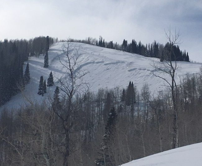
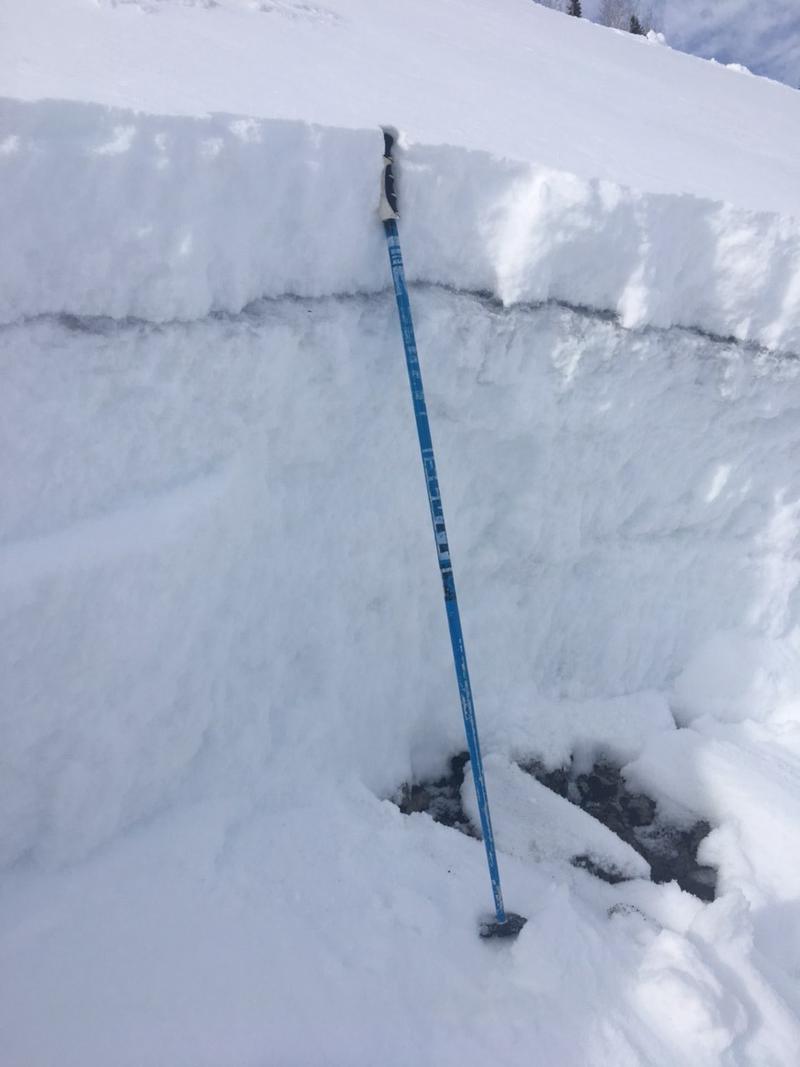
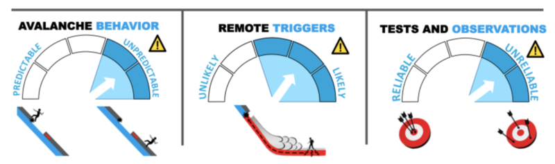
A scary MODERATE danger exists for large destructive avalanches several feet deep. Thinner snowpack areas and areas along the periphery of the Cottonwoods are most suspect. Cracking and collapsing are unlikely to be present. The danger will also reach at least MODERATE and perhaps CONSIDERABLE this weekend for wet avalanche activity on the steep sun-kissed slopes.

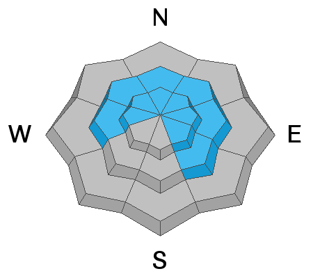
Hot Tip! Wind and sun-sheltered low angle terrain is 4 stars. Low Risk High Reward.
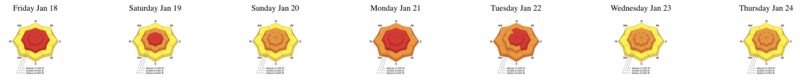
Low
Moderate
Considerable
High
Extreme
Learn how to read the forecast here
Special Announcements
Yesterday a snowmobiler was buried by an avalanche in the La Sal Mountains of southeastern Utah. Members of his party were unable to locate him. Search and rescue personnel will continue the search this morning. We will provide more information as it becomes available.

Snowbird will be firing upon the Gad Valley White Pine ridge on Jan 26th from 7:30am until 930. Please stay well clear of the ridgeline.
Weather and Snow
The latest Week in Review INFO.

Skies are partly cloudy. West-northwest winds are 10-15mph with gusts to 25. The highest anemometers spin 30mph with gusts to 45. Temps are in the mid-teens.
Total snow depths are 90-100" in the Cottonwoods and 50-60" along the Park City ridgeline. It's been a good run. Various sun, rime, and wind crusts abound but the best conditions are found in the mid-elevation sun and wind sheltered terrain. For today, expect fair weather, light to moderate northwesterly winds, and ridgetop temps rising to the mid-20s. The weather looks uninteresting until the turn of the month.
Recent Avalanches
Avalanche control teams continue to trigger large dangerous avalanches to (near) the ground. PCMR snow safety triggered a large avalanche in Homelight with just a single hand charge surface shot yesterday, prodding out a 3-5' deep and 500' wide deep slab on this east facing run at 9000'. Photo courtesy of PCMR snow safety. In the backcountry, we only heard about a couple shallow wind drifts triggered in the high alpine terrain of Superior (video below).
Ad
Avalanche Problem #1
Wind Drifted Snow
Type
Location
Likelihood
Size
Description
Shallow and pockety wind drifts will continue be found in the higher elevations today and in the open bowls and exposed terrain. Video from yesterday on Superior.
Avalanche Problem #2
Persistent Weak Layer
Type
Location
Likelihood
Size
Description
We are trending toward a deep, conditionally stable snowpack, but the glue needs to set. It's not there yet, but it's getting there.
The past week's storms that brought 4 - 6” of snow-water-equivalent and wind have stressed many of the older dormant weak layers from October and November. In the recent days, avalanche control teams have triggered some very large avalanches at or near the ground. These monsters have all been in mid to upper elevation north to east facing terrain. None of these have been skier or snowmobile triggered, but a person finding a thin spot or triggering a more superficial avalanche may be enough to trip the trigger. Trending toward low-probability and high-consequence. Certainly any entanglement with one of these deep slab avalanches would be fatal. The mid-Dec and early Jan weak layers are also stressed from the week's loading events and may be more reactive outside of the Cottonwoods (Snake Creek, upper American Fork, Grandview/Bountiful Sessions). These avalanches may be found as well on mid-elevation southeast facing slopes.
Avalanche Problem #3
Wet Snow
Type
Location
Likelihood
Size
Description
Previous crusting of the snow surface will help slow or stem a major wet avalanche cycle, but I expect both natural and human triggered wet avalanches on the steep sunlit slopes today. Watch for the tell-tale signs of thaw-instability such as rollerballs and pinwheels or if the snow becomes wet and unsupportable. If you've overstayed your welcome, move to a cooler aspect or seek low angle terrain. More info on wet avalanches can be found in the Avalanche Encyclopedia here.
Additional Information
Risk management in the backcountry is all about time and place. Take steep sunny aspects, for example. Too early and it might be slide-for-life conditions. Too late and it might be terrifying wet avalanche conditions. Timing is everything. If your sense of timing is off, avoid the steep sunny aspects altogether. Same goes for wind drifts. Tomorrow, the drifts should be mostly stable. For today, avoid the alpine terrain where they exist.
There's an old adage, Of terrain, weather, and snowpack, we can only choose terrain. It's actually not true. It's through our terrain choices that we choose our weather and and snowpack. It's up to us to choose when and where we go.
General Announcements
This information does not apply to developed ski areas or highways where avalanche control is normally done. This forecast is from the U.S.D.A. Forest Service, which is solely responsible for its content. This forecast describes general avalanche conditions and local variations always occur.