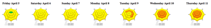
The chance of triggering an avalanche today is generally Low, but there are enough concerns, especially with unpredictable spring weather, that warrant your careful attention today:
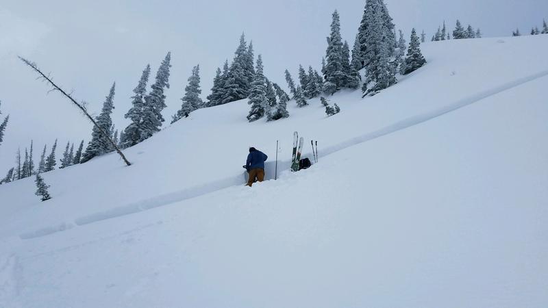
Wind Drifted Snow - Yesterday in the Salt Lake mountains, my partner and I (
observation) were finding isolated pockets of fresh wind drifts that were generally unreactive to ski cuts. You are most likely to find any recent wind drifts along upper elevation ridges, especially on any aspects facing north, through east, and south. These drifts may be up to 6-12" deep.
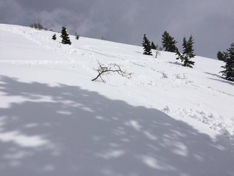
New Snow - The 12-18" of storm snow has settled into a dense, cohesive slab, and it has bonded well to the old snow surface. A density inversion on Wednesday was reactive early in the storm cycle, but indications are it has settled out. yesterday's skier-triggered slide in Mineral Fork in the Salt Lake mountains (photo below pic:Torrey/Hawley) is a reminder this layer may still be reactive in isolated areas. Although any new snow amounts are likely to be small, sluffing in storm snow is possible during any extended period of heavy precipitation.
Wet Snow - Clouds, cool temperatures, and snow showers should prevent wet activity today, but if the sun peeks out for any extended period or you notice greenhousing (where clouds trap warmer temperatures), you can expect the storm snow to quickly become reactive. This includes both wet loose sluffs as well as larger wet slabs. I would be especially aware of this problem on steep sunny aspects as well as all aspects at lower elevations. Watch for rapid changes in the snow surface such as rollerballs, and have an exit plan that allows you to quickly respond to wet snow activity.