Forecast for the Provo Area Mountains

Eric Trenbeath
Issued by Eric Trenbeath for
Tuesday, March 19, 2019
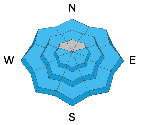
The avalanche danger is MODERATE today, both for wet avalanches, and for avalanches involving a buried persistent weak layer. To avoid wet avalanches, get off of, and out from under steep slopes as they begin to turn wet and sloppy. Avalanches involving a persistent weak layer can still be triggered on steep slopes facing NW-N-SE at mid and upper elevations. This type of avalanche will be deep and dangerous, and careful snow stability analysis is required before venturing into steep terrain with these aspects.
Low
Moderate
Considerable
High
Extreme
Learn how to read the forecast here
Special Announcements
The latest podcast is out! The Wise Ones - A Conversation About Mentorship with Eeva Latosuo and Aleph Johnston-Bloom. LINK
Weather and Snow
Skies are clear, winds are light from the WNW, and upper elevation temps are in the low 20's. Today will be a beautiful, sunny day in the mountains though we’ll see a slight increase in winds with a shift to the ESE by afternoon. 9000’ temps today will climb to near 40 degrees.
Today will be the last day to enjoy the clear skies as a weak but active weather pattern is setting up for the latter part of the week. By tomorrow we’ll see breezy conditions and partly cloudy skies with a chance of snow developing by Thursday, though it looks like most of the energy will be diving south.
Recent Avalanches
After a significant wet avalanche cycle on Saturday in the Provo mountains (link), additional large, wet activity was reported from the Provo mountains again on Sunday. This includes a large slide that ran nearly 3000' vertical, burying Squaw Peak road under 15' of debris. [Photo UDOT Provo] More details from Sunday's wet activity can be found by clicking here.
If you're getting out in the Provo mountains please send us an observation. It helps us be more accurate with forecasting. You can easily fill one out by clicking HERE.
Ad
Avalanche Problem #1
Wet Snow
Type
Location
Likelihood
Size
Description
The snow surface has had another night with a solid refreeze, but natural and human triggered wet avalanches remain possible as snow heats up from the sun. Stay off of, and out from steep slopes as they start to get wet and sloppy. Plan your exits so you're not coming out of steep canyon bottoms during the heat of the day.
Avalanche Problem #2
Persistent Weak Layer
Type
Location
Likelihood
Size
Description
The Provo snowpack remains dangerous on some mid and upper elevation aspects, with a complexity that makes it difficult to identify patterns. Field reports indicate persistent weak layers are still reactive to stability tests, and this is enough for very experienced people to continue to provide a wide buffer of margin in this terrain. These are difficult and dangerous conditions to assess because to get into the upper elevation bowls, one must walk in/underneath many large slide paths. With warming from the sun, avalanching down in these persistent weak layers can produce very large avalanches, breaking several feet deep and hundreds of feet wide, possibly larger.
Additional Information
Thinking about a trip south to the La Sals? It is a much different avalanche situation to our south with significantly more dangerous avalanche conditions. Be sure to check the forecasts for the La Sals (link) as you plan your trip.
General Announcements
This information does not apply to developed ski areas or highways where avalanche control is normally done. This forecast is from the U.S.D.A. Forest Service, which is solely responsible for its content. This forecast describes general avalanche conditions and local variations always occur.