Forecast for the Provo Area Mountains

Drew Hardesty
Issued by Drew Hardesty for
Sunday, February 17, 2019
A CONSIDERABLE DANGER exists on heavily wind loaded slopes at the mid and upper elevations. The danger is most pronounced on upper elevation northerly through easterly facing terrain. Human triggered avalanches 2-5' deep are possible and may be unsurvivable.
Cornices are an issue - Exercise great caution along and underneath the heavily corniced ridgelines.
Safe Travel Protocols are critical: one at a time, get out of the way at the bottom, have a plan.
Low
Moderate
Considerable
High
Extreme
Learn how to read the forecast here
Special Announcements
The accident reports for the four avalanche fatalities are all finalized with some first-hand accounts and worth reading. We all have something to learn so that we can get home safely to our loved ones.
Jan 18 Electric Lake Accident (Skyline area)
Jan 25 Laurel Peak Accident (Moab area)
Feb 7 Circleville Mtn Accident (Southwest area near Beaver, UT)
Feb 9 Chalk Creek Accident (Western Uintas)

The latest UAC Podcast was just released: The Message and the Messengers - A Conversation with Alex Hamlin. In our conversation, we talk about the psychology behind marketing (and influencing behavior change), with a particular eye toward marketing safety. We talk about what storytelling means as a way of establishing connections and meaning - as this was central to his philosophy in producing and directing the exceptional BDTV series from a few years ago.
Weather and Snow
Skies are partly cloudy with temperatures in the teens.
The winds defied expectations yesterday and some might even say overachieved. They blew 15-25mph from the west and northwest with gusts to 50 up high but have largely settled down and are now generally less than 10mph from the southwest.
Snow depths are 90-100" with good coverage at the low elevations.
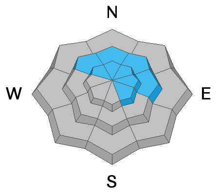
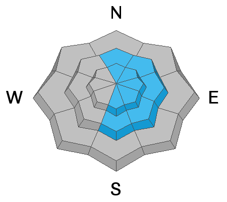
Wind and periods of sun had their way with the snow surfaces and you'll find both excellent and variable conditions in the mountains with the most consistent riding in the sheltered mid-elevations.
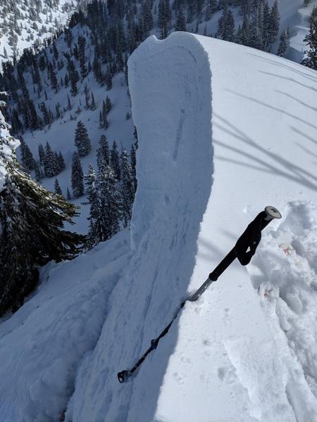
Photo of winds yesterday below (Merrit)

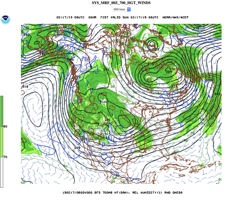
A large trof of low pressure cradles the entire western US. A couple weak systems rippling through will keep us with cold temps, light winds, and occasional light snowfall for the upcoming week.
Recent Avalanches
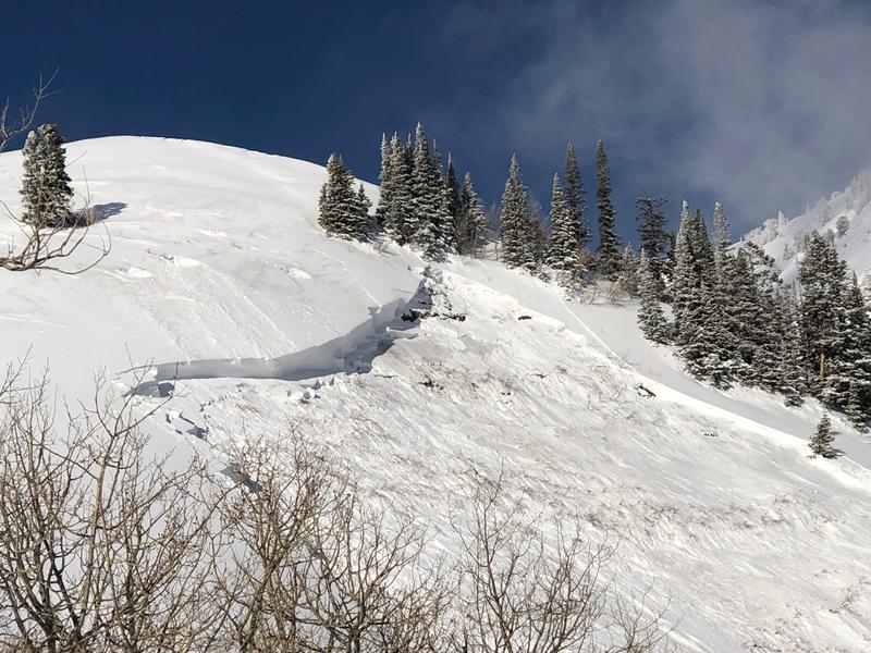
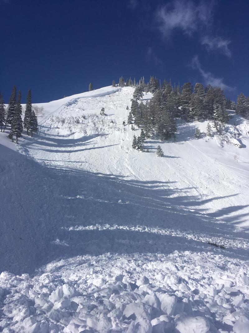
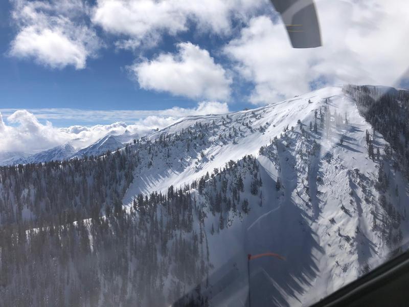
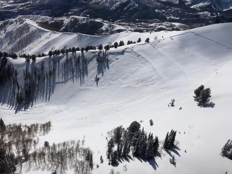
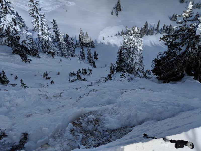
Ski patrol triggered a very large avalanche in terrain above Sundance ski resort yesterday, with explosives pulling out a 6-9' deep and 300' wide hard slab to the ground. Hill's Headwall is a steep, heavily wind loaded east-northeast facing slope at 8450' and is controlled because it threatens the ski resort. PC Sundance ski resort. With direct sun and warming, skiers triggered some shallow wet loose sluffs in the Bob's Knob area. UDOT noted a few shallow natural wind slabs releasing in the high alpine.
Ad
Avalanche Problem #1
Wind Drifted Snow
Type
Location
Likelihood
Size
Description
New and old wind drifts exist on many aspects now at the mid and upper elevations. Some are stubborn and hard; others are shallow and soft. Steep wind drifted terrain should continue to be avoided for another day. The usual bag of tricks for soft wind slabs do not work effectively for hard wind slabs. In other words, cornice drops and ski cuts can be misleading at best and dangerous at worst. I imagine we'll have a couple more human triggered wind drifts to talk about tomorrow. The majority of these drifts are in upper elevation northerly through easterly aspects but others are scattered around the compass in the mid-elevations due to terrain channeling.
Avalanche Problem #2
Persistent Weak Layer
Type
Location
Likelihood
Size
Description
Human triggered large avalanches into much older snow layering 3-6'+ deep are possible in localized areas and particularly dangerous in heavily wind loaded terrain. In general, these avalanches are likely to be triggered by a heavy load such as a cornice fall, new snow avalanches stepping down to older layers, or an explosive. Or being unlucky enough in finding the thinner trigger spot in the slab. Terrain that has avalanched previously (repeater slopes) or other thinner snowpack areas are not to be trusted. Cracking and collapsing rarely play a role here. More significant natural avalanches from likely Thursday or Friday noted in the Mill Canyon area. Powderbird photo below.
Avalanche Problem #3
Cornice
Type
Location
Likelihood
Size
Description
CORNICES ARE ENORMOUS. Most of these are too large to intentionally drop onto a slope below. They will break back farther than you think, well back from the apex of the ridgeline. 5% of our avalanche fatalities in Utah have involved cornice fall. Exercise great caution along and underneath the heavily corniced ridgelines. See pic from yesterday below that shows in great detail what the consequences might be for going over with the box car. (pc: Murray)
General Announcements
This information does not apply to developed ski areas or highways where avalanche control is normally done. This forecast is from the U.S.D.A. Forest Service, which is solely responsible for its content. This forecast describes general avalanche conditions and local variations always occur.