Forecast for the Provo Area Mountains

Trent Meisenheimer
Issued by Trent Meisenheimer for
Monday, February 18, 2019
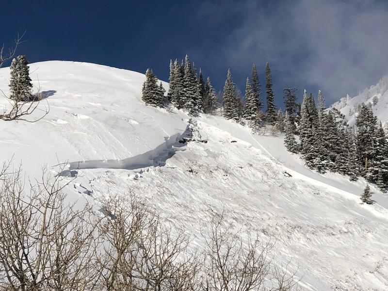
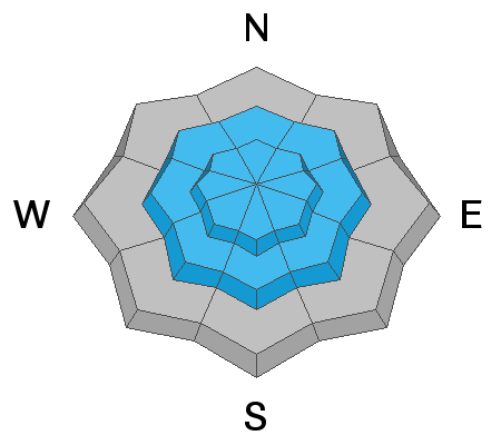
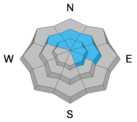
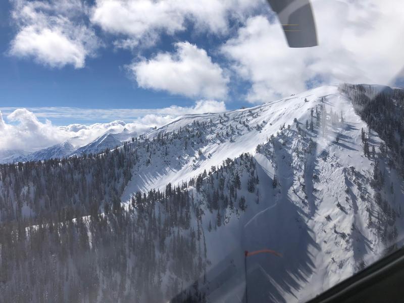
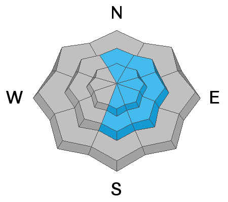
A CONSIDERABLE DANGER exists on heavily wind loaded slopes at the mid and upper elevations. The danger is most pronounced on upper elevation northerly through easterly facing terrain. Human triggered avalanches 2-5' deep are possible and may be unsurvivable.
Cornices are an issue - Exercise great caution along and underneath the heavily corniced ridgelines.
Safe Travel Protocols are critical: Beacon, shovel, probe, one at a time, get out of the way at the bottom, have a plan.
Low
Moderate
Considerable
High
Extreme
Learn how to read the forecast here
Weather and Snow
Currently, there is a center of low pressure down in southern Utah that's spinning counter clockwise creating southeast winds and ushering in clouds to northern Utah. Overnight we picked up a trace to a few more inches of cold smoke as the clouds passing by spit and sputtered a few snowflakes. This morning the winds are from the southeast and are blowing 10-15 gusting into the 20's at upper elevations. Mountain temperatures are in the single digits. The riding and turning conditions are all time with cold dry powder on almost every aspect.
Recent Avalanches
Ski patrol triggered a very large avalanche in terrain above Sundance ski resort on Saturday, with explosives pulling out a 6-9' deep and 300' wide hard slab to the ground. Hill's Headwall is a steep, heavily wind loaded east-northeast facing slope at 8450' and is controlled because it threatens the ski resort. PC Sundance ski resort. With direct sun and warming, skiers triggered some shallow wet loose sluffs in the Bob's Knob area. UDOT noted a few shallow natural wind slabs releasing in the high alpine.
Ad
Avalanche Problem #1
Wind Drifted Snow
Type
Location
Likelihood
Size
Description
Yesterday's human triggered avalanche off Pioneer Peak, shows it's still possible to trigger soft and hard drifts of wind blown snow. Most of the avalanches reported over the past couple of days have been on steep, upper elevation, northerly through easterly facing terrain. I would continue to let the snow settle and heal up for another day or two before committing to large open faces.
Photo: The crown and trigger point from Pioneer Peak. (PC: Shearon)
Avalanche Problem #2
Persistent Weak Layer
Type
Location
Likelihood
Size
Description
Human triggered large avalanches into much older snow layering 3-6' + deep are possible in isolated areas. In general, these avalanches probably need to be triggered by a heavy load such as a cornice fall, or a new snow avalanches stepping down to older layers. Or being unlucky enough in finding the thinner trigger spot in the slab. The recent avalanche from Guardsman Pass area (video below) shows this problem still exists and terrain that has avalanched previously (repeater slopes) or other thinner snowpack areas are not to be trusted.
More significant natural avalanches from likely Thursday or Friday noted in the Mill Canyon area. Powderbird photo below
Avalanche Problem #3
Cornice
Type
Location
Likelihood
Size
Description
CORNICES ARE ENORMOUS. Most of these are too large to intentionally drop onto a slope below. They will break back farther than you think, well back from the apex of the ridgeline. Exercise great caution along and underneath the heavily corniced ridgelines. (PC: Grainger)
Additional Information
The accident reports for the four avalanche fatalities are all finalized with some first-hand accounts and worth reading. We all have something to learn so that we can get home safely to our loved ones. List of all accidents found HERE.
General Announcements
This information does not apply to developed ski areas or highways where avalanche control is normally done. This forecast is from the U.S.D.A. Forest Service, which is solely responsible for its content. This forecast describes general avalanche conditions and local variations always occur.