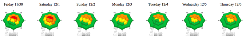
Forecast for the Provo Area Mountains

Evelyn Lees
Issued by Evelyn Lees for
Friday, December 7, 2018
The avalanche danger is CONSIDERABLE on upper elevation slopes facing northwest through easterly, where a slide could break 2 to 4 feet deep, failing near the ground on weak, sugary facets. At the mid elevations of similar aspect and upper elevation slopes facing west and southeast, the avalanche danger is MODERATE - while the likelihood of triggering a slide is less, the size would be the same, still breaking near the ground.
Low
Moderate
Considerable
High
Extreme
Learn how to read the forecast here
Weather and Snow
Under clear skies, temperatures in the Provo area mountains are in the low to mid 20s this morning. The southwesterly winds are very light, and should remain in the 5 to 15 mph range for at least another 24 hours. Temperatures will warm to near 30 today, and skies may become partly cloudy, especially in the Provo area mountains. High pressure will continue into early next week, and the next chance for a real shot of snow is not until Wednesday night.
Snow depths in the Provo area mountains are about 1 1/2 to 2 feet at the trail heads to 2 to 2 1/2 feet at the mid elevations around 8,000' to 9,000'. Hitting rocks and logs remains likely with the shallow, early season snowpack.
The sun crusted the southerly facing slopes, but there will still be settled powder on the shady slopes, and some wind damage, confined to the ridge lines.
Recent Avalanches
We have no new observations from the Provo area mountains. To the north: There were continued reports of collapsing yesterday, but no backcountry avalanches reported. A few wind drifts released with explosives in the Cottonwoods. Still, it’s only been 2 days ago that there was a skier and an explosive slide breaking to the ground, so I’d still call that avalanche activity “recent”.
Check out the Weekly Review, if you are heading to the Salt Lake area mountains, highlighting an active early week of snow and avalanches.
Ad
Avalanche Problem #1
Persistent Weak Layer
Type
Location
Likelihood
Size
Description
The faceted snow near the ground is still weak, and the slopes to avoid remain the same: those facing northwest though east at upper and mid elevations, and upper elevation west and southeasterly facing slopes. A look at the past week's danger roses illustrates how "persistent" this avalanche problem is.
Getting dialed on determining aspect is key right now. Use a compass, map or an ap on your phone, and check the direction a slope faces often. Greg explains the importance of aspect in the video below. Also, dig quick snow pits on low angle slopes. If you find weak sugary snow at the ground, stay off similar facing steep slopes.
Avalanche Problem #2
Normal Caution
Type
Location
Likelihood
Size
Description
Terrain without old faceted snow near the ground has a mostly low avalanche danger, but small avalanches could be triggered in isolated places – perhaps a wind drift along a high ridgeline or a sluff on a very steep, northerly facing slope. Terrain that’s super steep or above cliffs, trees or gullies has higher consequences, even if you are caught in a small slide.
General Announcements
This information does not apply to developed ski areas or highways where avalanche control is normally done. This forecast is from the U.S.D.A. Forest Service, which is solely responsible for its content. This forecast describes general avalanche conditions and local variations always occur.