Donate to the 2024 Spring Campaign to help rebuild the UAC website.

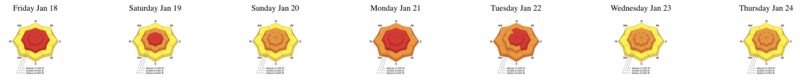
Forecast for the Provo Area Mountains

Drew Hardesty
Issued by Drew Hardesty for
Friday, January 25, 2019
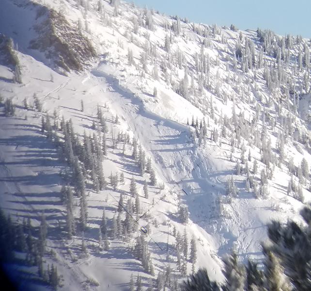
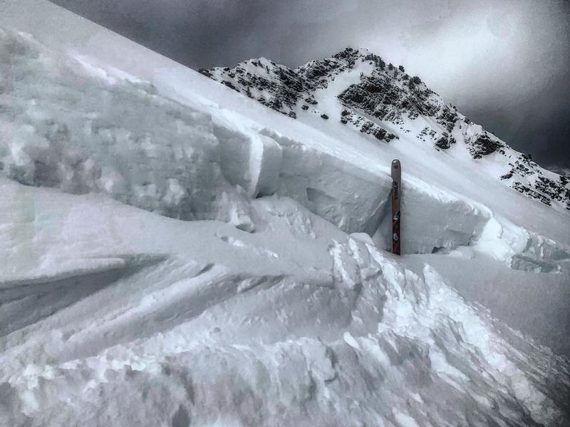
A MODERATE danger exists for human triggered wind drifts primarily in the upper elevations and steep exposed terrain. A scary MODERATE danger exists for large destructive avalanches several feet deep. Thinner snowpack areas are areas in upper American Fork and the Wasatch back are particularly suspect. Collapsing and cracking are unlikely to be present.
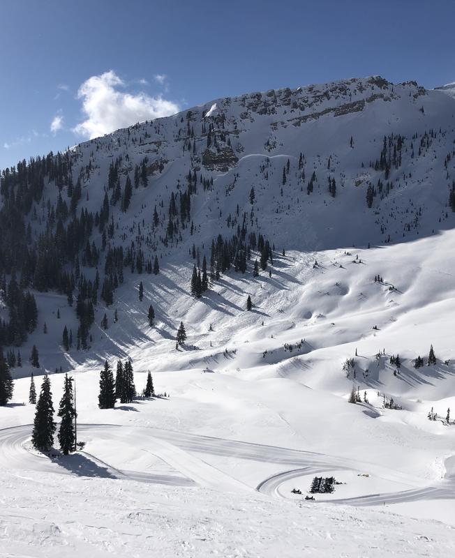
With warming temps and clearing skies, wet avalanche activity will be on the rise over the weekend. Anytime the sun comes out for prolonged periods of time, the sun-kissed slopes will become wet and unstable.

Hot Tip! Wind and sun-sheltered low angle terrain is 4 stars. Low Risk High Reward.
Low
Moderate
Considerable
High
Extreme
Learn how to read the forecast here
Special Announcements
Our second 3 minute Blog-cast is The Metamorphism Parable, read by retired UAC forecaster Tom Kimbrough. He begins, "Brethren and sisteren, today I want to speak on morality and the snowpack...there are many paths you can choose."
Are you new to the backcountry or looking to refresh your skills? The UAC has released a free 5-part avalanche skills eLearning series.
Weather and Snow
The latest Week in Review is hot off the presses - INFO. As you can imagine, it's been quite the week -

Skies are partly cloudy with many areas picking up a trace overnight. Temps are in the upper teens to low 20s. West-northwest winds are 10-15mph with gusts to 20. At 11,000', it's a different story. They've been blowing 40-45mph with gusts 65-75 through the night.
Total snow depths are 70-80" with excellent coverage at the low elevations. Some southerly aspects will be crusted this morning, but the wind and sun sheltered slopes are divine.
A building ridge to the west will keep us under a cool northwest flow today with clearing skies over the weekend. A system moves through on Monday, although the models are not in much agreement over if or how much snow we might see. Otherwise, the weather looks uninspired until just after the turn of the month.

Still, the winter has been good to us so far. I cherry-picked the Timp Divide snotel site to provide reference. Most areas are 100-125% of normal for this time of year and certainly far and away better than last season.
Recent Avalanches
No reports of activity from the backcountry yesterday, however long time observer Joey Dempster was in Aspen Grove two days ago and I was in Timpooneke yesterday to note lots of avalanche debris from recent avalanche cycle. You can read the reports here and here.
Ad
Avalanche Problem #1
Wind Drifted Snow
Type
Location
Likelihood
Size
Description
Recent and overnight wind drifts will be found in the higher elevations today and in the open bowls and exposed terrain. Most of the lingering drifts noted in the mid-elevations should be well on their way toward stabilization, but pockets of rogue unstable wind drifts can't be ruled out in these elevations.
Avalanche Problem #2
Persistent Weak Layer
Type
Location
Likelihood
Size
Description
The past week's storms bringing 4” of snow-water-equivalent and wind has stressed many of the older heretofore dormant weak layers. In the recent days, however, avalanche control work has triggered some very large avalanches at or near the ground in the upper Cottonwoods on upper elevation northerly terrain. None of these have been skier or snowmobile triggered, however, but a person finding a thin spot or triggering a more superficial avalanche may be enough to trip the trigger. Trending toward low-probability and high-consequence. Certainly any entanglement with one of these deep slab avalanches would be fatal. Photos below from the Cottonwoods. (Wilson, Snowbird, White) The Provo mtns have a similar snowpack.

The mid-Dec and early Jan weak layers are also stressed from the week's loading events and may be more reactive in areas like Snake Creek, upper American Fork, etc. These avalanches may be found as well on mid-elevation southeast facing slopes.
Additional Information
General Announcements
This information does not apply to developed ski areas or highways where avalanche control is normally done. This forecast is from the U.S.D.A. Forest Service, which is solely responsible for its content. This forecast describes general avalanche conditions and local variations always occur.