Donate to the 2024 Spring Campaign to help rebuild the UAC website.

Forecast for the Provo Area Mountains

Evelyn Lees
Issued by Evelyn Lees for
Thursday, January 24, 2019
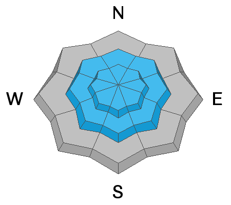
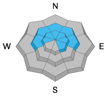
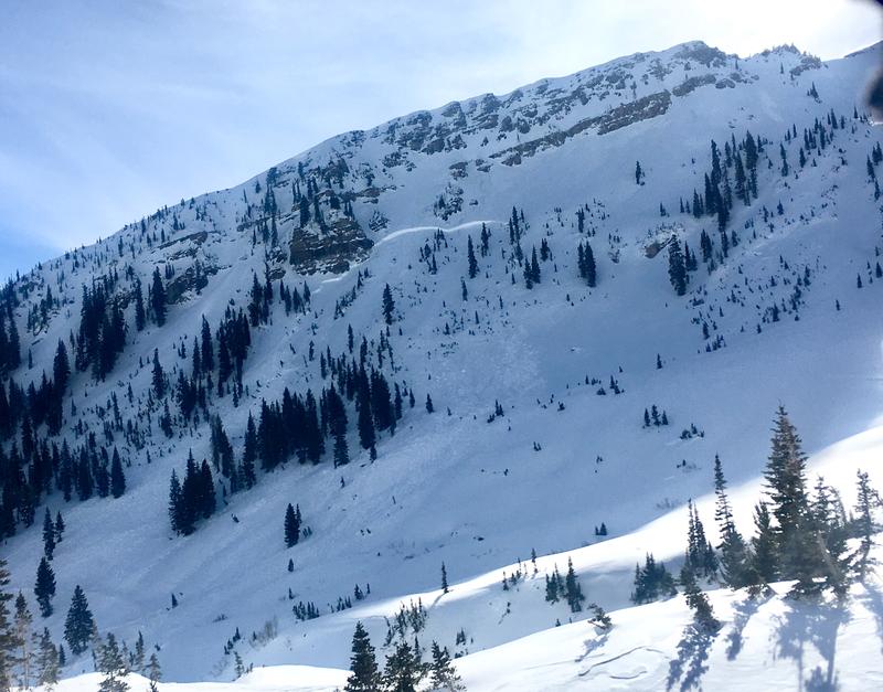
The Avalanche Danger is CONSIDERABLE on all mid and upper elevation slopes and MODERATE on all low elevation slopes. Human triggered avalanches are likely on slopes steeper than about 30 degrees, especially those with wind drifts. Natural avalanches are possible, so avoid travel on and below steep slopes and in avalanche runout zones.
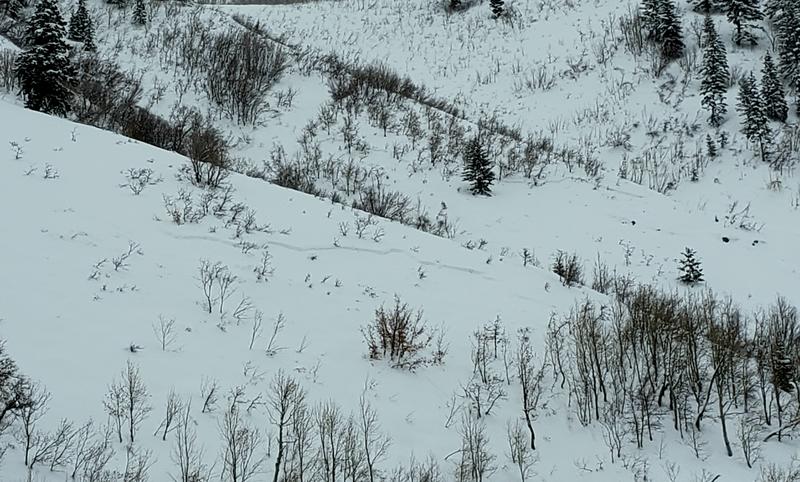
The Wasatch mountains have an amazing variety of terrain - those with excellent avalanche and route finding skills will find great turning and riding in untracked snow on safer low angle, wind sheltered slopes, with no steep slopes above.
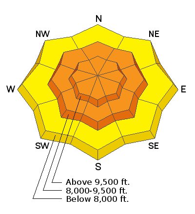
Low
Moderate
Considerable
High
Extreme
Learn how to read the forecast here
Special Announcements
Our second 3 minute Blog-cast is The Metamorphism Parable, read by retired UAC forecaster Tom Kimbrough. He begins, "Brethren and sisteren, today I want to speak on morality and the snowpack...there are many paths you can choose."
Are you new to the backcountry or looking to refresh your skills? The UAC has released a free 5-part avalanche skills eLearning series.
Weather and Snow
The Provo area mountains received about 2" of snow from the storm, and there may be a thin rime crust near the bottom of the new snow.
Winds once again stole the headlines yesterday - averages of 20 to 35 mph, gusts to 45 mph, from the southwest to northwest were recorded at the 2 anemometers in the Provo area mountains. The upper elevations in the Cottonwoods (and presumably Provo area mountains) got blasted for hours yesterday with 50 to 55 mph west to northwesterly winds, gusting in the 70s.
For today, mostly cloudy skies with a few lingering snow showers, and temperatures warming into the upper 20s. The northwesterly winds will remain strong at the upper elevations, averages of 30 to 40 mph, gusting to 50 mph. Mid elevation wind speeds should be civilized, with 5 to 15 mph averages, and gusts to 20 mph.
Recent Avalanches
Another natural large avalanche off Cascade, yesterday, January 23rd, spotted from the valley. Video below taken from Orem by E. Miller and provided by KSL News.
Several natural avalanches were heard coming off Robert's Horn yesterday. The Bonneville Shoreline trail was hit by a small slide on January 22nd. More and more reports are coming in of what a large avalanche cycle occurred in the Provo area mountains around January 17th. Avalanche activity from Bountiful through Provo this past week has included slides on SE facing slopes.
Ad
Avalanche Problem #1
Wind Drifted Snow
Type
Location
Likelihood
Size
Description
Another major wind event yesterday, overnight and continuing today has drifted snow at the mid and higher elevations into another layer of sensitive wind slabs. Drifts can be found on almost any aspect, wherever the wind slows and drops it’s snow. The dense, smooth drifts are to the lee of ridgelines and cross-loaded into couloirs, gullies and mid slope break overs. Wind slabs on the rime crust may be extra sensitive. Drop in elevation and seek wind sheltered slopes. Out of the wind affected terrain, shallower new snow slides can be triggered.
Below - a new slide, shallow slab avalanche, probably spontaneously triggered on 1/22. South facing, 8000 ft. Joey Dempster photo.
Avalanche Problem #2
Persistent Weak Layer
Type
Location
Likelihood
Size
Description
The last 24 hours of wind plus snow equals another major loading event, especially at the upper elevations. The snowpack is groaning under 4 - 6” of water, and the stress placed on the buried faceted weak layers is tremendous, and pushing the weak layers over the edge. The few reported large slides breaking into old snow are the canaries in the coal mine. While activity in the backcountry has been hidden by clouds and covered by snow, I expect a few similar large, long running slides breaking into old facets have or could occur in the high alpine of the Cottonwoods and the Provo area mountains. Avoid travel in runout zones beneath steep slopes, large peaks and the bottoms of gullies.

In addition, mid elevation terrain and terrain outside the upper Cottonwoods remains especially suspect, with their own mid pack weakness and basal facets. Shallower snowpack areas are a likely place to trigger slides or a smaller new snow slide or wind drift may “step down”, breaking on one of these deeper weak layers.
Old growth tree broken by recent avalanche, Primrose Cirque, Provo area mountains. Joey Dempster photo.
Photo: one of a couple “indicator slides” that have released. This was a large avalanche that happened Monday night naturally at Snowbird on a wind loaded slope, approximately 6 to 8 feet deep.
Additional Information
There is some good news - we are moving toward a deep, strong snowpack, but we're not there yet. We need a break in the snow and wind to allow the faceted weak layers and wind slabs to strengthen.
General Announcements
This information does not apply to developed ski areas or highways where avalanche control is normally done. This forecast is from the U.S.D.A. Forest Service, which is solely responsible for its content. This forecast describes general avalanche conditions and local variations always occur.